


APRIL RAINS ARE JUST GETTING STARTED
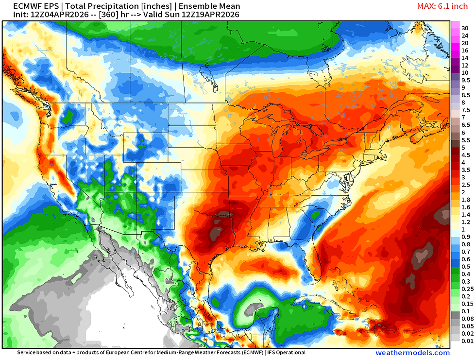
After an active start to April the pattern looks to continue its rather rainy and stormy stretch with a strong signal for well-above-normal precipitation from the Southern Plains through the Great Lakes. European Ensemble guidance has a large area of 3"+ over the next two weeks,

The pattern really starts to get active late this week into next weekend. While precise details this far out are hard to pin down, early indications are two separate periods roughly April 9-11 then 13-15. There are several ensemble members with some heavier rainfall totals. Mixed in are some potential severe weather chances as well given the time of year and upper air pattern.

The upper air pattern will feature a strengthening trough coming off the Pacific Ocean with strong southwesterly flow aloft over the Central and Southern Plains. This is a pretty classic signature for active weather over the Central US. All guidance is in pretty good agreement for this pattern to take shape but the small details will become clearer in the days ahead.
The GFS

The Euro
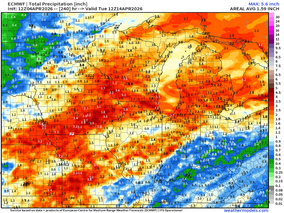
The Euro Ensemble

Guidance through Tuesday April 14 is in pretty good agreement across the Midwest with 2-3" of rainfall with the heaviest set over Missouri, Iowa and Illinois. Very beneficial rain nonetheless.
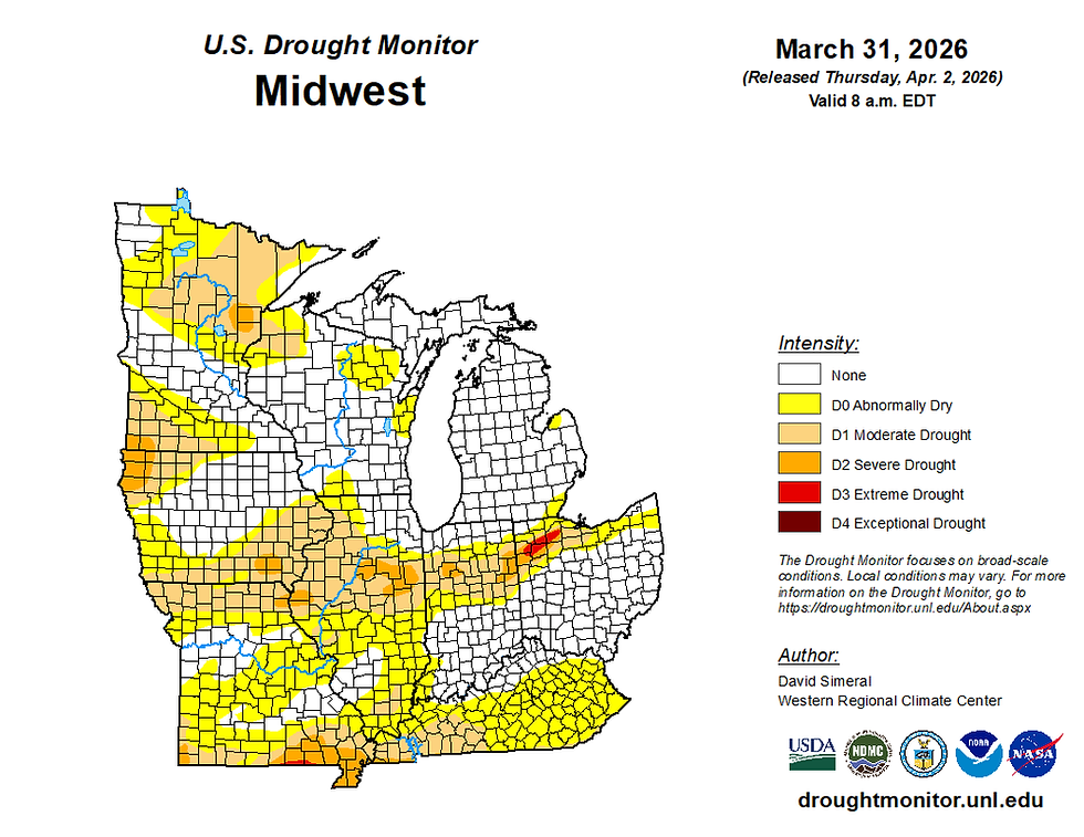
Moderate the Severe Drought extends across the Tri-State area. Looking at the forecast going forward we could see some rather dramatic improvement to this over the course of the next two weeks.
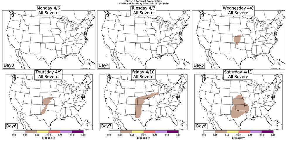
Machine learning forecasts are starting to indicate some potential for severe weather in the extended period. Locally, Friday is starting to pop out as a possibility but overall odds are pretty low at this point in time especially given the time range.

In addition to the active weather the trend will be towards warmer spring-like temperatures as well midweek and beyond. Just need to get passed a few cool days.
Bring on the rain!
-Meteorologist Nick Stewart


Comments