BRING ON THE RAIN
- May 18, 2025
- 2 min read

Happy weekend everyone! Those that have been hard at work dancing for the rain are going to see the benefit of their labor with some hefty rainfall totals expected to kick off the week. Widespread 1-2"+ is anticipated for much of the Midwest, and the best part is it 's coming with a limited severe threat.

A Level 1 of 5 risk, a Marginal Risk, extends across much of Iowa and Illinois Monday as a warm front advances into the region. There could be a few severe storms, especially across southern Iowa into the Tri-State region, that could produce large hail, damaging wind gusts and a tornado or two. It appears the main Quad Cities region will miss the majority of the severe risk.

Nearly all high-resolution models keep the threat of strong storms well southwest of the area Monday. However this does not mean we will miss the rain.

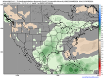
Looking at the rainfall forecast using the same model, there are some big amounts forecast across southern Iowa and northern Missouri. This is roughly where the warm front will set up and this will offer great "overrunning" the allow the rain to fall. Through early Tuesday morning there are vast areas over 1" along and east of the Mississippi River.

This area needs the rain! While much of Iowa was removed from drought conditions, southern Iowa and northern Missouri, as well as west-central Illinois, remain in drought conditions. This will really help that heading into next weekend! Great stuff!

Timing out the rain using the HRRR, we start seeing showers and storms move into the area mid/late afternoon Monday with widespread rain continuing through about midday Tuesday. The farther east you are the later the rain will hold on. Chicago for example will be fighting some dry air preventing rain until very early Tuesday morning. That rain activity could persist through the evening commute Tuesday.
Wrap around showers will likely persist into Wednesday, albeit much lighter than the activity on Monday/Tuesday. A rather gloomy start to the work week.

Behind the cold front, drier conditions will end the rain and also bring some cooler temperatures. Wednesday morning could start in the mid/upper 40s for much of the area with highs barely reaching the upper 50s. We will see a slow and steady trend in temperatures through the week into the weekend as the sun returns, however, with 70s not too far away. Thursday and Friday look like nice, sunny days under the influence of high pressure.
Have a great weekend everyone!
-Meteorologist Nick Stewart


Comments