


CLOSE ENOUGH TO BE A NUISANCE
- terryswails1
- Sep 21, 2025
- 3 min read


Models continue to indicate a pretty heavy rain event in the region this week with widespread 3"+ totals looking rather likely from central/southern Missouri through the Ohio River Valley before it's all said and done. Locally we will be just close enough for some stray showers and storms, but the heaviest and beneficial rain looks to remain to the south. Above, you can see the axis of heavy rain on the Euro. Eastern Iowa and northwest Illinois see some rain on this model run, mainly Monday night into Tuesday, with some quarter-inch totals.

What is somewhat intriguing is the GFS indicating some rather heavy totals well north of this, right over the region. This is a pretty significant outlier solution, but bears watching to see if it gets any other support from the high-resolution models. The GFS indicated this being on Wednesday.

The latest NAM run is also showing this as a possible solution on Wednesday, so the GFS isn't on an island when it comes to seeing this potential. I still consider it to be an outlier solution, and seems more on the unlikely side in my opinion.

Looking at the Euro ensemble, there are a few members with some heavier totals on Wednesday despite the average of all 50 runs of the model being around a quarter of an inch. So there are a few, potential signs that Wednesday could overperform. Again, I still would consider this an outlier solution for now.
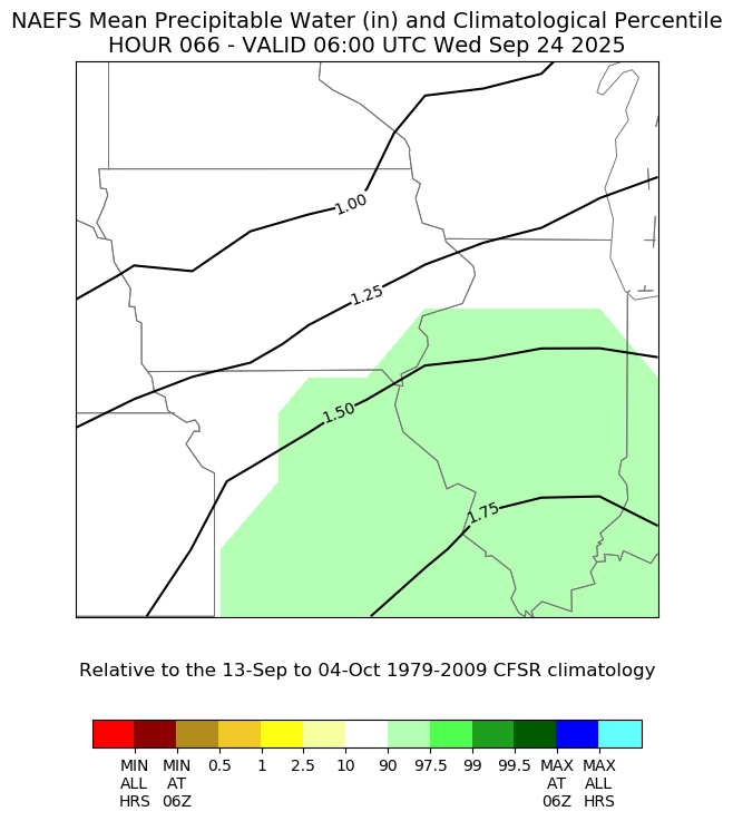
Now if storms do form in this environment, the moisture levels of the atmosphere would support heavy rainfall. Precipitable water values are expected to be in the 90th percentile - so rather high end for the date. The right showers and storms to tap into this could produce a nice rain event if they develop, the key being if.
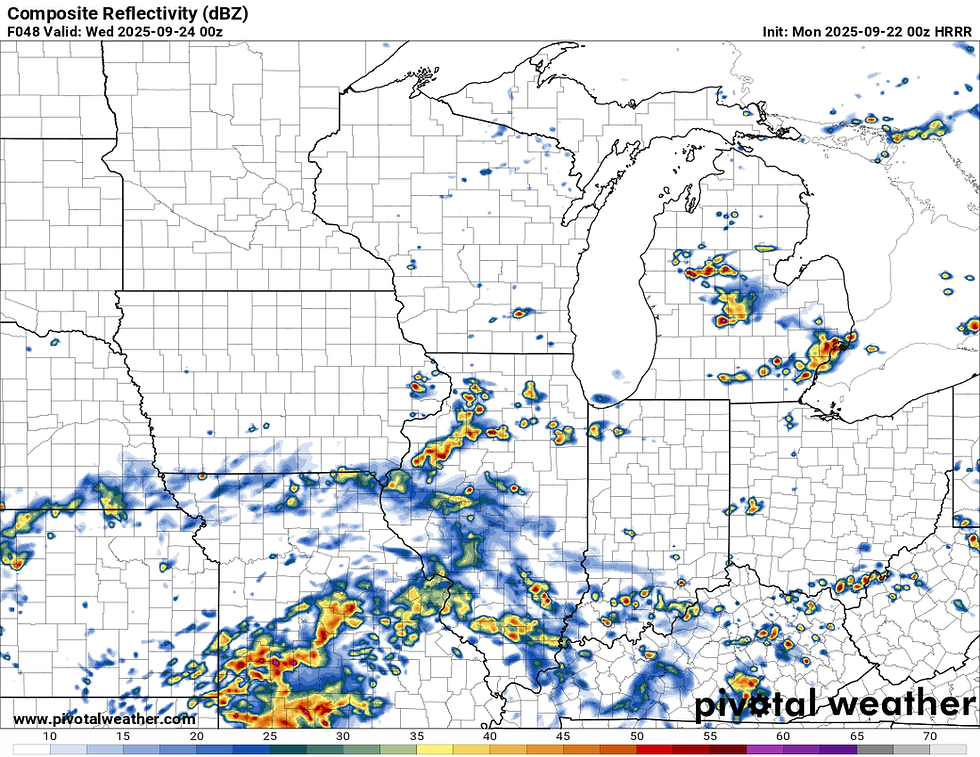
The long-range HRRR shows a few showers and storms scattered around the area. The runs tomorrow will be in range of what the GFS and NAM are trying to pain over the area Wednesday. If the HRRR is also on board for this, we might have to take it a little more serious.
I think given the disturbance nearby with a fairly moisture-laden atmosphere, there will be chances for showers especially Monday night through early Thursday. Overall more of a nuisance type of setup opposed to an impactful one locally. Down south it will be heavier with some flash flooding potential.

Since August 1 the areas likely to receive the heaviest rain have missed out on most of the accumulating rain. There are large portions of Illinois and Missouri that haven't had more than a few drops of rain which has allowed the drought to expand in coverage and severity. This will help certainly those folks. We could also use some more in our area.
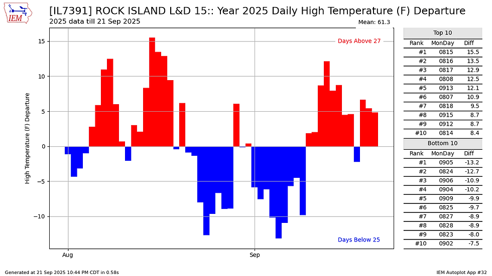
While it has been quite warm recently, during this same period (Since Aug. 1) we have had a nearly even split between above-normal and below-normal high temperatures in the Quad Cities. However, 11 of the last 12 days have been on the warmer side of normal.

There continues to be a rather remarkable signal for well-above-normal temperatures to end September and kick off October across not only the Midwest, but the Northern Plains and Pacific Northwest as well. The ridge expected to build in will be highly amplified. Current ensemble support shows five-day average temperatures running 6-8 degrees above normal locally which is impressive at this range.


Looing at the Cedar Rapids and Davenport meteograms for the next two weeks, the average temperatures are forecast to be in the mid/upper 70s headed into October. What's somewhat impressive is the fact the 95th percentile on some of these runs are even near normal. This tells me the average temperatures may be on the cooler side of what will actually unfold.

For example, analogs to start off October do have probabilities of temperatures reaching higher than 80F at 75-85% across the region. I don't think we're done with the 80s quite yet. Now 90s on the other hand are likely out of reach. The ensembles above peak around 85-87F.

I just wrapped up a beautiful weekend touring the southeast US including Atlanta and Savannah, Georgia. Just because I briefly left the Florida Space Coast does not mean I miss the rocket launches! I happened to catch a jellyfish early Sunday morning over the Atlanta skyline as a Starlink mission headed to space, just catching some pre-dawn sunlight. It helps when you know where to look!
Have a great week everyone!
-Meteorologist Nick Stewart


Comments