DROUGHT EXPANDS, SO DO TEMPERATURES...
- Jun 11, 2021
- 4 min read
The latest drought index is out and and outside of a few isolated pockets where spotty rains occurred, dryness continues to expand. Back on April 1st the index looked like this. Northern Iowa along with much of Minnesota and Wisconsin were abnormally dry but outside of NW Iowa, few were in actual drought conditions. My entire area was considered in normal spring conditions.

In just over two months moderate to severe drought has expanded to include the northern half of Iowa, southern Wisconsin, and has even crept into NE Illinois.

Now most of my area north of I-80 is abnormally dry with moderate drought encroaching on places such as Dubuque and Cedar Rapids as well as the Freeport area of NW and NC Illinois. In just the last week abnormally dry soils in the Midwest expanded from 41 to 55%. Moderate drought increased from 18 to 27%.
So far June is really looking ugly. With a third of the month behind us rainfall from my area west has been 25% or less compared to the mean. From SW Minnesota and central Iowa west no rain at all has been reported!

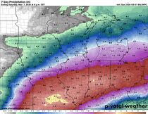
That is why the long range rainfall projections off the EURO and GFS are concerning. Including what may or may not fall Friday night and early Saturday, the EURO ensemble indicates 15 day rainfall deficits that look like this through June 25th.

Aside from the dryness on the table, the temperatures and humidity are going to be challenging elements to forecast starting Sunday and beyond. I'm going to show you an animation of the jet stream over the the next two weeks. In it you will see energy diving over the western ridge carving out troughs that amplify over the east. Take a look.

That keeps the Midwest in a west to northwest flow that is short on moisture. It also creates a push pull pattern where strong highs will repeatedly dig into the Great Lakes. Each of these will bring a surge of low dew point air and cooler temperatures for short periods. Before the 2nd and 3rd high arrives to replace the 1st, there will be a period of return flow where some heat can sneak in before it's quickly beaten back by the arrival of the next high and its associated cool dry air. Here's an example where the high is providing cool dry air.

Two days later the high has moved east and another is building south in Montana. That allows return flow to bring hot but still dry air into the Midwest. That lasts a couple days and then the new high brings back cooler conditions. That's the push pull thing I'm talking about.

If the EURO is right, this pattern is going to generate some very low dew points, especially with evapotranspiration from crops still minimal and soils dry from a lack of rain. Here's something I'll have to see to believe. It's the dew points on the EURO June 16th. They are in the 30s and yes, even the low 20s in NC Illinois. Wow!

Look what that does to mid-day humidity levels. They are down in the low to mid teens in my far eastern counties.

These are probably the low end scenario but moisture levels such as this are what you would expect to see in the desert SW. Now we all know what happens in the desert, it gets hot, especially in the long days of summer. Could that happen here? The EURO is showing a compressional heating set-up that due to the extremely dry air could drive highs close to 100. I can't even remember the last time we saw a high break the century mark, maybe 2012? Well, as of today the EURO is calling for such a thing June 18th with readings that look like this! 101 in Cedar Rapids.

What's interesting is that the air is so dry evaporative cooling is enhanced and the heat index, (how it feels) is reduced from 100 to the upper 80s and low 90s.

Back in the 30s, many of our heat records that stand today were established in low dew point conditions such as this. At this distance I can't say the EURO is right but I see what it's doing and in this day and age that's about the only plausible way highs could reach 100+. It's certainly and interesting trend that we'll keep it on the back burner for now and see where it goes. The GFS is substantially cooler.
Last but not least, I'm glad I kept that 20% chance of storms in for Thursday. Once again convective temperatures were met and that allowed some heavy but isolated storms to develop. I had nothing at my place on the NE side of the Quad Cities but in Davenport around 3:00 PM I got into a big downpour. I would guess at least 1/2 inch in 15-20 minutes. Then the sun was right back out and that was it. This is the Doppler radar estimates through mid evening Thursday. A real nice cell set up just west of Lowden over towards Clarence. In the core up to 2" may have fallen.

Alright, Friday looks to be a dry day but perhaps we can scare up a couple more storms late Friday night or early Saturday as a dry line approaches from the northwest. They do look spotty but a few of you may reap the rewards of rain. I'm done. Roll weather and thank god it's Friday...TS


Comments