FROST ON THE FLOWERS
- Apr 20, 2024
- 3 min read
Mid-spring is a stunning time of year in the Midwest. That emerald green grass is a sight to behold, as are the flowering crab trees and assorted flowers that suddenly pop up everywhere. The morel mushrooms also burst onto the scene, a true delicacy when done right. Things are busting out everywhere. It's visual overload.
Unfortunately, the remnants of winter's cold still lurks in Canada and when conditions are right, some of it can find its way into the region. This 500mb jet stream pattern is aligned in just the right configuration to allow that to happen this weekend. The ridge in NW Canada has buckled the jet and opened the door for the cold. That is problematic for our tender vegetation, as it leads to frost and freezing temperatures.

Here's the big 1036mb high that drives not only cold, but blustery winds once again Saturday. Very dry air is also a part of its DNA ensuring dry conditions through Monday afternoon.

Despite no rain, Saturday will be nothing to write home about. Winds should remain powerful creating significant wind chills. (In fact, at 1:00am Friday night, Hampton in NE Iowa reports a wind chill of 17 degrees. That's brutal for April 20th). Clouds will also be on the increase during the morning Saturday thanks to the passage of a mid-level wave. The additional clouds and 850 temperatures of -8 to -9, will keep highs confined to the mid and upper 40s. That's a good 15-16 degrees below normal. Here's the projected afternoon departures.

Winds will be the key to how chilly temperatures get Saturday night. They may not fully de-couple which is the best case scenario, keeping lows closer to the 30-32 range. If winds can diminish more, there's less mixing allowing even lighter winds and colder temperatures with some mid 20s possible, especially in the NW. Even with a breeze Friday night some lows slipped to 30 or lower. A freeze warning was issued for the counties below unil 8:00am Saturday. Additional Freeze warnings or frost advisories are likely to be widespread Sunday night as well.

Sunday we close out the weekend with improvement but temperatures that are still very much on the cool side. Even with sunshine highs are only projected to reach the mid to upper 50s. Hopefully we won't see another weekend as cold as this for at least 6 months!
TERRY'S 5-STAR AIRBNB, WHERE VACATIONS ARE HEAVENLY (MAKE IT YOURS)
TSWAILS.COM, THE GUY DOES WEATHER RIGHT
NEXT WEEK...
Monday we finally crack the 60 degree mark after a long lay-off. However, a fast moving distubance in the northern branch of the jet digs quickly southeast bringing a shower threat Monday night and a bit of Tuesday morning. With the best forcing further north and marginal moisture, amounts should be on the light side.
Cooler air returns for midweek behind the system. The question becomes, how cool. The GFS drops temperatures back into the low to mid 50s. The EURO is not as extreme with low 60s. It will take a couple more days before the outcome is clear.
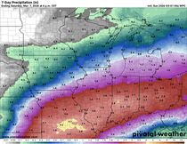
The end of next week, models are in good agreement another strong storm will come out of the southwest. The slow movement of the trough will likely allow multiple pieces of energy to eject out of it. With moisture and dynamics plentiful, an active period looks likely. This has the potential to be a wet system. It's a long way down the road but already the EURO and GFS are suggesting this for rainfall Thursday night through Sunday.
The EURO

The GFS

I'll leave it at that for now. Thinking warm thoughts on a cold Saturday. Roll weather...TS


Comments