


FROST ON THE PUMPKINS
FEELING MORE LIKE FALL
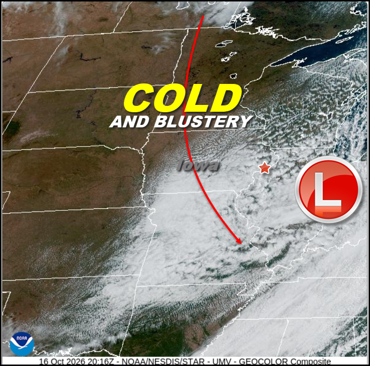
A potent but fast moving disturbance raced across the region Thursday night and Friday replacing rain with gusty winds and much colder temperatures. The afternoon satellite image from Friday afternoon showed plenty of instability clouds and even some showers on the back side of the system.
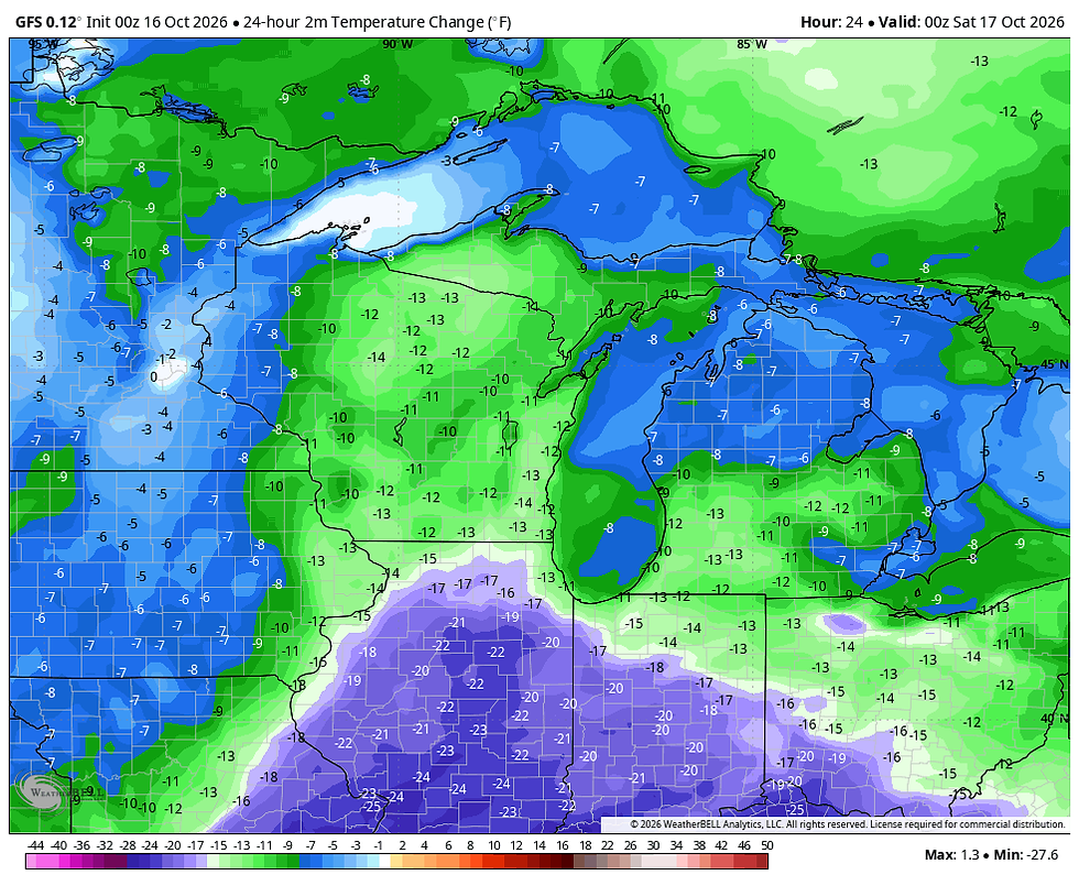
Temperatures Friday over much of the area were 12 to 22 degrees colder than 24 hours earlier. The drops were more substantial east of the Mississippi than west, due to the fact that part of my area was about 10 degrees warmer than my western counties Thursday.
The clouds and light showers rapidly cleared Friday afternoon and evening with strong subsidence in the wake of the storm. That and the fact winds quickly subsided has allowed temperatures to quickly tumble overnight. By morning the hi-res HRRR shows readings hovering near or just above freezing making it the coldest morning of the fall season so far. Most areas will see some frost early Saturday but current guidance is 2-3 degrees warmer than yesterday, meaning the majority of the region may avoid a killing freeze. Here's what the HRRR indicates for temperatures around daybreak.

Despite the models showing readings a hair above freezing, the NWS has a Freeze Warning in effect near and north of I-80. It may be that the ridge axis passes fast enough to keep temperatures (as the HRRR indicates) above the 32 degree benchmark. However, a slighty slower progression could allow readings to cool a bit more than indicated allowing some low lying spots to hit 31 or 32 for a brief period, especially in the NW. Hopefully that is not the case and considering the warmth coming next week, we can keep the growing season going into late October. We will know the outcome by 8:00am Saturday.

Now for the good news if you like your weather mild and dry. The 500mb storm track is projected to look like this next Thursday. Note the ridging over the NC United States. That block should keep the weather stable and mild Sunday through the majority of next week.

These are 5 day average temperature departures for the period Tuesday the 20th to Sunday the 25th. That's a nice little blow torch.

The GFS meteogram for the Quad Cities has highs building into the mid 60s to low 70s Monday through next Saturday. Lows remain above freezing out to November 1st indicating the growing season will still be alive and well if the GFS is on the mark.

Also the GFS shows no measurable precipitation the next 5 days and that could conceivably last several days longer.

Once again, this has been one of those years where its been feast or famine regarding rainfall and the trend going forward certainly favors famine through next week.
I'll end with this to help you appreciate what is coming compared to what it was like in late October 1925. That year Iowa experienced a pair of early-season winter storms followed by unseasonably bitter cold air that set historic temperature lows across the state. Following the storms, temperatures plunged drastically, setting an all-time Iowa October record low of -15°F at Inwood. My climate source Steve Gottschalk provided this specific data on the cold and snow.
MINIMUM TEMPERATURES FOR OCTOBER 31st 1925
Inwood - -15
Decorah, Postville - -7 (Postville also had -2 on the 29th)
Fayette, Iowa Falls - -5
Waverly, Marshalltown, Williamsburg - -3
Cedar Rapids, Belle Plaine - -2 (Cedar Rapids also had 0 on the 29th.)
Dubuque - +2
OCTOBER 1925 MONTHLY SNOWFALL TOTALS (most fell on the 27th)
New Hampton - 8.1"
Marshalltown - 7.3"
Fayette - 7.2"
Decorah - 7.0"
Postville - 6.6"
Toledo - 6.0"
Belle Plaine, Iowa Falls - 5.5"
Independence - 5.3"
Cedar Rapids - 5.0"
Dubuque - 3.9"
Iowa City - 3.0"
Davenport - 1.5"
If that doesn't make you feel thankful for whats ahead this year. You are a hard core weather geek. That makes you a special breed like me! Roll weather...TS


Comments