


SO MUCH FOR SUMMER....
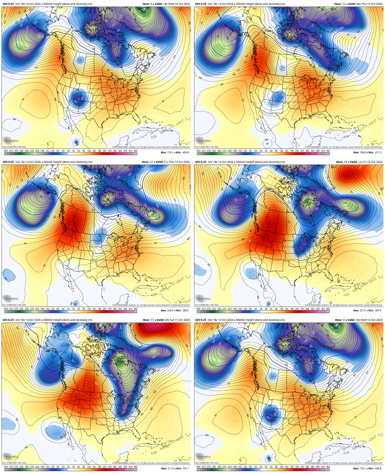
At least for a few days, we can kiss our recent run of balmy days goodbye. A complex storm system composed of a southern stream distrubance and a northern branch trough is in the process of phasing. The absorbtion of the tropical energy into the larger mean trough will develop a healthy storm that brings rain Thursday, wind Thursday night, much colder weather Friday. That's followed by the threat of frost Saturday morning. You can watch the energy merger at 500mb unfold in the animation below.
Wednesday night's satellite loop shows a strong influx of moisture ahead of the closed upper low surging towards the central Midwest leading to rain chances Thursday.

By mid-afternoon Thursday, water vapor has reached 2.36 inches over southeast Iowa. That level is in the 99th percent of local climatology thus we have a well endowed system regarding available moisture.

Recent models suggest showers and embedded thunderstorms will hold off until shortly after daybreak Thursday morning before spreading northeast during the day. Guidance is unfortunatly, not in good sync where the heavier rain will occur. The issue is tied to the track of the surface low which the EURO brings over Ft. Madison. If you look closely below, you can see a bit of a dry slot (with lower amounts) on the EURO just north of the surface low extending from NW Missouri to SE Iowa and on to NE Illinois.
The EURO

The National Model blend is only of minor help being further north and much broader on the primary rain band.
NBM BLEND

Then you have the hi-res HRRR which is somewhat banded and all over the board on its rainfall totals.
The HRRR

Until the final track is established early Thursday this will be a challenging rain forecast. I myself see the heavier rainfall occuring near or just north of the stationary boundary the low tracks along extending from the SE tip of Iowa to near Chicago. I doubt if it makes much progress north of that and thus I lean more toward what the EURO is selling for rain amounts. That also keeps temperatures in check with upper 50s NW to mid 60s SE of the Quad Cities Thursday.
By early evening the low has pushed into Chicago which means any lingering showers will come to a rapid end. At that time, winds are swinging in from the northwest and are on the increase. Gusts will eventually reach 35 to 40 and continue at that level into Friday morning before slowly easing up late that afternoon. Temperatures will be on a downward trajectory and by Friday morning will have slipped into the low to mid 40s.
Friday, strong cold air advection associated with 35-40 mph gusts will only allow temperatures to warm a few degrees meaning readings may struggle to get out of the upper 40s NW to low 50s SE. The wind will make it feel substantially colder. Also, the cold air aloft will drive instability, passing clouds, and a few light showers in spots. Rest assured, Friday will not be a pleasant day.
High pressure arrives Friday night with winds quickly subsiding after sunset. With clearing skies and very dry air back in place, the stage is set for strong radiational cooling and lows in the low to mid 30s. Frost or even freezing temperatures are expected. The far north has the best chance of seeing a freeze. The NWS will no doubt be putting out headlines for the potential at some point. Here's what the 3K NAM shows for lows Saturday, similar to what the GFS indicates.

The entirety of Saturday, readings remain rather crisp in the low to mid 50s under sunny skies. Sunday, stronger southerly winds will send highs back into the 60s and come Tuesday highs of 65 to 70 are back on the table.
Needless, to say we've got a couple active weather days ahead with rain, wind, and much colder temperatures. However, this is just a wake up call and the set-back is only temporary for now. Stay strong my friends and as always, roll weather...TS


Comments