


HIGHWAY TO HEAT...
- Jul 29, 2022
- 4 min read
The road of weather is full of twists and turns with straight-away stretches that last for days. Sometimes you need the GPS, others you don't. Right now we're on freshly paved interstate that will take us on a pleasant path right on into the weekend...cruise control if you will. Then we head up a big hill that ends with full on heat and humidity. Of course, there's no turning back when you travel this road so enjoy the ride while it lasts, the cruise control only lasts for a limited time.
CRUISE CONTROL
What a day we pulled out of the hat Thursday. Highs in all but the far south were in the 70s with dew points in the mid to upper 50s. Along with that, came a fresh breeze that created as nice a day as you can ever hope to see in late July. All you need to do is look at the late day temperature departures to see how sweet conditions were.

If the day's temperatures weren't good enough for you, look at the readings we'll be looking at early Friday. We start the day with the thermometer well into the 50s thanks to fair skies, dry air, and light winds.

Below you can see the pressure anomalies associated with strong surface high pressure in the center of the country. The stronger than usual high provides a pleasant feed of comfortable dry air through Saturday.

Confirming the strength of the high are the PWAT's showing water vapor going into the weekend running 30-40 percent lower than normal. Our moisture source (the Gulf of Mexico) is essentially cut-off and shut down.
Water vapor Friday evening on the GFS

Water vapor anomalies for the same time.

What this all means is that our weather remains on cruise control through the weekend. The EURO shows this for weekend highs in Davenport...these are representative of what the entire area will see. July goes out like a lamb!

AUGUST AND THE DOG DAYS OF SUMMER...
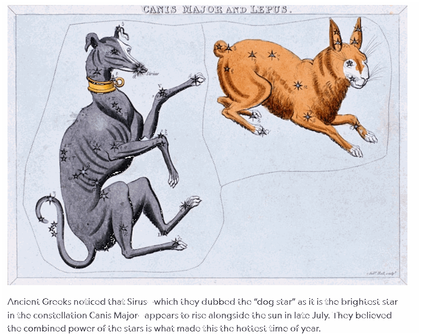
Next week brings early August, a time of year where the weather tends to be hazy, lazy, hot and humid. For many, the “dog days,” bring to mind those summer days that are so hot and steamy that even your dog lies around on the asphalt, panting. But originally, the phrase had nothing to do with dogs, or even with the lazy days of summer. Instead, the dog days refer to Sirius, the brightest star in the constellation Canis Major, which means “big dog” in Latin and is said to represent one of Orion’s hunting dogs.
To the Greeks and Romans, the “dog days” occurred around the time Sirius appears to rise alongside the sun, in late July in the Northern Hemisphere. They believed the heat from the two stars combined is what made these days the hottest of the year, a period that could bring fever or even catastrophe.
It's always a good idea to let sleeping dogs lie so I'll stop with the astronomy. What you need to know is that prolonged periods of heat are common at this time of year and that's what the tea cards are telling me happens next week and perhaps beyond. The first thing you will notice is that water vapor by the end of next week is back up near that oppressive level of 2 inches (that's the disgusting threshold we simmered in last Saturday).

The return of rich moisture and (the muggies) is a sure sign the upper air pattern is undergoing major amplification and that's very evident at 500mb, the jet stream level. Here's the NW flow aloft that is bringing our fine weather now.

Notice the difference in about a week. The heat dome is building east into the Midwest ejecting any cool air.

As it looks now, the coming heat may arrive in two waves. The first starts Tuesday-Thursday (August 2-4). A second appears to focus on the period (August 6-10). At the very least highs in the mid to upper 90s could be found in both cases. The EURO even pops a 100 August 3rd in the Quad Cities.

The GFS due to its unrealistic heat is just about unusable other than to ascertain trends when the heat should be at its peak. Otherwise it continues to over forecast highs by 5-10 degrees. Apparently the heat gremlins have gotten into the algorithms because even a dork like me can see temperatures of 106 to 110 are not within the realm of reality. Take a look but keep in mind the model is in gremlin land.

One thing I do feel good about is the overall trend of heat and humidity that is well supported resulting in high confidence it will occur. The Climate Prediction Center shows moderate to high risks of extreme heat for my area in the period August 5-8th.

The 6-10 and 8-14 day temperature outlooks show extremely high chances of above normal temperatures nearing the 90 percent threshold.


The other issue that comes to light is that this is looking like a prolonged period of above normal temperatures that could carry into the first 10-14 days of August. Typically, a pattern like this is not likely to produce much in the way of precipitation as we would be under the heat dome where there's capping and subsidence. The ring of fire is generally too far north to provide rain and cooling relief. Something we'll need to keep an eye on is the location of the northern edge of the heat dome. If it's in the Upper Midwest we remain dry. If it can meander closer to the Iowa border for time it would at least bring a chance of storm clusters that could sneak in from the W/NW. Some models depict a storm threat Monday night or early Tuesday as the heat approaches. After that mesoscale details will dictate what happens in the future and those are impossible to foresee. My guess is any rain will be widely scattered (if at all) leading to a hot and relatively dry 2 week stretch of weather. The GFS shows rainfall departures like this through August 13th.

No matter what road you're traveling be sure to buckle up and enjoy the ride. Happy Friday and roll weather...TS


Comments