INTENSE WINTER STORM IS UNDERWAY...
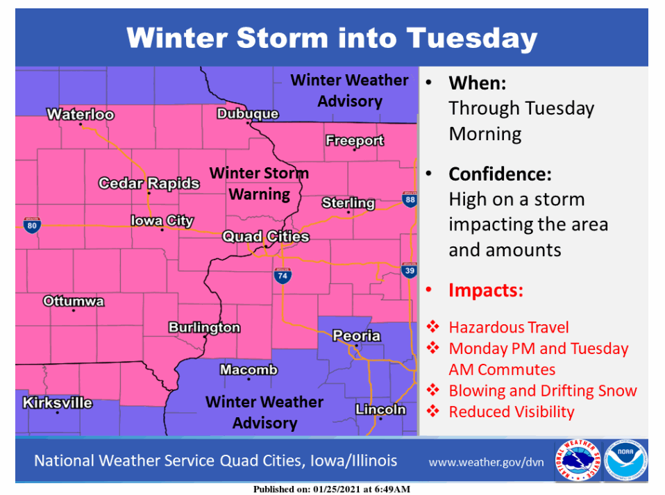
A winter storm of significant proportions is set blast the region overnight into Tuesday morning. Heavy snow in the range of 6-9" will impact much of the area with some local spots in Iowa west of a line from Dubuque back to Cedar Rapids and on to Grinnell could go over the 10" threshold. Along with the snow will come gusty winds of 20-30 that will generate blowing and drifting snow. Combined with the heavy snowfall rates of 1 to perhaps 2" per hour visibility could be quite low, particularly in the open country where near white out conditions are possible at times. Travel will become very difficult tonight and Tuesday. All of my area is currently under a winter storm warning into Tuesday.

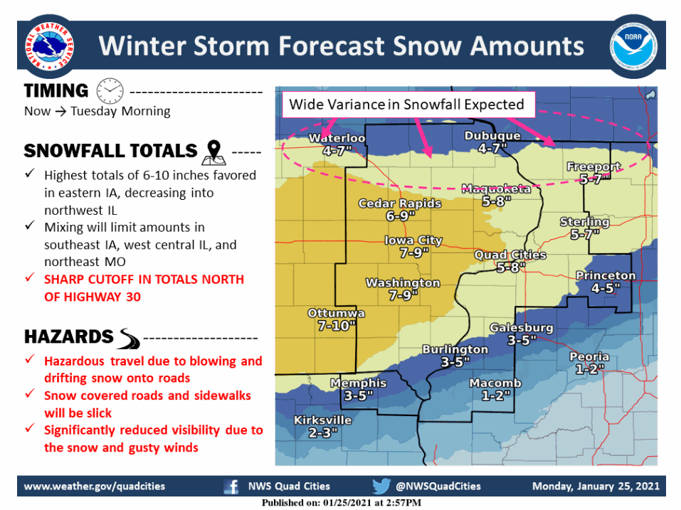
This is the official NWS forecast for snowfall. Amounts are expected to be slightly lower as you go east into Illinois. The lowest totals are expected from Burlington to Galesburg and on to Princeton where a period of sleet or freezing rain may cut into amounts. One area where I disagree is up north along the HWY 20 corridor where most models are in the range of 7 to 9 inches as opposed to the 4-7 shown. We'll see how that works out.

Saturation of a dry air mass has been occurring from south to north all day and snow is now falling south of a line from Waterloo to Clinton and moving northeast. All areas, even the northeast should see snow by 5 or 6:00PM
By the way, some new models are in from the 18Z runs and this is what they show for potential snowfall. Again, these are not the official forecasts but the trends derived from them is what will drive updates and forecasts going forward. Look for consistency in the various solutions.
The HRRR

The 12K NAM

The 3K NAM

The GFS

This is the 12Z EURO, the new one does not arrive until after 6:00pm

That's what I have for you at this point in time. I will drop the latest EURO on you mid-evening. I'll also have snow reports to pass along as well. Conditions should go downhill fast now that we have undergone saturation in most parts of the area. Until next time, roll weather and white gold!...TS
A SECOND PRINTING OF MY NEW BOOK IS ON THE WAY...
250 NEW COPIES OF DERECHO 911, IOWA'S INLAND HURRICANE ARE AVAILABLE. Around Christmas we sold the last of the 1500 copies of our book on this historic thunderstorm, the most damaging in U.S. history. Due to continued demand we have ordered a limited number of 250 for those of you interested in having the most authoritative account of this extreme event. You can get yours at derechobook.com


