LET IT SNOW...
- Nov 15, 2022
- 3 min read
It was just a few days ago that we were enjoying record highs in the 70s, almost 80 in spots. How the times have changed. Now were are in an entirely different pattern that features December-like temperatures and our first accumulating snow. Nothing boring about our weather that's for sure.
In response to the snow which has been spreading into the area from the south Tuesday, the National Weather Service has issued a winter weather advisory for all of my area until 6:00pm Tuesday. While the snow is generally going to be in the 1-2" range (perhaps 3" in some isolated spots), the ground is still marginally warm from our recent warmth. With that being the case, and temperatures near freezing, some of the snow is likely to melt on area roads, especially those that have been treated. However, there may be periods where roads are snow covered during heavier snowfall rates resulting in periods of slick travel. Elevated and grassy surfaces should see the brunt of the accumulations.

While November snow is not unusual, this event is roughly 2 weeks ahead of schedule. It's being caused by a very energetic set-up aloft that will bring periodic chances for light snow or flurries into Saturday. Most of what accumulates is likely to occur Tuesday before the event tapers off in the afternoon over the south and early evening north.
After a brief lull, another spoke of energy rotates in late Tuesday night and Wednesday. The renewed lift should generate another round of light snow. Accumulations from this are expected to be minor but a few places could tack on another inch.
Between the two rounds of snow, total accumulations should generally end up in the 1-3 inch range around my region. The official NWS forecast for my area looks like this.

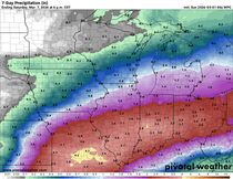
Here's what the latest models were indicating for snow totals through Wednesday. Remember, what you are seeing is just raw model guidance. It's not a snowfall forecast, just the data we use to make them. In general, they seem to be pretty much in sync with what the NWS forecast indicates. Take a look. These are 10:1 snow ratios.
The EURO

The GFS

The 3k NAM

The 12k NAM

The HRRR

The National Model Blend.

These are the NWS odds of seeing at least 1 inch of snow. Pretty big numbers.

SIGNIFICANT EARLY SEASON COLD IS COMING
The snow producing energy is contained within a deep 500mb trough that looks like this Friday morning. Make no mistake about it, that is a very cold November pattern. If you follow the heights (the black lines) you can see the ones in our area originate at the North Pole and come directly into Iowa. That is the Arctic Pipeline and we can be thankful its not mid-January or we would be in the deep freeze.

As it is, we will still be frigid by mid-November standards. Highs Tuesday and Wednesday will hold in the low to mid 30s. Then, a new wave of cold arrives and they get even colder with most areas remaining in the 20s Thursday through Sunday. The GFS only depicts highs in the 20-25 degree range Friday with wind chills in the single digits!

Highs like the ones expected Friday are 20-25 degrees below normal. Even colder than the January norms!

Exploring low temperatures, they are projected to be in the single digits Sunday morning on the EURO. Depending on how much snow cover exists, they could be close to zero in the north.

Again, some spots are running more than 25 degrees below normal early Sunday morning.

Look at these wind chills Friday night down around zero to +5. Holy cow Batman!

The 6-10 day outlook from NOAA shows a lot of cold air into early next week.

If you are looking for some positive news after the onslaught of early winter, the MJO is projected to move into phase 6 around the 21st which should bring moderation just in time for Thanksgiving. It doesn't stay there long as it rolls back into 7 by the 25th which signals the break from cold could very well be short in duration.

I will dig into the long range trends more in my next post. For now, enjoy the gift of WHITE GOLD and by all means, roll weather...TS


Comments