


MORE RAIN AROUND THE CORNER
- Apr 5
- 2 min read
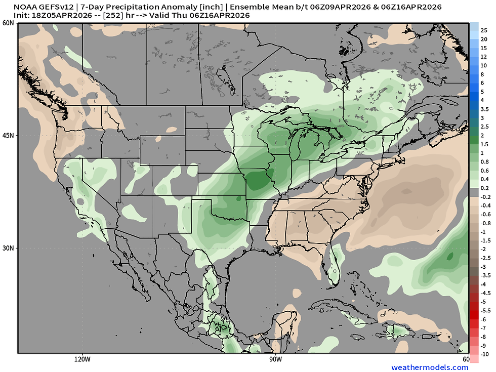
Models continue to indicate a rather high probability of well above normal precipitation over the next week and a half across the central US as a storm track sets up from the Southern Plains through the Great Lakes region. American Ensembles have rainfall running more than 1.5" above normal for this time of year which is quite a strong signal.
The first bout of rainfall looks to roll in Thursday/Friday of this week with chances continuing into early next week.
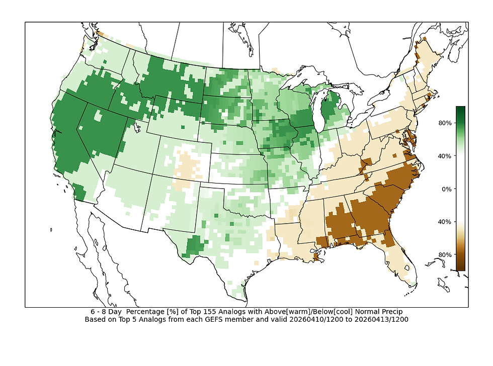
Analogs are additionally very well in line with this forecast with probabilities of above-normal precipitation essentially maxed out across eastern Iowa through Michigan.
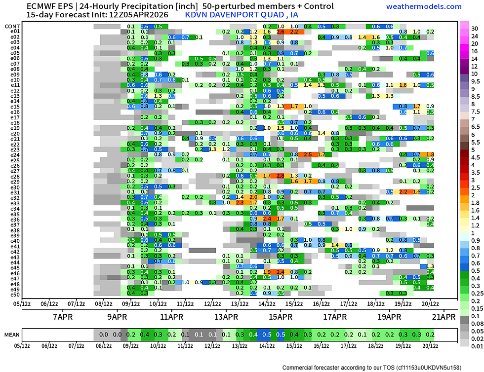
Using the 50 members of the European Ensemble you can make out some of the active days. Light rain chances Wednesday will be followed by a heavier rain threat Thursday into early Friday. The European Ensemble has a bit of a break until the next round of heavier rain Sunday through Wednesday of next week. So we are quite a few days out, but the pattern is starting to get that look.

The precipitable water values, or a measurement of moisture in the atmosphere by Sunday, will be well into the 99th percentile for portions of the area which indicates an environment capable of very heavy rain. If this continues we should consider threats for flooding given rivers across the region are running high already.
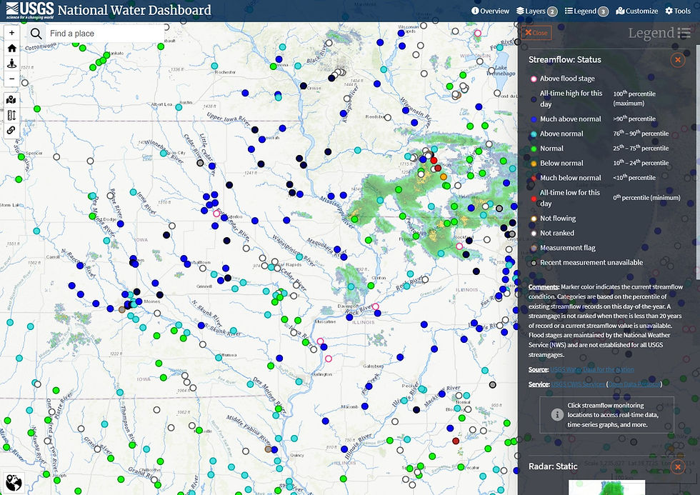
Looking at the current river observations across the region rivers west of the Mississippi River north of I-80 are at 90th percentile, if not all-time-highs for the date. East of the Mississippi River in northern Illinois rivers are in the 75th to 90th percentile. Add additional heavy rain on top of this and we could see more widespread flooding concerns along area rivers.
Since the start of April the soil moisture levels are on the way up. While good for improving drought conditions, the more we add the more the flooding concerns increase and problems for farmers compound heading into the spring planting season.
MODEL BLEND

Euro Ensemble
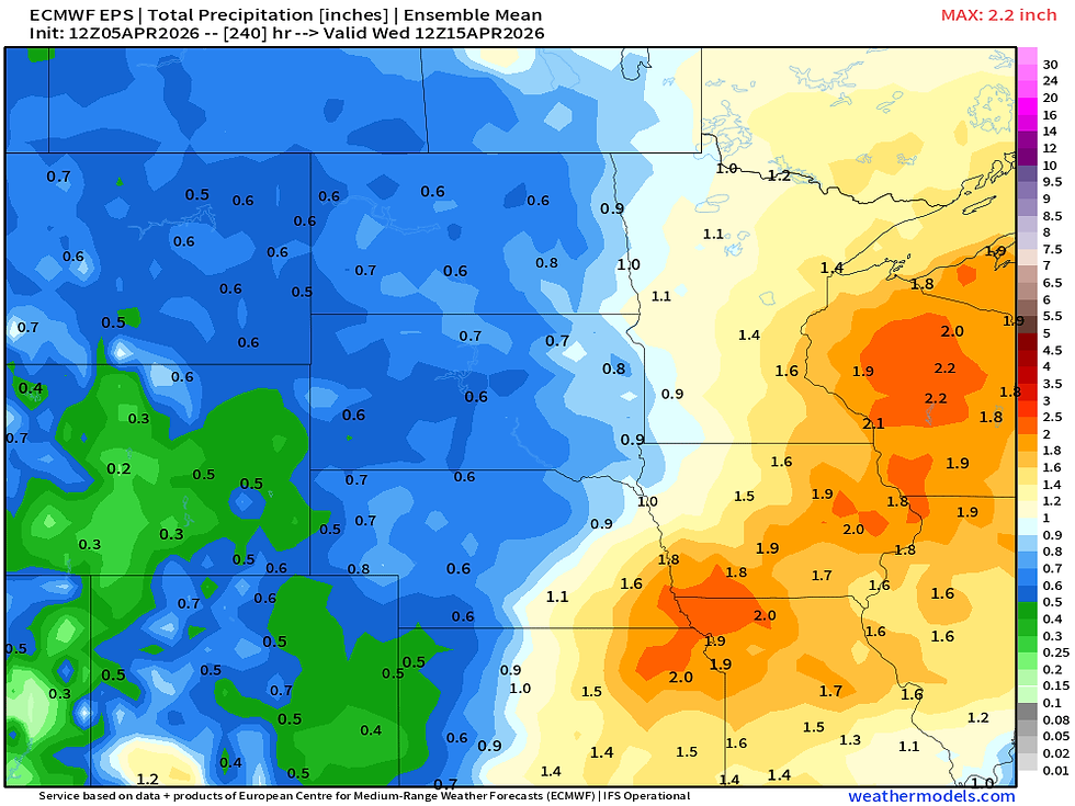
Through next Tuesday the model blend has widespread 2-3" of rain across the region with the Euro Ensemble approaching 2" with this generally in line.
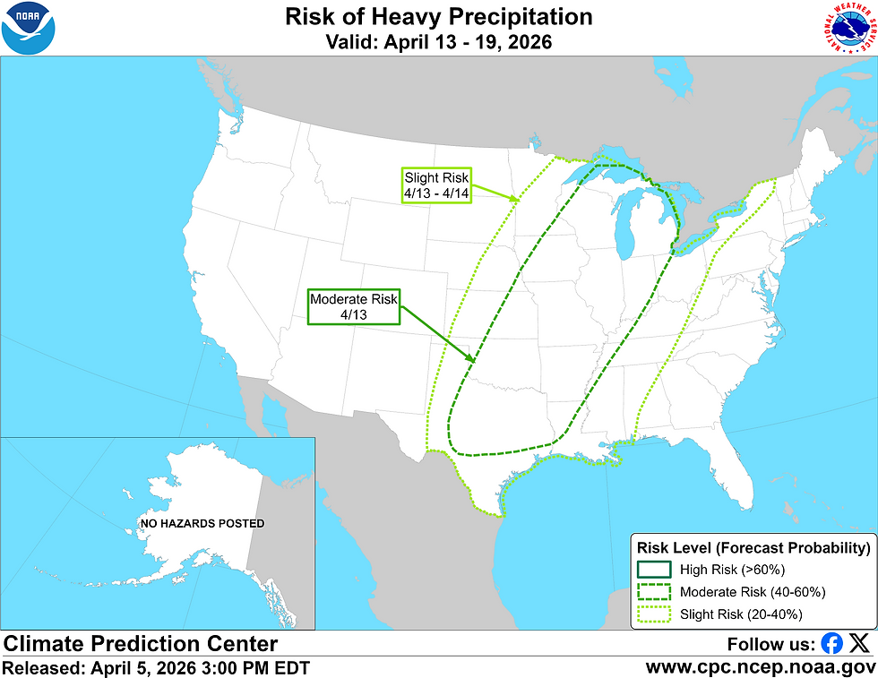
The latest outlook by the Climate Prediction Center already has a Moderate Risk for heavy rain and flooding concerns across the central Mississippi River Valley region starting by Monday of next week. It's all lining up for an active stretch of weather across the central US.
While the rain is beneficial, this may be too much of a good things as we get into the spring planting season. When may the pattern simmer down a little bit? Well long-term outlook shows quite a lot of precipitation across the Corn Belt through late April. There's not much a dry signal for the foreseeable future.
A lot to watch in the week ahead. Those with interests on area rivers should keep a very close eye on the ongoing forecast. Severe weather certainly cannot be ruled out as well.
-Meteorologist Nick Stewart


Comments