


NOW THAT FELT GOOD...
- Dec 8, 2023
- 4 min read
After a couple of weeks of wintry weather featuring snow and single digit lows, a sunny day and highs in the 50s does wonders for the constitution. It's amazing how good a 55 degree day feels after you're acclimated to the 30s. I dare say I ventured out without a coat. Oh, what a big boy I am!
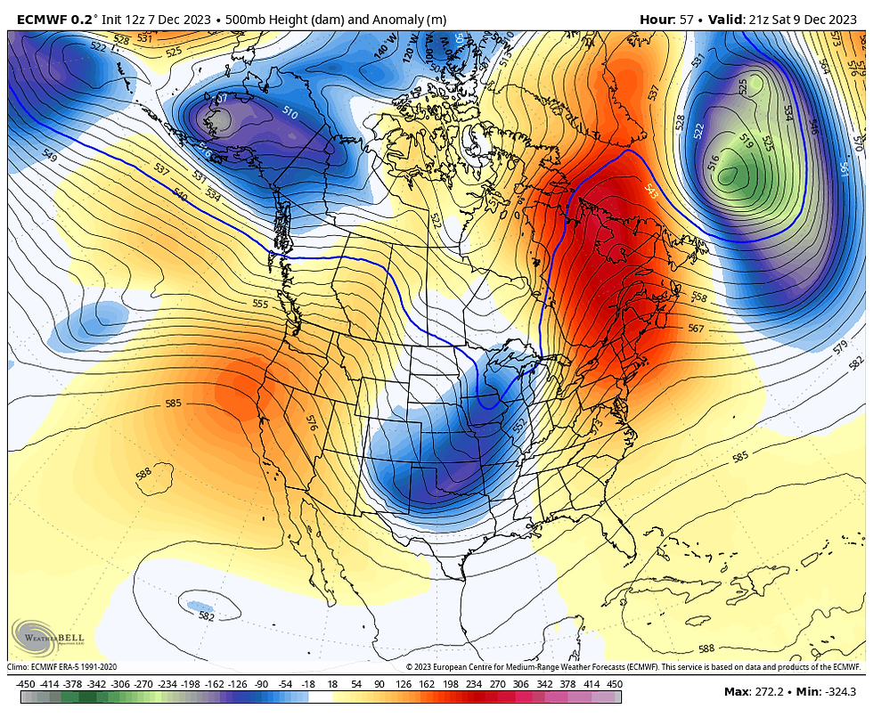
The sparkling weather is the result of a 500mb ridge passing through the Midwest.

Subsidence (sinking air) under the ridge produces cloud free skies and enhances the effects of mild westerly winds. You can certainly see the cold air bottled up well to the north near the polar jet. What a day for the Midwest.

Here's temperatures at 1:00pm. Not much winter to be found.

Look at the temperature departures across North America. From the North Pole through the Rockies and Mexico, above normal temperatures dominate the region. As I sit here at the table, I'm watching a barge pass quietly down the Mississippi. I can remember a few years when the river was frozen up around Thanksgiving and barge traffic was shut down for winter. Those days are long gone.

We'll get another mild day Friday, but clouds will begin to increase as the ridge passes and the pattern breaks down for a few days. Notice how the 500mb pattern evolves Saturday. A long wave trough has emerged from the Plains, bringing colder weather and a quick hitting round of rainfall.
So after another day in the 50s Friday, a cold front slips through the region by midnight. Once through, a low pressure wave rides northeast into central Illinois late Friday night. That provides the forcing for a band of rain late evening through the overnight. For some the track is actually favorable for snow, but there's not enough cold air, imagine that! Anyway, the rain comes and goes by Saturday morning, with only a slight chance of some wet snow mixing in late across the far NW.
One important change is the track is just far enough east now that the heavier rains now appear destined to fall in the SE half of the area. That again means the drought stricken areas of eastern will wave this one off. Here's the latest drought monitor issued Thursday.

Here's the rainfall forecasts from the EURO and GFS. I would not be surprised if even in the southeast these amounts are too generous.
The EURO

The GFS

What little snow was shown in the NW yesterday has been reduced even more. In fact, the GFS shows nothing at all. I could see a few wet flakes in the far NW at the tail end of the system, but nothing that would accumulate. Here's the latest snowfall forecasts.
The EURO
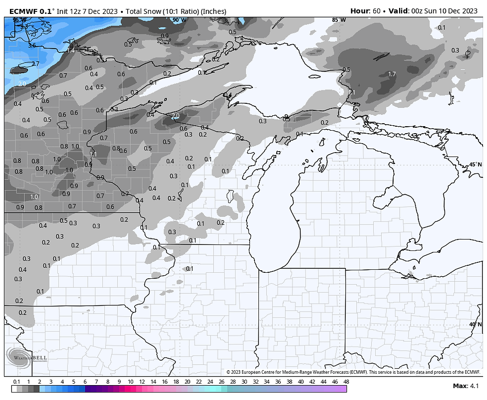
The GFS

Temperatures behind the system will certainly nosedive, especially Sunday. Readings will go from the upper 30s and low 40s Saturday to the low to mid 30s Sunday. After another chilly day Monday, warmer air gradually returns and by next Thursday and Friday highs will once again be back around 50.
After that, the big question is whether or not the mild air remains in control through Christmas. Yesterday's GFS was considerably colder than today's run by December 20th. The EURO makes an attempt at colder air around the 21st, but at least for now, I have little faith in any solution (especially anything cold) beyond December 17th. CPC's 8-14 day outlook through December 23rd is looking rather toasty.

To add some perspective to how dry the pattern looks, the GFS shows this for snow cover around the nation December 24th. Gosh, that is abysmal. There's not a place in the central U.S. showing snow on the ground. That would be unprecedented, creating a new benchmark for lack of snow on the ground December 24th. Hope that changes in coming days.

Flat out, I'm very distraught at the lack of snow as well as the dryness indicated in the overall pattern. Here's hoping for a radical change that brings a more moderate brand of warmth and dryness. In the big picture, it would be beneficial for all of us going forward.
Well, enjoy another mild late fall day and by all means have a great weekend. Roll weather...TS
HOT HOLIDAY DEALS AT OUR LITTLE WHITE CHURCH IN GALENA

A HEAVENLY RETREAT
Enjoy some Holiday Magic at the Little White Church of Galena! Terry and I are offering fantastic holiday discounts from now through the end of January. Book now and any weekend from today through January 2024 is $600. That is the total price. The only exception is if you bring Rover. There is a small pet fee. This is a 50% savings, even dear old St. Nick can’t match it!
The Little White Church is a fully renovated 18th century church nestled in the valleys of Jo Daviess county…just a little over five miles to the center of downtown Galena. With all the amenities of a five-star hotel, the Little White Church offers beautiful historic touches with comfort and style. Every group we have hosted to date has given us a perfect 5-star rating. We are considered a Superhost by Arbnb.
We have five beds, three full bathrooms, full kitchen with dishware, small appliances, ice maker, a luxurious private master suite with en-suite and private deck, a large main floor deck, attached two car garage, fire pit, gas grill, and 2700 sq feet of space to sprawl out You will not find a more modern and historic place to unwind and get away from it all. Furthermore, we are now decorated for the holidays, so get your holiday spirit cranked up and come and join us. I also can arrange a talk about the Christmas Eve weather scenario with Santa’s favorite meteorologist! Just text me at 563 676 3320. https://www.tswails.com/galena-airbnb
Carolyn


Comments