QUIET WEEK AND A WEEKEND STORM TO WATCH
- Nov 3, 2025
- 3 min read

There are always two sides to a story, and in the case of the upcoming weather pattern, two scenarios for a weekend storm system with the European and American (GFS) models with a similar idea of a weekend system Thursday night/Friday morning, but with critically different details such as timing and placement.
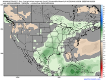
The operational European has decent rain chances over the area as depicted above. While not a significant amount of precipitation, it would run in the ballpark of 0.25" to 0.50" which is on the higher side of all the model data available.

European Ensemble guidance indicates about a 40-60% chance of at least 0.1" with the first of two systems this upcoming weekend with higher probabilities farther east across southern Wisconsin and northern Illinois. This would at least benefit eastern Iowa and areas along the Mississippi River.

The ensemble mean is about 0.2" to 0.3" on the European ensemble locally. This continues to be somewhat favorable.

The European is also indicating a second system Saturday as a mainly rain affair as cold air hasn't quite built in to allow snow chances. Although it does show some light snow potential farther north into Wisconsin and Minnesota. I do believe there is a pretty good chance for some snow in the Upper Midwest, but accumulation is a little more unlikely.

Snowfall probabilities of 1" are quite meager locally, and even across the northern stretches of the Midwest. The reason I point this out is the American GFS has been a little more robust with snow development and I have seen some of the hype pages on social media calling for widespread snow. I just don't see the model agreement yet at this point.

The GFS with the first system is farther east Thursday night/Friday morning and keeps almost all the precipitation to the east of the area. This would be another miss on some much needed rainfall, even though it might not add up to much.

The American GEFS (ensemble) is equally far east with the precipitation potential for the first system which is rather interesting. Typically the ensembles have a bit of a meeting in the middle ground, but they are split along with their deterministic model brethren. One will likely cave to the other in due time, especially once the storm system gets better sampled by our upper air weather balloon network.
I personally believe it will trend more toward the European solutions, which means more rain potential Thursday night/Friday locally. We need it!

Now the GFS also has that second system Saturday and there is some funny business with it. It is much stronger and brings accumulating snow across the area. I think this remains an outlier solution and is of low confidence. Worth watching for some potential snowflakes, but the likelihood of accumulation is limited at this point in time. I am sure Terry is all over it hoping for the white gold to come early.

For those curious, the first 1" of snow on average falls about December 5 in the Quad Cities, so we're about a month out from from this which is why any models showing accumulating snow in November should be taken with some skepticism.

The first measurable snow is earlier on average - November 21 for the Quad Cities so we are still early for that as well. Soon enough the snow will start flying and there will likely be many model runs between now and then showing some big snow in the future. Always have some doubt when you see images showing some accumulating snow several days in advance.

Temperature trends will be on the warmer side of normal in the short term with low 60s in the forecast this week. Heading towards the weekend behind the weekend systems temperatures will take a bit of a hit, dropping back into the 50s and perhaps even 40s for highs.
Looking longer term, next week likely starts yet another warming trend before what appears to be a colder end to November we discussed in detail yesterday. That still appears on track based on the model data coming in today.
Have a great weekend, everyone!
-Meteorologist Nick Stewart


Comments