SHUT DOWN MODE...
- May 6, 2025
- 4 min read
FROM THE "IT COULD ALWAYS BE WORSE VAULT" (MAY 1-3, 2013)

An unprecedented spring snowstorm impacted the central United States from May 1 to May 3, dropping record-shattering amounts of snow up and down the western Mississippi River Valley. Some locations across the southern United States saw their first ever May snowfall and cities in Kansas and Missouri saw their highest snowfall totals in 106 years. Meanwhile, noteworthy May single day and storm total records for the states of Iowa, Minnesota, and Wisconsin were eclipsed by this event. South central Iowa up through southeast Minnesota and western Wisconsin bore the brunt of the snowfall with 10+ inch reports not uncommon. My area managed to escape the snow, but it broke May records just to the west, with the snow extending as far south as Arkansas. Osage, Iowa picked up 13 inches with Dodge Center, Minnesota picking up a whopping 15.4 inches.

Photos above and below courtesy of the National Weather Service.


In Des Moines snow fell continuously from 6:34am May 2nd to 2:48pm May 3rd, for an uninterrupted 31 hours and 14 minutes. It was Iowa's all-time largest snowstorm based on the average statewide snow: 3.3 inches. Very impressive considering the eastern third of Iowa saw no snow at all. It was also the latest spring storm to produce more than a foot of snow in Iowa.

As the saying goes, it can always be worse, and it was across central and western Iowa May 1-3rd, 2013.
TERRY'S LITTLE WHITE CHURCH IN GALENA
Check out some of the ways you can save as much as $400 dollars on a stay at my AIRBNB, a renovated church in Galena. It's a most loved guest favorite with perfect 5-star ratings. https://www.littlewhitechurchgalena.com/
TURNING DRIER AND WARMER
The weather pattern for May is unusually stagnant, with an omega block keeping our weather from changing much. Without the full force of the westerlies to act as a kicker, systems bog down and overstay their welcome, especially in those places where the weather is cool and wet under the persistent troughs (in blue).

In this animation, you can see an upper air circulation swirling nearly stationary over southern Indiana. Spokes of energy (vorticity) have been rotating around it since Saturday. We were far enough away for the cold core to keep showers away Monday, but some of my southeastern counties dealt with clouds spinning around the center. This kept temperatures there in the 60s, while some low 70s were found in the west, where sunshine was more prevalent.

The next couple of days should see partly cloudy skies and slightly warmer temperatures, with enough sunshine in all areas to get highs back in the low to mid 70s. One caveat to watch comes Wednesday afternoon, when some weak convergence is shown that might be able to kick up a few light showers. The area north of I-80 is most favored. This develops between the retreating low to the east and a secondary one to the southwest. I doubt precipitation would amount to much, if indeed it can reach the ground.
This new disturbance (as it drifts east) reinforces cool air aloft and E/NE winds that may cool temperatures several degrees Thursday and Friday. In fact, the EURO holds readings in the north, to the low to mid 60s while the south is closer to 70.
Saturday, a back door cold front is shown entering the region. It is faster on the EURO passing during the day. The GFS has it holding off until evening. Both scenarios produce a warm day in the south, with highs in the upper 70s to near 80. However, the EURO solution could hold readings in the north to the low 70s. Additionally, the EURO gets the front through quick enough to keep any showers and storms to the south. The GFS pops a few towards evening up north near HWY 20 when it sneaks into that area. However, moisture is scarce and forcing weak, so any rain should dissipate quickly after sunset, (if it can develop at all).
At this point, I don't think cooling will be too significant Sunday unless the high pressure comes in stronger on future runs. I would say 72-78 from north to south looks in the ballpark.
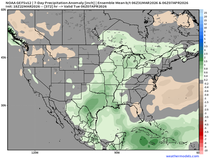
One thing really stands out the next 10 days and that's the fact the upper Midwest will be under the blocking high and that means minimal if any precipitation. Look at the 10-day rainfall departures through May 14th. We are going into shut-down mode.
The EURO

The GFS

Temperatures are near to slightly below normal through Sunday, but after that models are indicating a pattern that should produce above normal readings in the week 2 period. Here's the 7-day temperature departures for the period May 13th-20th.
The EURO

The GFS

By the way, we are now entering into the meat of severe weather season. Obviously the lack of precipitation means a lack of storms despite the needed warmth. The CFSv2 week 2 supercell composite parameter shows the best chances of any severe weather well to the southwest.

That is a wrap for now. Enjoy what should be a pleasant May day. Roll weather...TS


Ascent Innovations is your trusted partner for Microsoft Dynamics 365 Finance & Operations. With a focus on excellence, innovation, and client success, we deliver tailored solutions that transform businesses. Our certified experts bring extensive experience to every project, ensuring seamless implementations, efficient operations, and continuous growth. We're committed to your success, offering personalized support, training, and strategic guidance. As your dedicated Microsoft Dynamics Partner, we harness the power of Microsoft Dynamics 365 to drive productivity, optimize finances, and elevate your competitive edge. Join us on a journey of digital transformation, where your goals become our goals, and your success becomes our success. Your future is brighter with Microsoft Dynamics 365 ERP Solutions or Software, and we're here to make it happen.