


SLOW & STEADY WINS THE RACE
- Jan 2
- 3 min read

We rang in the new year Thursday with a cold but quiet day (perfect for watching football). Outside the far south, where some low stratus prevailed, the rest of the region enjoyed periods of sunshine. With winds generally 10mph or less, it's fair to say we got 2026 off to a promising start.
You've probably heard the old proverb from Aesop's fable that slow and steady wins the race. So, just like the tortoise, we're going to let our weather plod slowly forward with the hope that next week we have a shot at winning the race with a potential run of 10 (or more) days of highs above freezing.
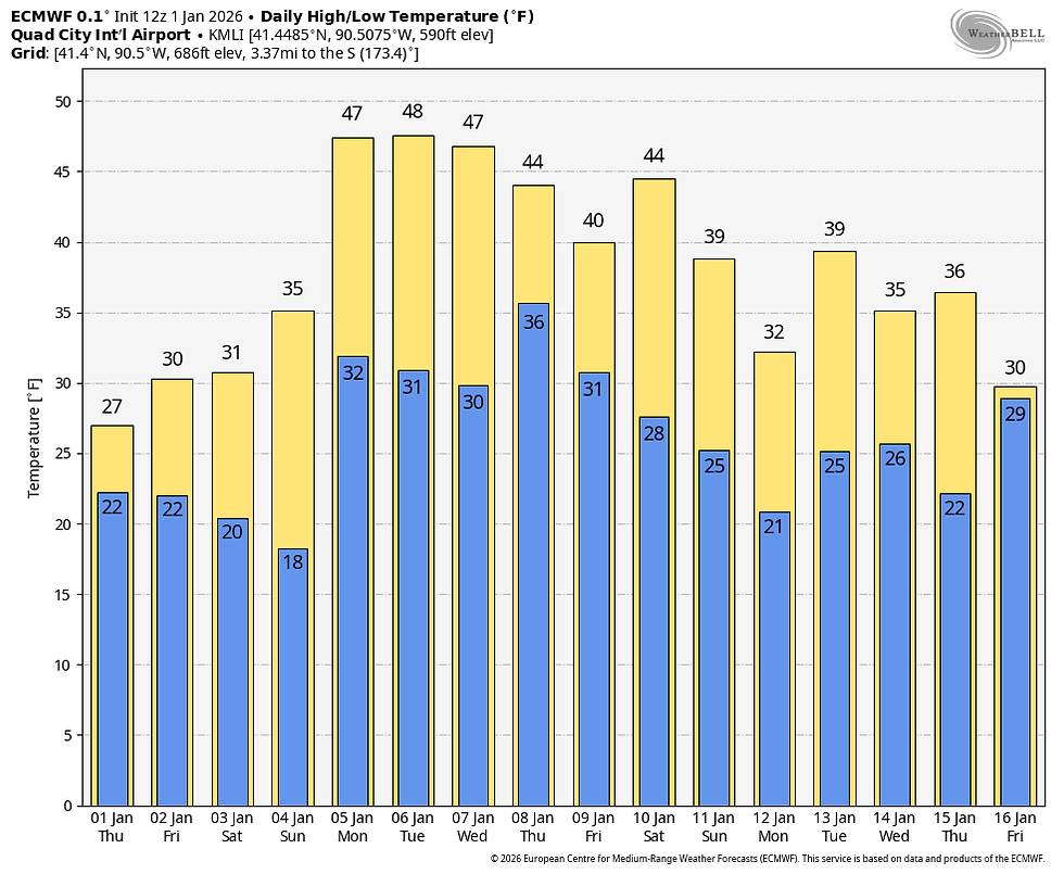
The EURO solution, below, shows 12 consecutive days with highs at or above 32 degrees Monday the 4th through Thursday the 15th. 6 of those days are in the 40s.
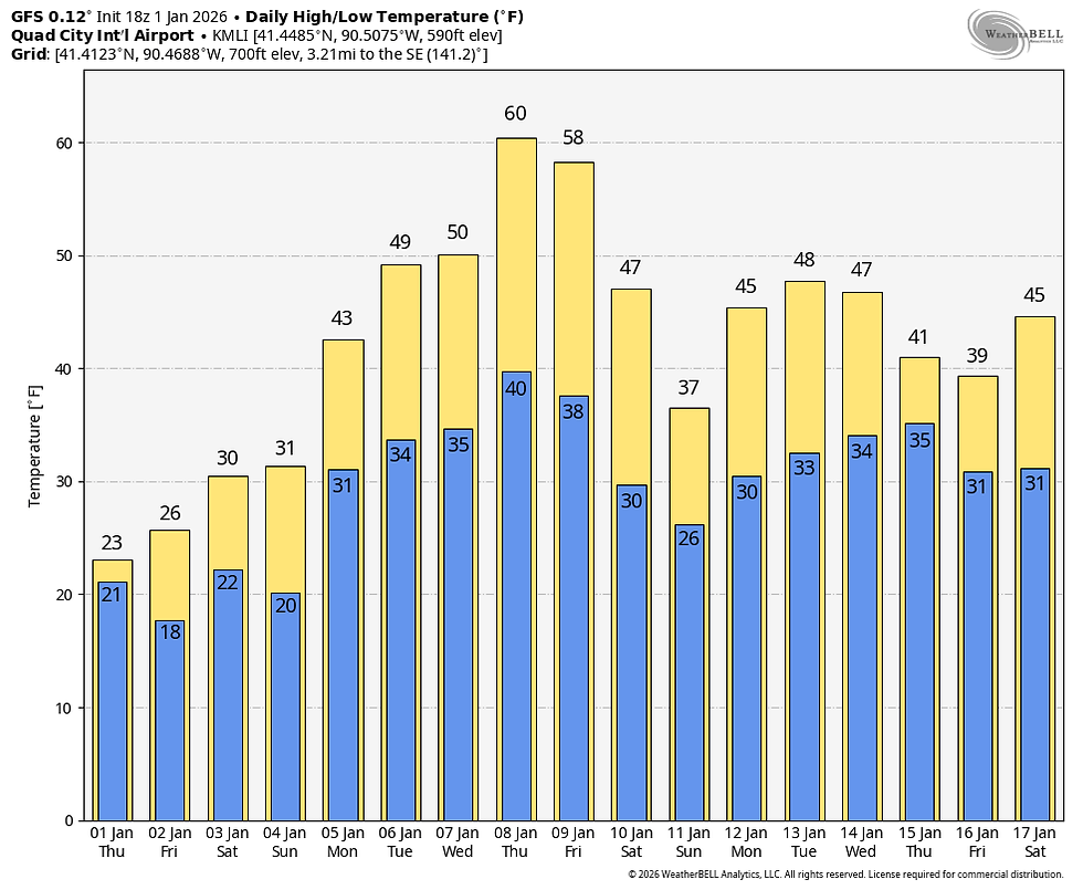
The GFS is really excited about the warmth, with 13 consecutive days above freezing. 11 of them are at least in the 40s, with 2 in the 50s and one at 60! I could see a day or 2 in the low 50s, but have serious doubts about a 60.
FLASH SALE THIS JANUARY

A January weekend, (4 GUESTS FOR $499) My AIRBNB outside of Galena is ready and waiting. Enjoy our unique, fully renovated church. It's an AIRBNB guest favorite with 5-star reviews. Warm and cozy, even in the winter. Minutes from Galena. Call or text Carolyn at 563-676-3320 for details about this very special deal. https://www.littlewhitechurchgalena.com/
THE GATE IS OPEN...
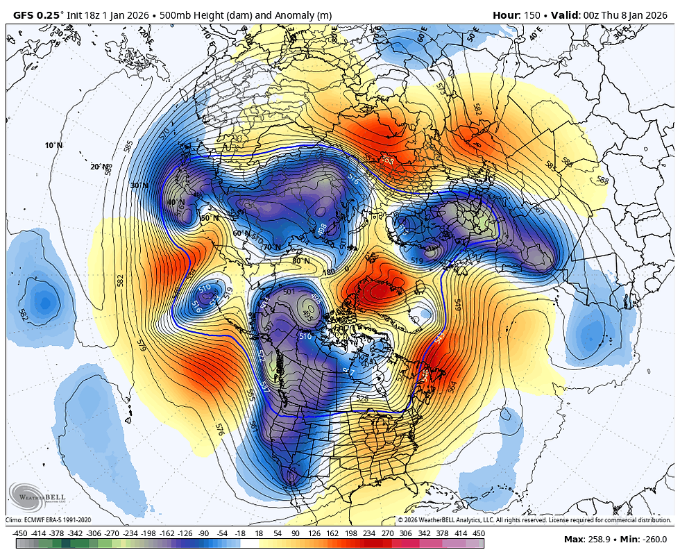
It takes some doing to get a prolonged streak of warmth such as that in January, and the first place to look for a reason is at 500mb (jet stream level). There, January 7th a strong trough is depicted over the west with a ridge centered over the Ohio Valley. That configuration opens the gate for unseasonal temperatures to build into the center of the nation.
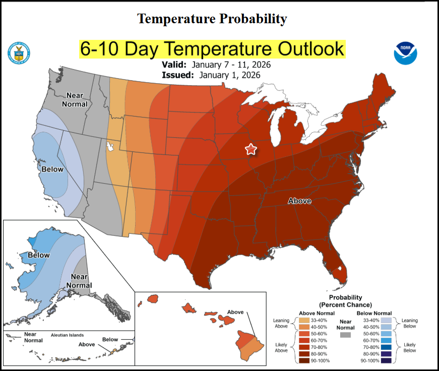
The Climate Prediction Center shows the anomalous warmth east of the Rockies.
At least for the next week, precipitation looks to be negligible, a trend that could continue into mid-January. The EURO shows this for total precipitation through the first 11 days of the year.

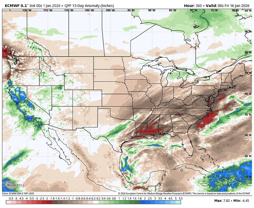
These are the precipitation departures shown the next 2 weeks ending January 15th. Again, much of the region east of the Rockies is shown with below, to much below normal precipitation. Mild and dry, hard not to take that in January...a huge bonus!
That brings up the million-dollar question, how long does this last? As I've alluded to in recent days, long range guidance continues to suggest that teleconnections such as the AO (Arctic Oscillation), the EPO (Eastern Pacific Oscillation), and the NAO (North Atlantic Oscillation) are shown trending negative. That implies the western trough breaks down, allowing colder air access to the center of the nation around the 17th or 18th of January. Both the EURO and GFS indicate a significant trough developing over the NC United States that would certainly do the job.
The EURO control

The GFS control

For the 5th consecutive day, the EURO control shows 30-day temperature departures significantly below normal for the period January 15th through February 15th.

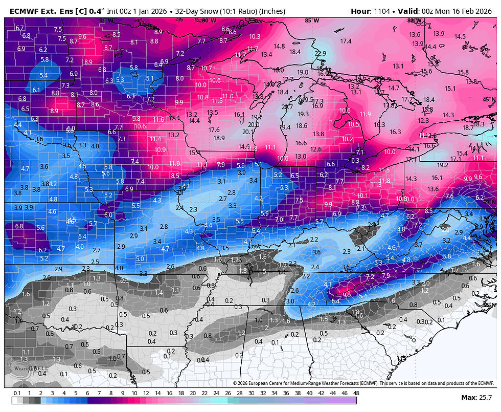
The EURO control also shows some healthy snow during that 30-day period.
This idea of a pattern change mid-January seems to be well-supported, but so far the deterministic runs haven't shown what the teleconnections and long-range ensembles are indicating. I would expect to see that in the near future, if indeed this turn to a more wintry brand of weather is going to take place. That's a wrap for now. Roll weather...TS
TSWAILS.COM expert weather consulting services (CLICK FOR MORE)

Private consulting
Legal forensic services as an expert witness
Public speaking engagements for groups or individuals
Post storm analysis
A private day-long weather school class
Specialized events forecasts
Severe weather seminars
Lectures and training
Climatological services
Meteorological workshops.


Comments