


SO CLOSE, YET SO FAR
- Sep 20, 2025
- 3 min read

If you've been following along for the last several days this shouldn't come as a surprise, but the rain threat is starting to wind down around the Quad Cities region - from eastern Iowa into northern Illinois - as the heaviest rain axis is likely to remain south of the area. The high-resolution models are starting to get in range and the picture they are painting Sunday night into Monday keep the bulk of the rain south of the area.
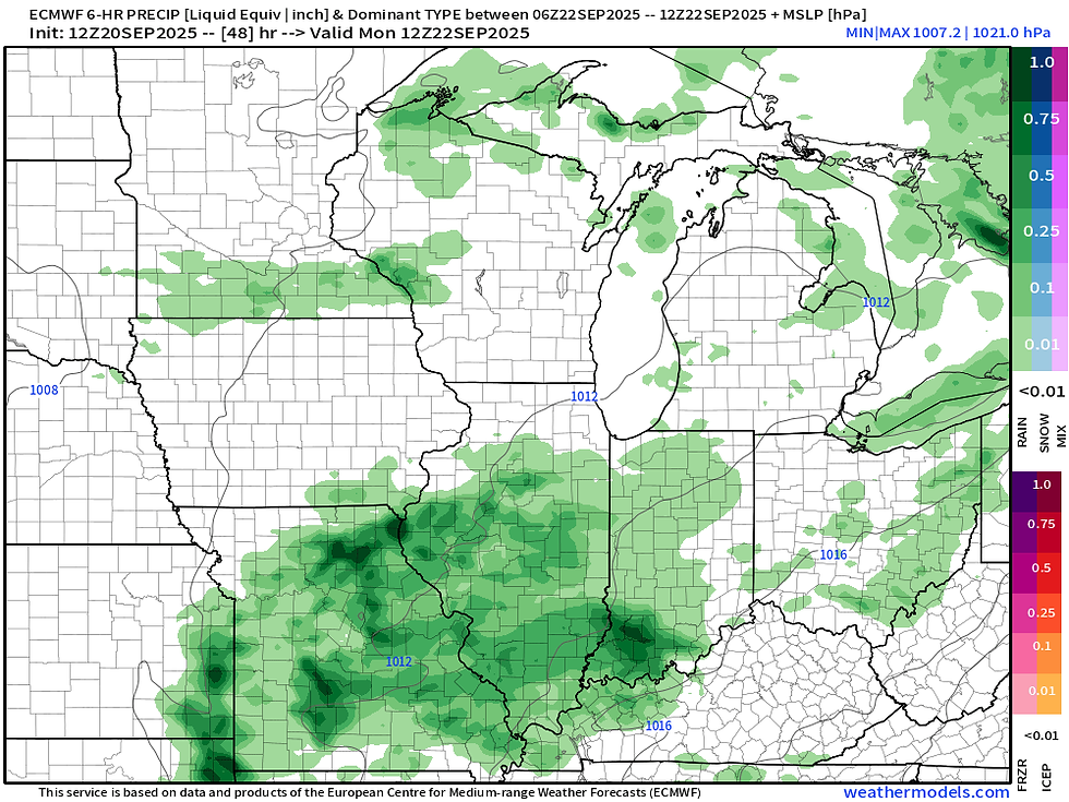
The operational Euro has the moderate to locally heavy rain in Missouri and central/southern Illinois by Monday morning. This is well in alignment with other models like the GFS and the NAM. All indications are the Q.C. will likely miss out on this first of two systems traversing the region. With that said, light showers are still not out of the question.

The European ensemble continues its southward trend, which again should not be a surprise as this was heavily discussed here as a likely outcome of this pattern. Now the 0.10" line is just south of the area, with a wider swatch of 0.5" from central Missouri into central Illinois.

The next system, likely Tuesday night/Wednesday, also continues to trend south. You can see some very heavy rainfall potential in central/southern Missouri. Still cannot rule out some showers in the area with this Tuesday night/Wednesday morning, but not expecting this to be much at this point.

The European ensemble for rainfall continues to reel this in as well, although the northern edge of the heaviest rain is still somewhat involved in southern/eastern Iowa with a few members pushing the rain more to the north. I think the southern option is the most likely option.

Officially, the forecast from the Weather Prediction Center continues to have some pretty significant totals in southeast Iowa and the Q.C. with 1.0" to 1.5". I still consider this too far north an an artifact of blended model approach, so I would continue to use caution when you see WPC forecasts out in the wild. I think it would be optimistic to get these heavy totals that widespread that far north.
We likely get a pretty significant update to this forecast Sunday trimming some of the northern high totals. We shall see!
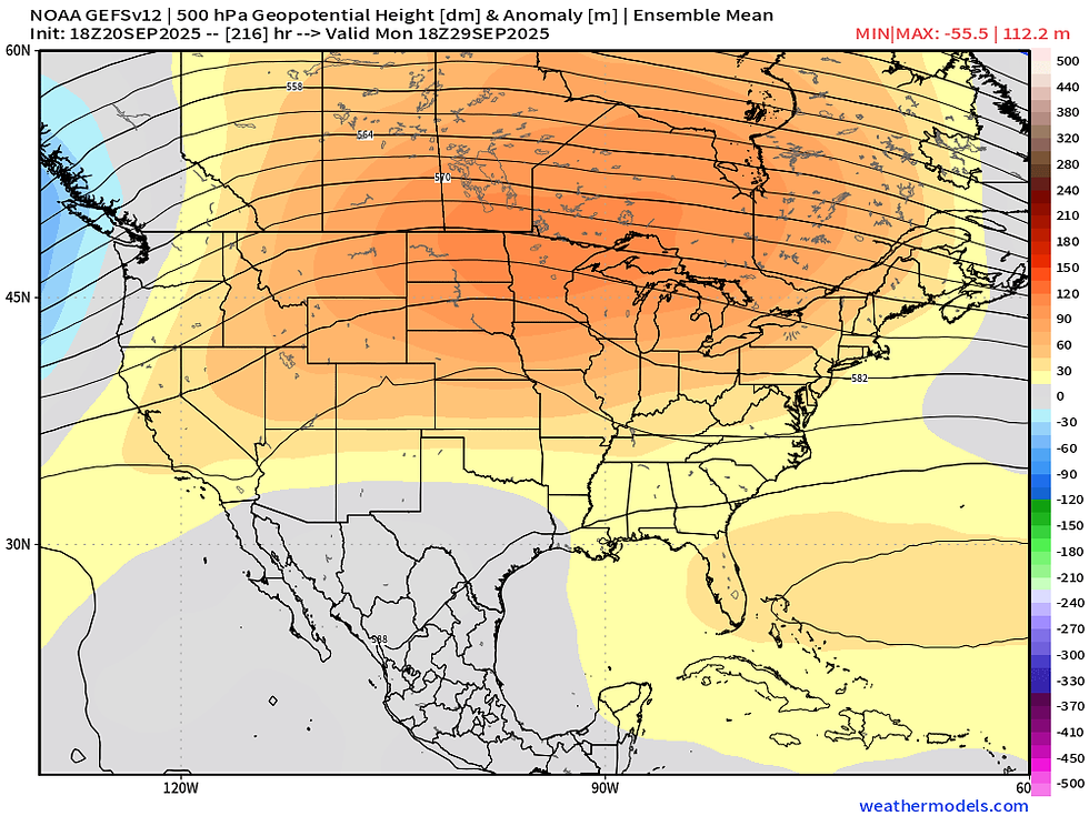
Let's continue with a refreshed look at late September/early October - bottom line not much has changed from previous discussions as a strong ridge is likely to build back in pumping the warmth and dry weather to the region. This is a highly amplified pattern and quite anomalous for the time of year.

What is somewhat remarkable is the very long range American ensemble (GEFS) that is indicating temperatures running 8°C+ above normal a week and a half out. This is an indication at minimum of high confidence warmth. Just how warm is a bit TBD but note that October will start quite warm based on current indications.

I will end with Typhoon Neoguri in the western Pacific Ocean. It is quite the specimen on satellite today. The oceans have been unbelievably quiet globally. Neoguri as it recurves north and pumps heat into the northern latitudes could finally get the weather pattern disturbed and bring some more action to North America. The lack of impactful weather patterns in the US over the last few weeks likely has some tie to the quiet nature of the Pacific.
-Meteorologist Nick Stewart


Comments