


SPRINGTIME PATTERN IS TAKING OVER
- Apr 8
- 3 min read
A rather classic spring-like pattern is taking over the Midwest as we head closer to the weekend which will feature some big temperature swings, threat for heavy rain and some breezy conditions. Wednesday will be the start of this pattern which will feature strong warm air advection with windy conditions followed by a chance for scattered showers and storms. The first bigger hit of heavy rain comes Thursday night into Friday morning as a stalled boundary is the focus for thunderstorm development.

Wednesday afternoon ahead of an approaching cold front wind gusts will likely top 40mph for portions of the area out of the southwest. This will pump in some much warmer air with highs likely pushing into the 60s and 70s.
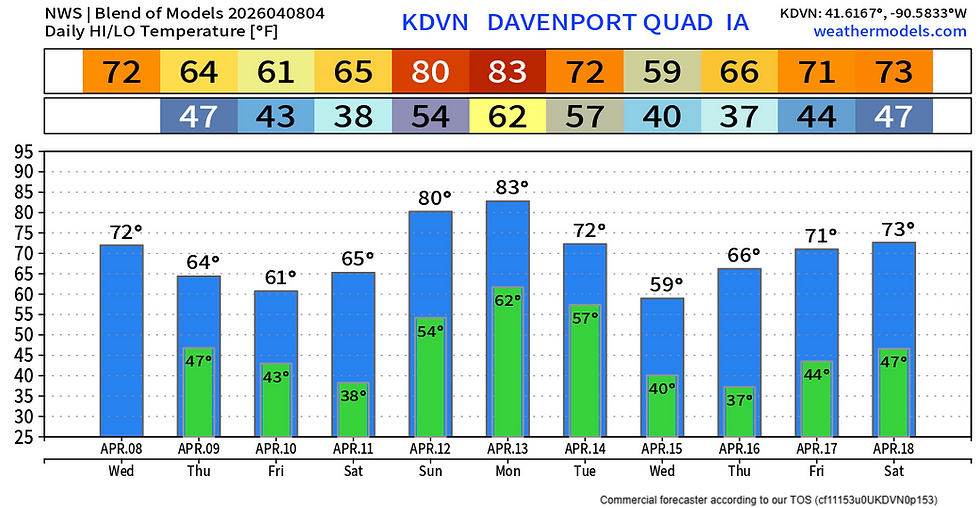
The model blend shows highs Wednesday in the low 70s for the Quad Cities with a drop Thursday/Friday on the cool side of this cold front which is projected to stall out just to the south of the area. More significant warmth is looming towards the weekend with 80s back on the table, and that comes with a renewed threat of showers and storms, especially Sunday as Saturday is a bit of a break between weather patterns.
As the cold front approaches late Wednesday evening and overnight we could see scattered showers and thunderstorms. Overall moisture supply is limited so we are not expecting very heavy rain with this threat. A strong storm or two is possible, mainly with gusty winds, but instability should be lacking therefore widespread severe weather is not likely.
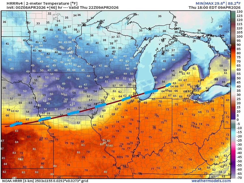
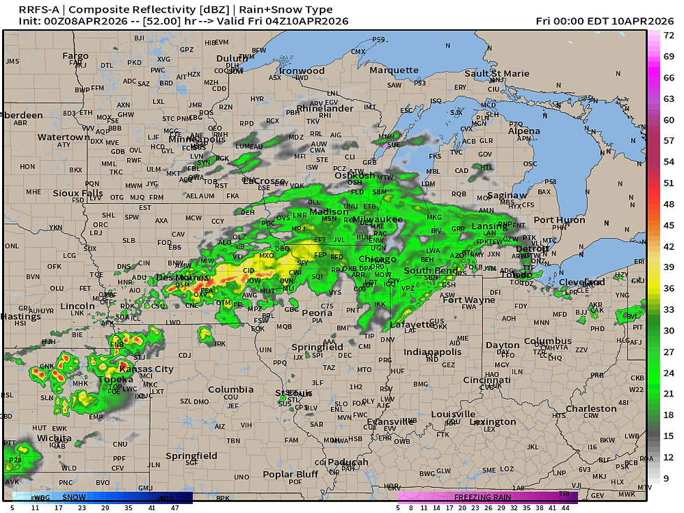
Thursday afternoon the cold front likely stalls out just to the south of the area. Notice the big range in temperatures across the region with 70s and 80s just to the south. As is pretty typical with these springtime patterns, these stalled boundaries act for a focus for heavy rain, and we will likely deal with that Thursday night into Friday.

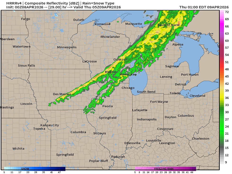
Longer-range high-resolution modeling has showers and thunderstorms developing on the north side of this boundary across Iowa and northern Illinois. This makes a lot of sense given the boundary position just to the south of the area. This heavy rain typically falls on the north side of the boundary, which lines up very well with what the RRFS shows above.
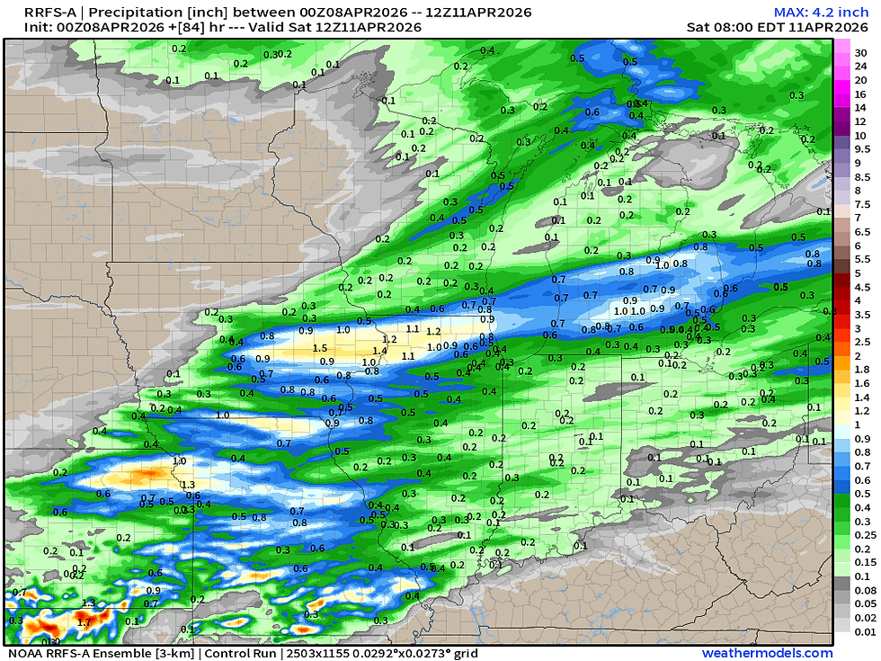
The RRFS is indicating a corridor of 1-1.5" of rain through Saturday morning with this first round of rain. Again I think this lines up pretty well with overall pattern recognition. The placement of this axis could be north or south pending the exact location of the training thunderstorms, however I think the potential of that heavy rain looks good.
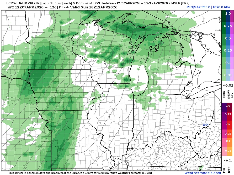
EURO - SUNDAY
GFS - SUNDAY
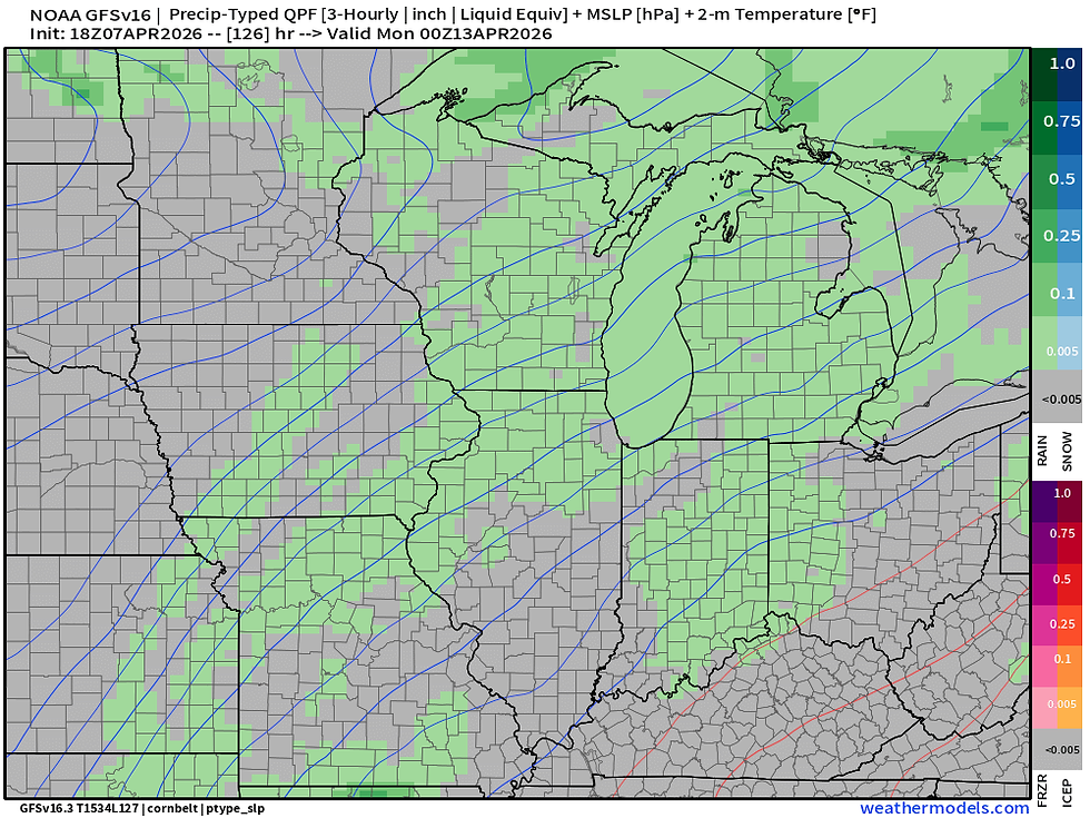
Sunday looks like the next risk for rain in the region, although there has been some retreat in the heavy rainfall concern with this second wave. Sunday looks quite warm, however, with that strong southwesterly flow pumping in warm air and more importantly, moisture, before our third wave early next week in the Monday/Tuesday time frame. Heavier rain and even a strong storm threat Sunday looks more to the west.
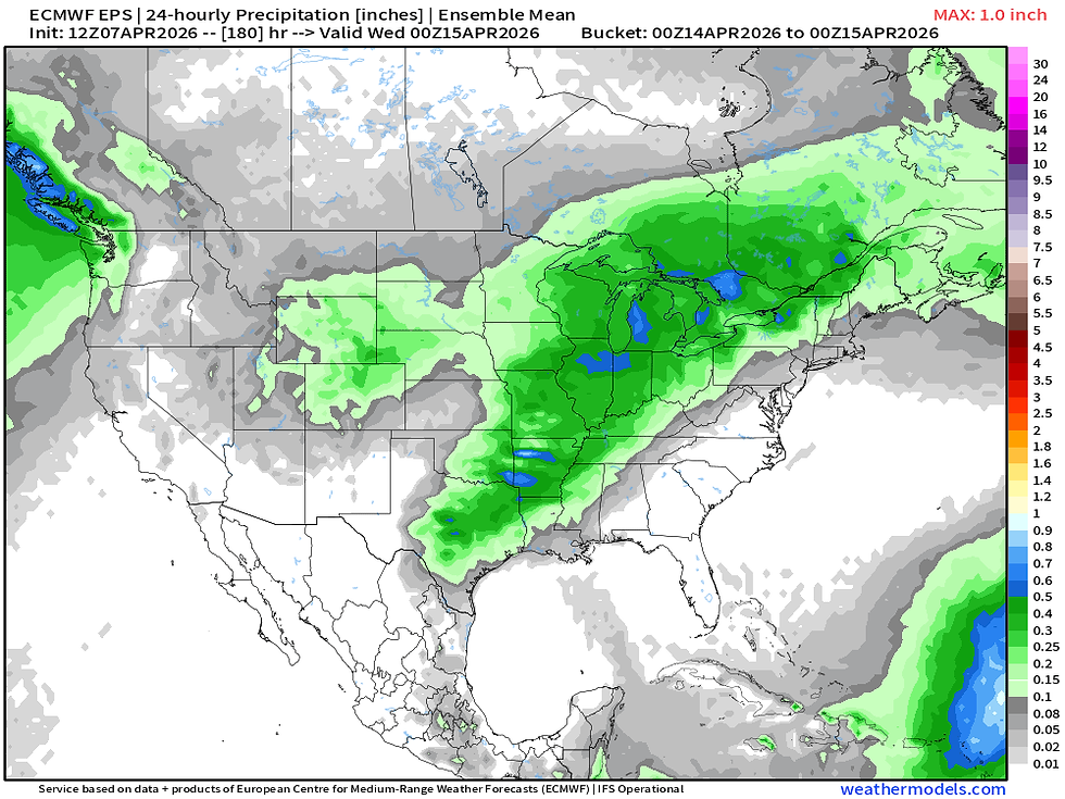
The European Ensemble has a pretty good signal for this third wave of rain and storm potential Monday/Tuesday. I would not be surprised to see this also accompanied by severe weather locally given the upper air support and instability likely in place ahead of this storm system. We will watch this regionally for severe weather potential.
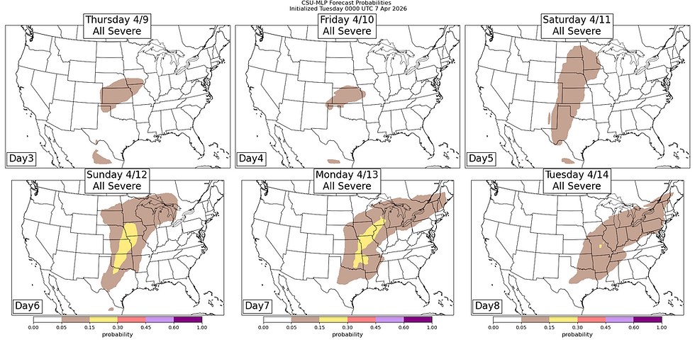
Machine learning forecasts have some 15% chances creeping into eastern Iowa and northwest Illinois Monday. The Storm Prediction Center also has an outlook in the vicinity but not quite this far north. Again I wouldn't be surprised if we are talking about severe potential Monday a little more depth in time, but for now let's just call it a watch item with lots of time in between.
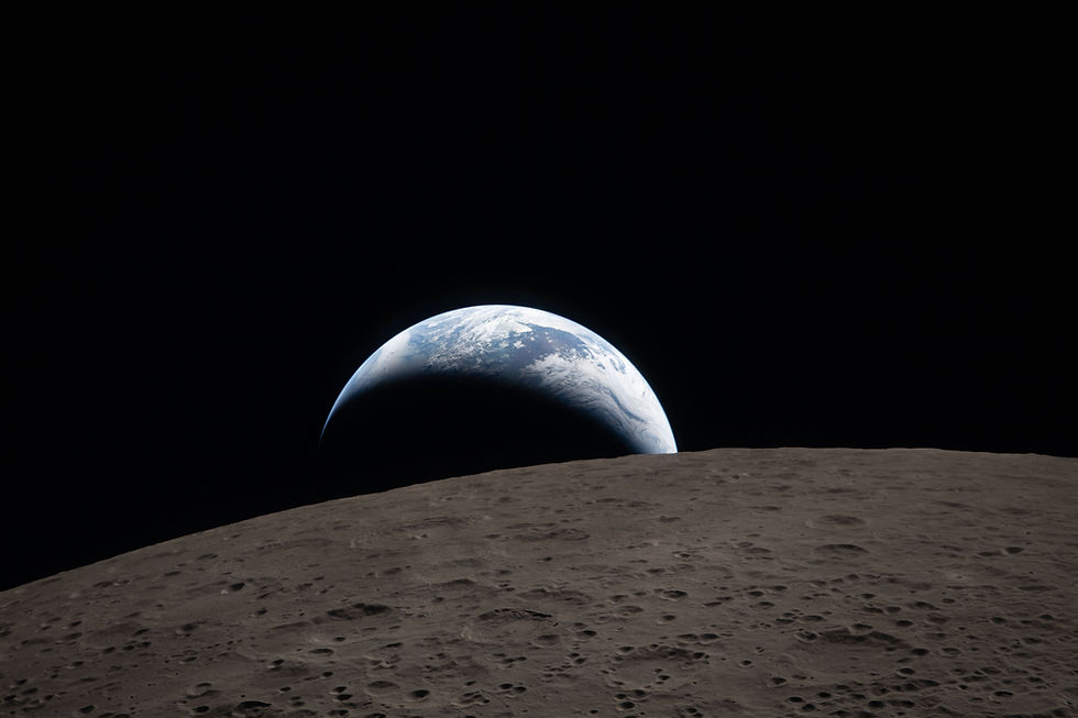
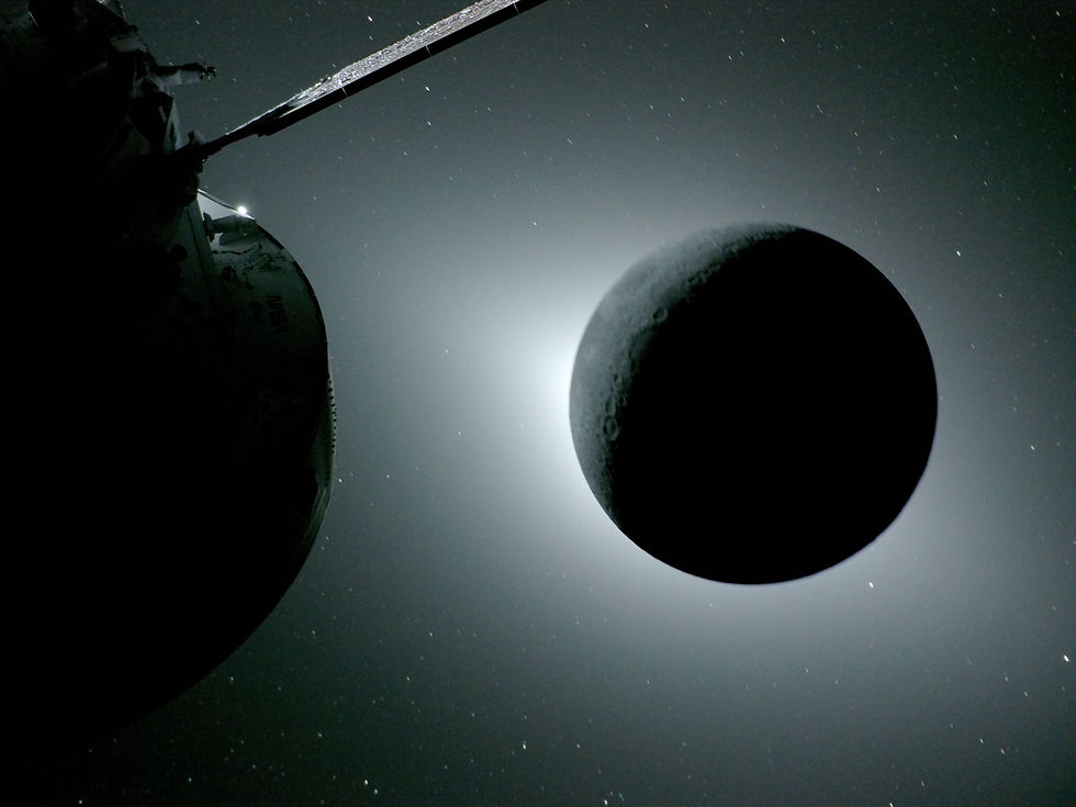
That's about all I got. I want to end with some images from NASA's Artemis II as it made its lunar flyby Monday - amazing images just about 4000 miles from the surface of our natural satellite. It was so incredible to help support this mission with weather support for the actual launch last week. Working on console knowing we are starting our generation's moon shot was an honor, and I cannot wait until we put humanity back on the surface.
-Meteorologist Nick Stewart


Comments