


THE BATTLE BETWEEN DRY AIR AND RAIN
- Oct 26, 2025
- 3 min read
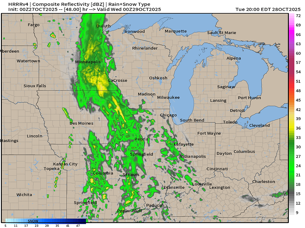
The state of the weather over the Midwest can be summed up by the fact we can be quite excited for 0.5" of rain. It has been just so dry, but an autumn storm looks to bring some appreciable rain to the area. The problem? There is a fly in the ointment as I alluded to yesterday - dry air over the northern Great Lakes that will cause quite a gradient in rainfall from west to east. The good news? High resolution modeling is depicting rain moving into the area Tuesday late afternoon and through the evening, with rain likely continuing into the first half of Wednesday.
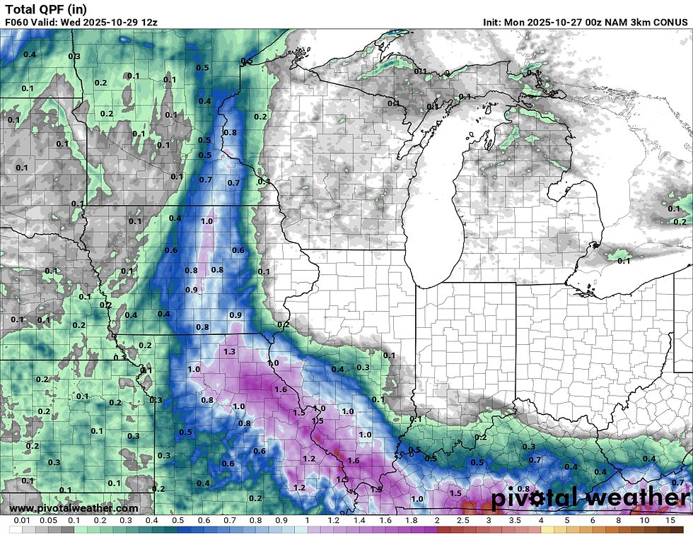
While confidence is somewhat high in rainfall for the area in the 0.25" to 0.50" range, there are a few outlier solutions that tilt towards the dry air winning out and killing rain chances. The NAM 3km, for example, is the outlier to watch as it keeps most of the area dry with the more meaningful rainfall in central Iowa through Missouri and far western/southwest Illinois. This is the outlier, but again given some dry air, I don't think it's completely out to lunch.

Observed soundings across northern Michigan show this really deep layer of dry air, and notice the northeasterly wind driving that towards the area. Precipitable water values are less than a quarter of an inch with relative humidity in the mid-levels (cloud layers) at just 3%. That is done dry, and a problem. That is what will keep the 1" totals in check locally as we will be in the battleground region of moist and dry air. It can never be easy as of late.

The RRFS, which I have been trying to use more and more to get a handle on how well it performs, has that battle with dry air as well right over the area. I don't think the confidence in rain is as high as some weather apps and some people claim, and that dry air continues to worry me. That line of appreciable rain is uncomfortable close to Cedar Rapids, Dubuque and the Quad Cities.

The GFS, yesterday's outlier, has pushed the axis of heavier rain farther east which is ideal for us. Still, I think 0.50" is a reasonable best case scenario for eastern Iowa and northwest Illinois with 1"+ totals certainly probably across central Iowa through northern Missouri. Notice a lot of low/zero values across Wisconsin and northeast Illinois including Chicago - dry air problems.

Running through the rest of the global models the European you can tell is fighting that dry air locally as well, but at least keeps 0.25" a common number locally with a cutoff in northeast Iowa.
BOTTOM LINE: The Mississippi River looks to the the battleground between moist and dry air. If you are west of the Mighty Mississippi, rain chances are looking good. East of the Mississippi your chances rapidly decline reaching near zero the closer you get to, say, I-39. Either way this is far from a drought busting rain and really would be a "nice to have." I think the RRFS has a pretty good handle on things personally given the overall setup.

Behind this system the wind machine will ramp up Wednesday and Wednesday night with gusts likely topping 30mph locally. Any Halloween decorations outside might need to be secured, or deflated. No wild pumpkins rolling down the streets please! (I did see it one year in Cedar Rapids on my way to KGAN-TV for work!)
This north/northwest wind will start the transportation of some rather chilly air to the region just in time for the trick-or-treaters.
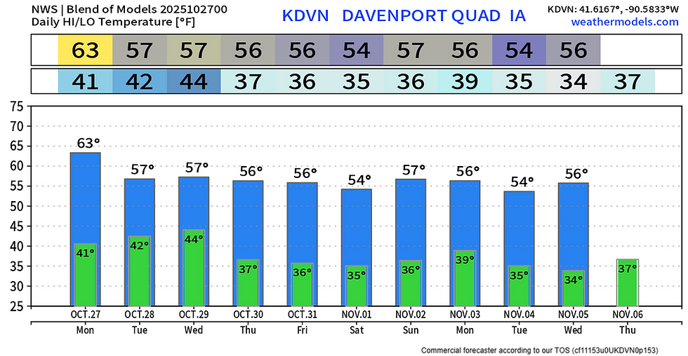
The model blend has spooky temperatures in the mid/upper 30s for the region later this week with highs in the mid-50s. Autumn temperatures really look to take over with some frost on the pumpkins likely in the morning. The hint at some slightly above-normal temperatures early next week is looking a little less likely based on the guidance this morning. Looks like the low-60s are decreased more towards the mid-50s. Not a big change, but notable. Still dry as well once we get to Thursday.

Five-day temperature anomalies on the European Ensemble are more neutral to slightly below normal next week. Out west ridging will allow the warmth to build and this could transition to us in time, but in a time frame I have pretty limited confidence in.
You wanted autumn, and we are finally getting autumn! Enjoy it before the conversation of dry air transitions to complications with a snow forecast (unless you love that white gold, then we're almost there!).
Have a great week!
-Meteorologist Nick Stewart


Comments