


THE BLIZZARD OF '26 IS HERE
- Mar 15
- 2 min read
A BLIZZARD WARNING IS IN EFFECT
WHEN: SUNDAY EVENING UNTIL MIDDAY MONDAY
WHERE: ALL OF THE AREA
WHAT: 5-10" OF SNOW, 60 MPH WIND, WHITEOUTS

SUMMARY:
The blizzard of 2026 is ramping up Sunday evening with wind and snow overspreading the region. Cold air surging into the circulation has caused thickness levels to collapse, allowing temperatures to fall into the upper 20s to low 30s. Wind chills are on their way to the single digits by midnight. N/NW winds have reached gusts of 45 mph, with some projected to hit 55 mph later tonight. Blowing and drifting snow, along with falling snow has begun to limit visibility. Blizzard conditions are likely to develop in the open country overnight (with occasional white outs). Travel will become very difficult in rural areas and is highly discouraged by authorities until after sunrise.
Travel is already a nightmare in central and western Iowa where snow began earlier. I-35 from Ames to the Minnesota border is blocked to travel. Much of I-80 west of Des Moines as closures and blockages. Those conditions are working thier way east.

Just before sunset these images were shared by the Iowa DOT. The first has whiteout conditions at the I-80 interchange near Minden Iowa.

The other is near the interchange of HWY 69 and I-35 in NC Iowa.

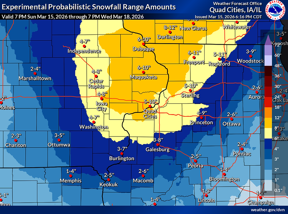
SNOWFALL
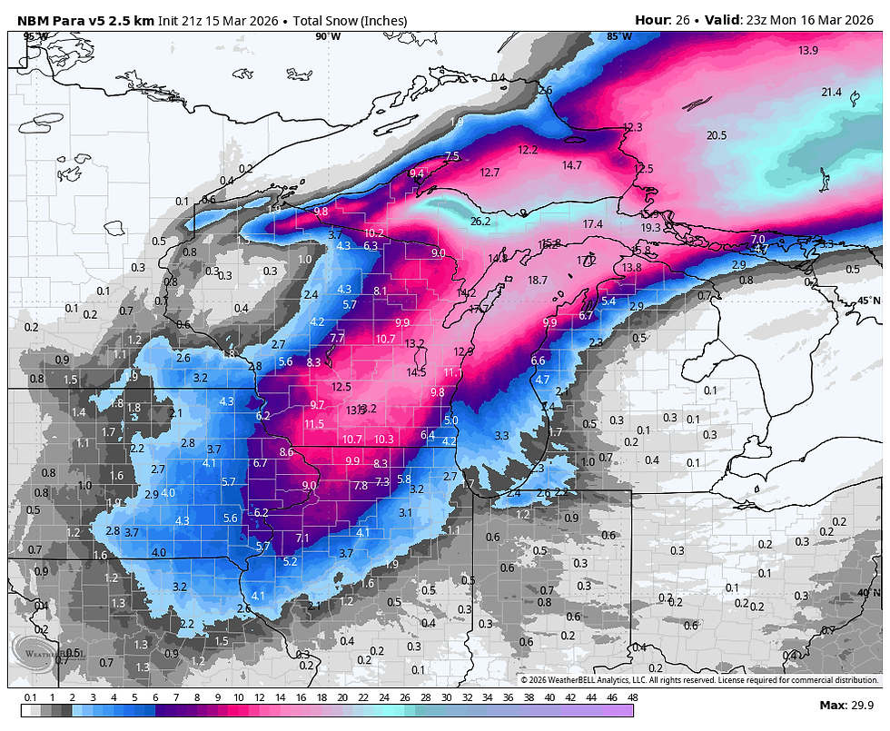
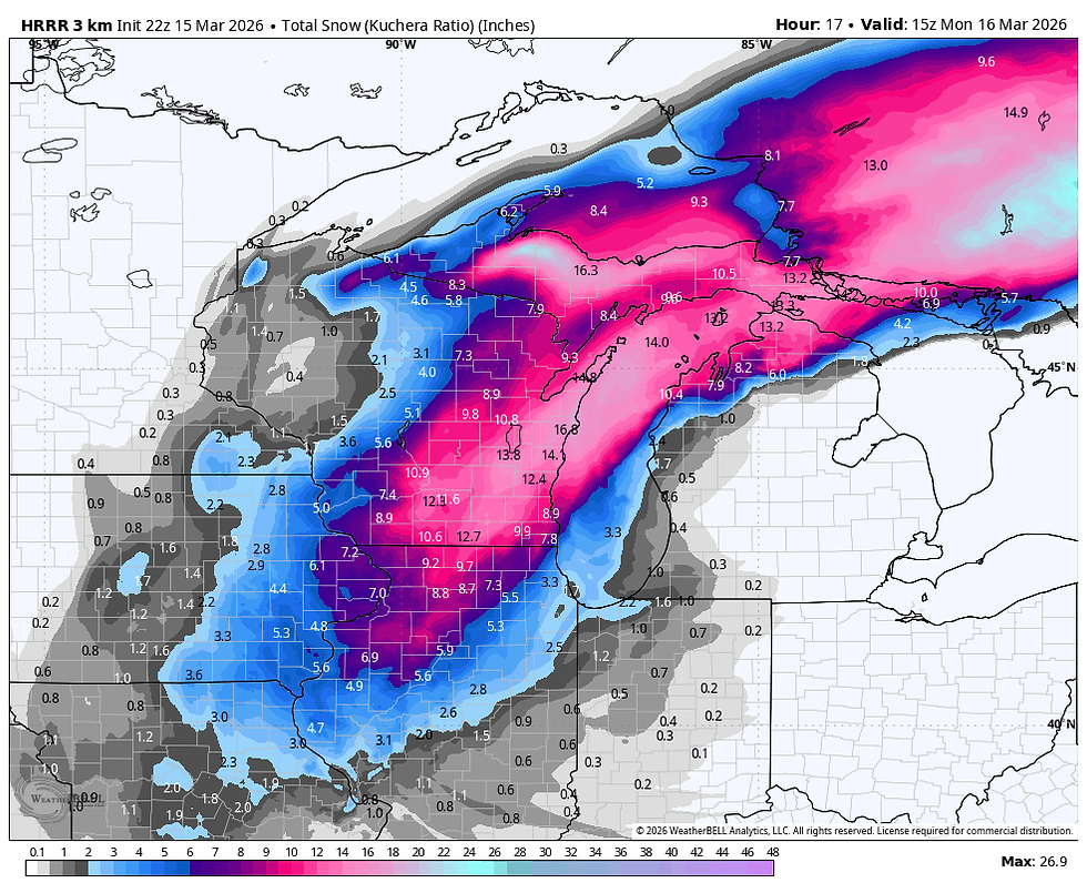
It still appears that snowfall of 5-10 inches is on the table for much of the area before it winds down early Monday. Here's some of the recent raw model output. Again, not actual forecasts but model guidance which is designed to help formulate forecasts.
The official NWS probabilistic forecast, designed to show the range of reasonable ranges looks like this.
Now the models: Notice they have show a tendency to cluster the heavier amouts entending further east of the Mississipi, in spots over a foot. That combined with the wind would be very problematic. Take a look.
The EURO

The GFS

The National Model Blend

The NBMv5
The HRRR
The RRFS

The worst of the snow should be gone by daybreak but wind and snow showers may continue on and off into the morning. We are in the teeth of it now and it looks like Monday will be a snow day for many. Be safe and roll weather...TS

My sincere thank you to all of you who made contributions and have taken it upon yourself to support the site. TSwails is with you for another year. If you haven't contributed, and think the site has value, or you use it extensively, it is still possible to donate. Any contributions will go into a trust to be used to support the site going forward. Thanks again!


Comments