


TOO CLOSE TO CALL

Some remarkble air is in place over the Midwest Monday with several locations registering 80-degree dewpoints. Some locations in west-central Illinois are toppin near 85 which is an all-time record measurment for places like Macomb, Illinois. This humid air sticks around Monday with heat indices likely topping 110° in spots as dangerous heat continues. Some relief is inbound through with a weak cold front Monday night. That front could also be the focus for some potential storms, but the confidence is too low.

With the very hot and humid air, instability will be incredibly high. Models are indicating 4000j/kg+ across a large swath of the region. While storm formation is questionable, any storm that may form will produce incredibly heavy rainfall rates in addition to strong to damaging wind gusts. The highest chance appears to be to the east, more into central/eastern Illinois, but it's too close to call.
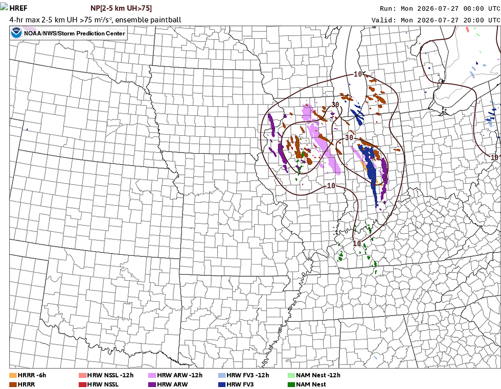
Convective models tend to have terrible track records in these very unstable environments with limited forcing, however they are grouped pretty well to the east. Some models do bring the storm threat very close to our area which again may be severe. Outflow from a more organized threat to the east may be enough to get storms to form in our area which I think is the most likely watch item.

Officially the Storm Prediction Center has a Level 2 of 5 Risk, a Slight Risk, for areas to the east with a Level 1 of 5 Risk, a Marginal Risk, clipping the Quad Cities. I would not be surprised to see this shift more to the west to include more of our area.
It's one of those low probability, but high impact events, where if storms form they will be severe, but it's uncertain if we get storms in the first place.

Behind the limited storm threat we do see a bit of a cooldown from our recent HOT temperatutes. Highs have some down a bit in the latest forecasts, more into the mid-80s heading through midweek. All eyes continue to look at the first few days of August, however, as it still appears likely we will return so some very warm temepratures, coupled with high humidity levels.
A break from the triple digit heat indices and 80-degree dewpoints is coming very soon, friends! Stay cool.
-Meteorologist Nick Stewart


A break from the extreme heat and humidity will definitely be welcome. Mid-80s temperatures sound much more manageable, even if the relief may be short-lived with hotter conditions expected in early August. Thanks for the update and the reminder to stay safe during the hottest part of the season. On especially hot afternoons, I like staying indoors and relaxing with Slope Rider, a browser-based game that’s a lot cooler than being outside in triple-digit heat indices!