THE RETURN OF A STRONG STORM THREAT
- May 11, 2025
- 4 min read
Happy Monday everyone! Hope you all had a wonderful weekend. I had a quick trip back to the Midwest to visit my mom for Mother's Day and it was a BRISK start to the day for me in Lake Geneva, Wisconsin. At the nearby Burlington, WI airport it dipped to 33.4° which is a lot to handle for this, now, Florida Man. I wish I could have stayed through the week as it looks like the Midwest will be getting back to the strong storm routine on Thursday, with more rounds of strong storms possible early next week.

The Storm Prediction Center has maintained a risk area for the Great Lakes region for Thursday with a Level 2 of 5 risk, a Slight Risk, currently in place. We continue to see rather good model agreement of a storm threat with details on location and hazard type still a bit uncertain at this point. One rather obvious trend over the last 24 hours has been a shift farther east with the severe threat potential.
The way it looks at this point is a brief period of more discreet storms capable of large hail and a few tornadoes before things transition more into a linear, wind threat through the late evening and overnight.

Above is a "trend" in the GFS model's depiction of instability. Notice a fairly obvious shift eastward of the unstable air over the last few days. The position of the cold front goes from Des Moines, Iowa to the Quad Cities at 1 p.m Thursday. If this trend continues it would likely keep the highest risk of severe weather east of our area, more into eastern Illinois and Wisconsin, southern Missouri, much of Indiana and Michigan. This was actually hinted at rather well in the analogs I presented in yesterday's post.
THE EURO

THE GFS

Notice the Euro and the GFS are significantly farther east with storms by 7 p.m. Thursday. If this eastward trend either continues, or at least holds, this could keep the rain and storms out of the picture for most of the Quad Cities region.

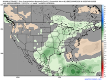
The European Ensemble probability of at least 0.10" of precipitation Thursday shows the very limited chances in eastern Iowa and northwest Illinois. This is a direct result of the severe threat shifting farther east. Now, as you can see, there will be some beneficial rain in the region especially across Minnesota and Wisconsin but this will appears to be less of a severe threat.
There are a few rules I have when forecasting:
1) Once a winter storm goes north your out of luck
2) I'd rather be west than east of a storm system a few days out
What I mean by these rules are typically when models take a big trend north with a winter storm you can typically say goodbye to the snow forecast. Additionally, with severe weather, these systems have a higher chance of trending west than east in the short term. So if I was wanting severe weather, I would rather be west of storm initiation instead of east. So it's not over until it's over, is my long-winded point I'm trying to make.

For what it's worth, the analogs continue to keep the highest chances of severe weather to the east/southeast. Once the shortwave responsible for the severe weather makes landfall on the western CONUS Tuesday and is better sampled by our network of weather balloons we should really have a better handle on things.

Now, if it's just rain you're searching for, some portions of Iowa and points north will likely see some of the good stuff. Storms late Wednesday into Thursday morning out west will track most likely across western/northern Iowa and much of Wisconsin and Minnesota. This once again does not look to benefit the Quad Cities region, however.

In terms of temperatures, we will be heating up into the storm threat with highs near 90 likely by Thursday. Looking ahead, post cold front, we will see temperatures take a bit of a cooler dive with highs back into the low-70s heading into next weekend. Overall, rather pleasant!
Beyond this stretch of storms to watch Thursday, our next threat of rain and storms appears to be around the Monday/Tuesday (May 19/20) time frame next week.

It was great being back in the Midwest this weekend! I really took the grass for granted before moving to Florida where my yard is mainly weeds, sand and little prickly things. I made sure to lay in in a good amount of time to really get grounded.
ONE YEAR AGO - HISTORIC NORTHERN LIGHTS


I will wrap up today's post with look at the historic northern lights show that occurred across the entire United States one year ago. On May 10/11, 2024 the pillars of light were visible from the US/Canada border to Florida. I happened to be on my storm chasing vacation and it was a rare case of us wishing for clear skies instead of storms! We captured the amazing event from the banks of the Missouri River along the South Dakota and Nebraska border. A night I will never forget!
If you are interested I featured the night as part of my documentary covering my storm chasing experiences in 2024.
Have a great week, everyone!
-Meteorologist Nick Stewart


Comments