THE SNOW GEESE ARE FLYING...

For those of you around the Midwest who love white gold (snow), be advised the snow geese are flying. By that, I mean the models are on the move and trending in the direction of producing more snowfall for much of my area the second half of the weekend and perhaps early next week. We are roughly three days away and the fine details are still to be determined in this intriguing set-up.
THE BIG TWO...HOW MUCH AND WHERE?
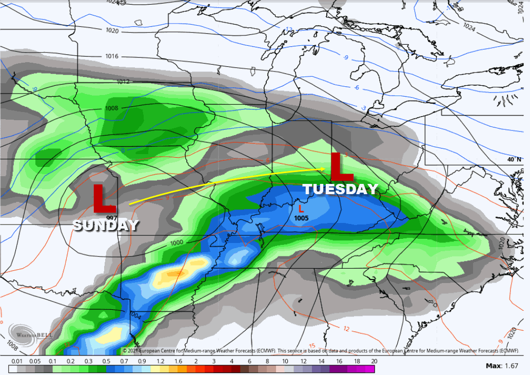
The two biggest questions, as is always the case, is how much snow and where. The biggest issue the models have been grappling with for a couple days now is the consolidation of energy coming out of the mean trough centered over the southwest. In a broad sense, it's forecast to remain anchored in place into the middle of next week firing bursts of energy directed at the Midwest. It looks today, as if two short waves (energy providing lift) will eject out of the trough this weekend. The first brings a round of snow Saturday night that could lay down an inch or two, especially in the NW half of my area. This is what the EURO indicates for the first wave which I am leaning towards as my model of choice for this time period. Some version of this looks reasonable.

After that, all bets become tenuous as big discrepancies develop among the models. My favorite, especially at this distance when there is so much variance is typically the EURO. In this case it shows the first wave of snow departing early Sunday resulting in a lull in snow until late Sunday or Sunday evening when the second and stronger wave enters the region. This is the one that produces a lengthy period of forcing and has the potential to produce 6 or more inches of snow. The favored area for that on the EURO is near and north of I-80. The EURO between the two rounds of snow comes up with this for totals by Tuesday.

You will notice down around HWY 34 in the far south there is much less snow owing to the fact that freezing rain, sleet, or even rain in the extreme south cuts into snowfall amounts. I am reluctant to put on snow totals of this magnitude so early in the game as small changes in track or thermal profiles can really mess up the final numbers. What you are seeing is raw model output that is based on a system that looks and tracks like this on the EURO. There will be modifications in future runs but how drastic will they be? The Canadian and GFS are much different.

A SECOND PRINTING OF MY NEW BOOK IS COMING...
250 NEW COPIES OF DERECHO 911, IOWA'S INLAND HURRICANE ARE AVAILABLE. Around Christmas we sold the last of the 1500 copies of our book on this historic thunderstorm, the most damaging in U.S. history. Due to continued demand we have ordered a limited number of 250 for those of you interested in having the most authoritative account of this extreme event. You can get yours at derechobook.com
NOT MUCH HELP FROM MY MODEL FRIENDS
As a forecaster the thing you look for to develop confidence in a forecast is model consistency. There is nothing I want to see more than that. Unfortunately, the Canadian and GFS are in major disagreement. They are both initializing data differently and already have a contrasting look being lighter on amounts showing less phasing with the second batch of energy. Essentially that forces the wave the EURO utilizes to dump all of it's heavy snow well to the south. Look at the difference in snow totals between the Canadian and GFS compared to the EURO above.
The Canadian GEM

The GFS

Clearly, we have a major issue to resolve which will determine if this is a high impact event for my region or one that is far more manageable and confined to Saturday night and early Sunday. I see arguments for each camp and I'm really troubled the EURO is the odd man out. It's hard for me to go against the king but I think at least for now this is a toss up. Sadly, my lack of devine powers has me on the fence and I'm going to need another day to get this all sorted out. There will be snow it's just a matter of how much.
While we wait for resolution on that you can expect another breezy day Thursday with seasonal temperatures in the 30s over all but the far south where some low 40s are again expected. Thursday night a stout cold front blazes through the area bringing highs in the teens Friday and the potential for sub-zero lows north of I-80 Friday night. Wind chills will also be a factor Thursday night and much of Friday but nothing out of line for late January. Then we wait for the first crack at snow Saturday night. Stay tuned for further details on that and roll weather...TS


