


TIMING IS EVERYTHING
- Sep 15, 2025
- 2 min read

The pattern has been incredibly dry, but late this week we continue to watch the potential for some beneficial rain in the region as the hot pattern breaks down to just "above normal" instead of "way above normal." You recall late last month we had an Arctic push of much cooler air. This time around the air is not really coming from a cool place this weekend, but that means there will be some more moisture to work with to produce some rainfall.
The European Ensemble (above) shows some potential for widespread 0.25" to 0.50" Friday/Saturday which is not a lot of rain, but at least something to add some moisture to the ground.
EUROPEAN

GFS
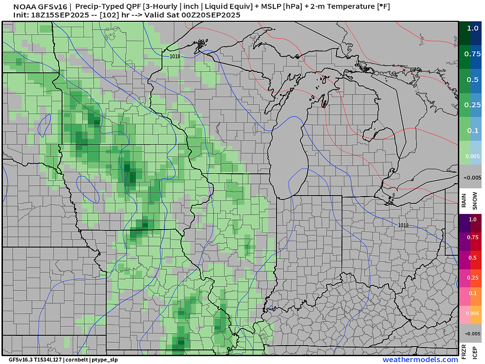
Compared to yesterday, we are finally seeing some consensus as to the timing of rain chances with our approaching system with the trend favoring Friday evening/night into early Saturday morning. Both the American GFS and the European are locked onto that solution as of Monday's runs.
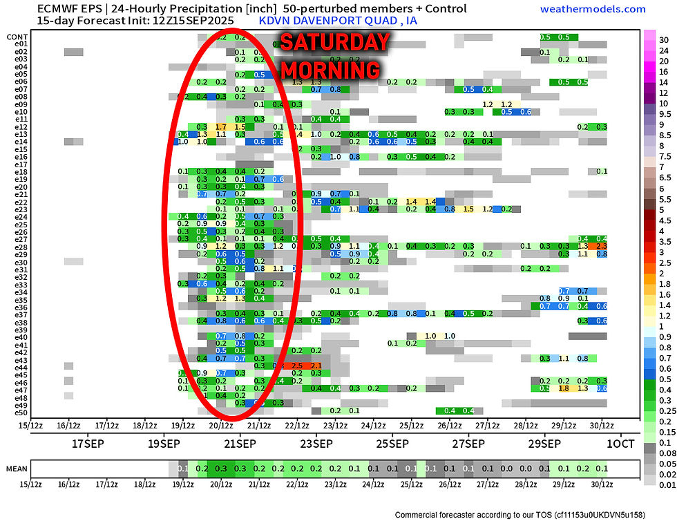
Looking at the European Ensemble, the timing is much more locked on compared to yesterday's run with the timing focused mainly early Saturday - slightly later than the deterministic run. Also compared to yesterday nearly all members have rainfall with many more members at 0.50"+. Many members do have rain as early as 7 p.m., however.
So this slight difference in timing does have pretty big implications on outdoor activities Friday night, notably high school football. So we will continue to watch it. I will say, with borderline drought conditions building in, this does have a tendency to delay the onset of rain somewhat, so I would favor a later arrival Friday night/Saturday morning as of this point.

Moisture supply will be sufficient for decent rainfall totals with precipitable water values approaching 1.50". While not in record territory, this will be near the 90th percentile for this time of year. We could see some thunderstorms capable of 0.50" to 1.0" totals if all goes well, embedded in more widespread showers.
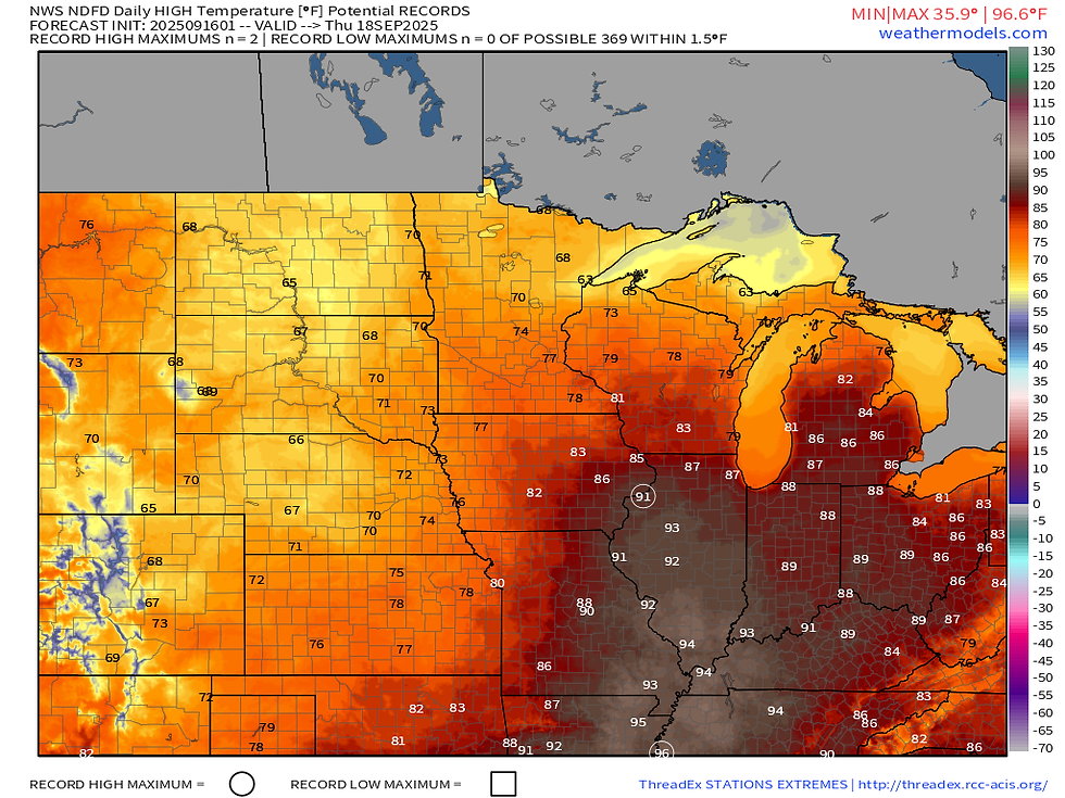
The storm system will bring some relief from the heat. The current temperature forecast for Thursday has near-record highs for the Quad Cities with highs in the low-90s. Low-to-mid 90s extend southward through St. Louis down the Mississippi River.

Saturday temperatures will be cooler, but still relatively warm compared to normal with highs near 80 in the Quad Cities and mid-70s across Iowa. Not terrible!

Looking down range, late September continues to look rather warm compared to normal across the central US - a stubborn pattern that really does not want to quit! Have a great Tuesday!
-Meteorologist Nick Stewart


Comments