


TRYING TO BUST THE HEAT AND DRYNESS
- Sep 17, 2025
- 2 min read

Thursday continues the unsettled weather across the region with another round of isolated showers and thunderstorms, especially to the west of the Quad Cities region in central and western portions of Missouri and Iowa. Those that get rain will be the lucky ones as likely much of the area will remain dry.
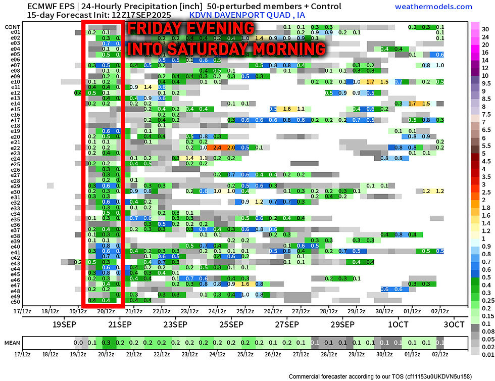
The larger forcing arrives Friday into Saturday with the ensemble guidance continuing to show higher probabilities of rain, however I continue to dislike the trends and idea of widespread beneficial rainfall. Ensemble means are about a quarter of an inch for the Quad Cities. As I've said the last few day, "when in drought, have some doubt." Friday and Friday night continue to have the highest chance in the short term of widespread showers, but overall it does not look like much.
We will get an updated drought update Thursday, and I suspect we will see worsening conditions.
GFS
Euro
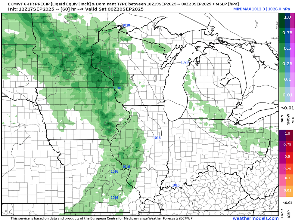
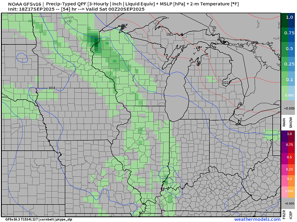
Both the American GFS and the European have rain on Friday evening, but amounts are somewhat lackluster. The Euro is a little more aggressive than the GFS with this system. This may be enough to have some impacts to Friday night football, but the good news is the overall thunderstorm risk is somewhat limited.
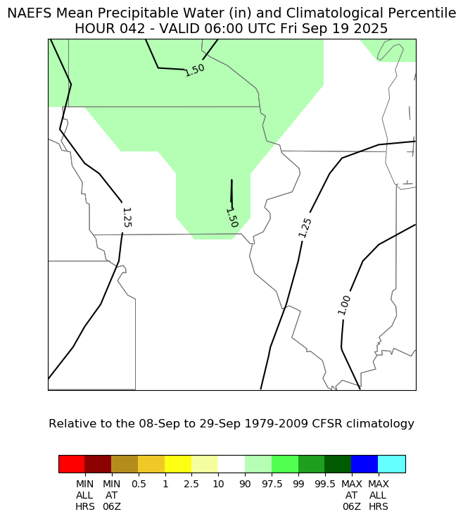
Moisture levels of the atmosphere will be elevated, with guidance hinting it's in the 90th percentile for the date Friday. Again, far from record breaking but if we can at least get some storms going they should be able to produce some locally heavy rain.

The good news is the system does knock down temperatures somewhat. Thursday is the end of the intense heat with highs near 90, but we continue to stay above normal with highs in the low 80s through the weekend into early next week.
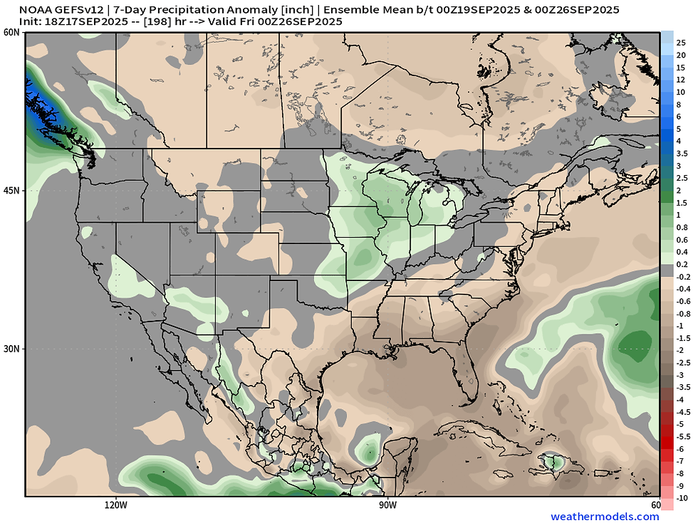
Early next week we will be watching another storm system in the region which could bring more rain and storms, hopefully with better confidence than what we are working with this weekend. The American Ensemble indicates above-normal precipitation. This is looking like Sunday night through early Tuesday.
By late Tuesday into Wednesday northwest flow will take over likely shutting rain chances down. This should also bring some cooler temperatures with highs back into the mid/upper 70s. But notice that ridge out west - that will likely bring some unusually warm temperatures back to the central US late September into early October. That amplified pattern could also bring more active conditions which would be ideal to help limit the dryness taking over.
-Meteorologist Nick Stewart


Comments