


WHAT A DAY, UNTIL WE PAY
- Jul 18, 2025
- 4 min read
What a difference a day makes! After a steamy one Wednesday, a cold front brought a kinder, gentler, brand of weather Thursday. Temperatures areawide stayed in the range of 69 north to 77 south. By evening, dew points were in the upper 50s to mid 60s, a far cry from the mid to upper 70s that were seen the day before. The 69 in Dubuque would be the average high September 26th and the 75 in the Quad Cities would be normal for September 20th. Bonus weather to be sure.

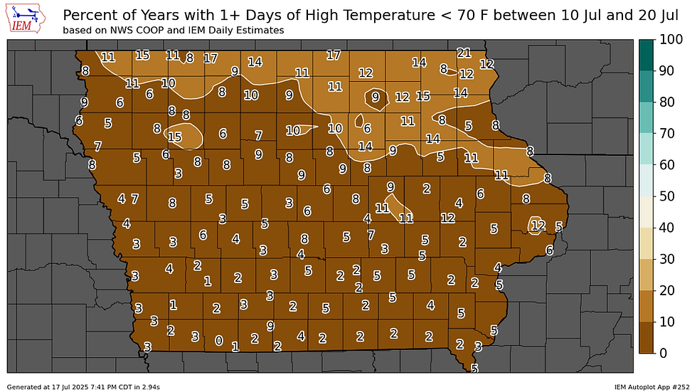
For some perspective on what's typically the hottest time of the year, only 18% of days in the Quad Cites stay below 75 degrees during the period July 10-20th. The high at the NWS office in Davenport Wednesday was 74.

In Dubuque, where the high was 69, the numbers are even more impressive with just 8% of days staying below 70 during July 10-20th.
Along with the cool conditions came much drier air. Available water vapor Wednesday was off the charts pushing 2.40 inches ahead of the cold front.
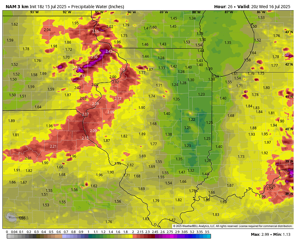
Behind it, water vapor had plunged to .85 inches in the north, with values as low as .42" in EC Wisconsin.

The Satellite image Thursday evening shows the dry air coming in off the Great Lakes, clearing skies and setting the stage for a fresh start to Friday, especially in the north.

Early Friday morning, lows in the mid 50s will be possible in some of the known cooler low-lying valleys of the north. Otherwise, upper 50s to low 60s will be common where some low clouds may linger, particularly in the far south.

Friday we should be able to pull off another dry day, but return flow will be underway, allowing clouds to begin working their way back into the picture. These will increase from SW to NE as the day progresses. Even so, there should be enough sunshine to produce warmer temperatures. Highs are expected to range from 77 north to 84 south for another pleasant day in that regard.
IT'S TIME TO VISIT TO MY 5 STAR GALENA AIRBNB

My 5-STAR AIRBNB just outside of Galena still has some openings this summer. All of our ratings are 5 star! We take pride in the amenities and the cleanliness. If you book now, we'll take off $200, and we can eliminate AIRBNB fees and additional costs that will save you big bucks. Other discounts apply. Call or text Carolyn at 563-676-3320 for our best deal of summer. See more at https://www.littlewhitechurchgalena.com/
THE PRICE WE WILL PAY...
Later Friday night, the stalled front in Missouri is inching north as a warm front as upper level ridging builds to the south. Saturday the warm front dissects my southern counties and the region gets back into the warm muggy conditions mid-July is known for with highs back in the mid to upper 80s. With the warm front straddling southern Iowa, dew points of 70-75 should produce strong instability and favorable deep layer shear for potentially strong storms. SPC has a slight risk outlook in effect for the possibility of strong to severe storms in my central and southern counties. Timing will be critical as morning convection could limit instability or even push the boundary further south, the usual cat and mouse game. Personally, I like the area south of I-80, especially near and south of HWY 34 most for strong storms at this time.

Additional storms are possible Sunday and Monday, but it's possible that Saturday's storms will force the front a bit to the south. As a result, much of the action those days may be over the SW half of my area, with the NE escaping with little if any rain. It will be a tough line to define as each round of storms impacts the position of the boundary. Stay tuned.
At this point, the intense heat and humidity associated with a growing heat dome has remained largely south of the region. But, as you can see, the ridge is quite substantial even heading into July 29th.

Today's trends bring tentacles of steam north from time to time, with heat index values over 100 on occasion. However, current guidance for most of the next 6–10 days keeps the "extreme" heat just to the south. The GFS shows 100 degree+ highs next Wednesday from Omaha to St. Louis and points southwest. That represents the northern periphery of the heat dome, which delineates the approximate position of the "ring of fire". North of it are where thunderstorm clusters known as mesoscale convective systems could form on a near daily basis in parts of Iowa and Northern Illinois. A positive is that cool outflow from the storms seems to be sufficient on today's models to hold the worst of the hot air just south.

That's fine and dandy, but my area will then be prone to daily rain chances from storm development on the north edge of the thermal boundary. There will be substantial instability at times that could not only allow strong storms, but heavy rain events that over time could cause excessive rainfall totals. As one forecaster noted, this active pattern is notoriously difficult to forecast, yet has the potential to yield impactful weather! Some part of my area may end up being in that position. The way I see it, if it's not the heat, it's going to be the storms that cause headaches.
With all that to chew on, I say TGIF and by all means, roll weather...TS


Comments