WHAT'S IT SPELL? U-G-L-Y
- May 21, 2025
- 4 min read
We asked for it and by golly we got. Rain, and plenty of it, soaked the parched fields and yards of the area. From the looks of it, at least everyone had an inch, and the majority of my area saw 2-3 inch totals, with some spots going over the 4-inch threshold. Here's the Doppler estimates through Tuesday evening.

By the way, this is not the end of it, the slow moving storm will only slowly inch off to the east the next 36 hours. Still under the influence of the upper air low, spokes of energy will circulate around the center close enough to spark additional showers. A large cloud shield is evident on the satellite, rotating southeast behind the cold core.

The wrap around clouds, cold advection and showers allows another band of light to moderate rain to gyrate across the region overnight and into the morning Wednesday before tapering off to sprinkles and drizzle by afternoon. This will be the final round of appreciable rain, the far south may miss most of it, with the energy passing just to the north. It's possible, some additional spotty showers could occur Wednesday night and Thursday, but amounts under .05" look to be in order. This is what guidance is showing for additional rain between Midnight Tuesday night and the conclusion of Thursday night.
The HRRR

The 3k NAM

The EURO

The GFS

HOW DO YOU SPELL UGLY?
THE DEFINITION OF UGLY: Offensive, repulsive, or unpleasant to any sense, especially appearance.
With extensive cloud cover, northeast winds, and spotty showers, sprinkles, or drizzle Wednesday, the area is going to take a step back in time with temperatures more reminiscent of late March. This is what the GFS has for readings at 3:00 p.m. Wednesday. These qualities meet the definition of "ugly". A spade is a spade.

Just to put an exclamation on how poor the day will be by late May standards, (especially in the north), these are the afternoon temperature departures

Thursday doesn't look a lot better, considerable cloudiness and some spotty showers should keep highs restricted to the upper 50s to the low 60s south.
TERRY'S LITTLE WHITE CHURCH, A GALENA AIRBNB
Check out some of the ways you can save as much as $400 dollars on a stay at my AIRBNB, a renovated church in Galena. It's a most loved guest favorite with perfect 5-star ratings. https://www.littlewhitechurchgalena.com/
MEMORIAL WEEKEND AHEAD...
Unfortunately, the holiday weekend has some trouble spots, with considerable discrepancy among the GFS and EURO regarding the outcome. The best hope for a respectable weekend lies with the EURO. It has the area close enough to the proximity of a Great Lakes high to force the brunt of a couple short waves south of the region. That said, it still shows a few showers catching the far south Saturday evening. Otherwise, the remainder of the weekend (including Memorial Day) it keeps us all free off precipitation. Highs Saturday through Monday are in the mid to upper 60s. The EURO shows this for rainfall, all of it falling Saturday night in the south.

The GFS goes ballistic, bringing in a slow moving disturbance and a healthy rain for much of the area Saturday night and Sunday. It still has a few light lingering showers, Memorial Day itself. Highs reach the low 60s before rain arrives Saturday evening, and Sunday the GFS holds readings in the range of 50-55. Monday, more like 54-59. Aside from that, it dumps 1/2 to 1 inch of rain north of I-80, while the EURO has none. In Burlington, the EURO pinches of .06" while the GFS has 2.48 inches.

Basically, the GFS would meet the UGLY qualifications for a holiday weekend in numerous categories. Meanwhile, the EURO overall is a tad cool but generally pleasant. Frankly, the recent weather pattern is so strange that I am having a hard time getting a handle on the outcome. The GFS trended wetter and more northerly this evening, while the EURO went drier and further south. Either of these solutions is plausible, and it may end up somewhere in the middle. However, until we get better initialization of modeling, I'm just going to put it out there that the weekend is up for grabs. Everybody hope that the EURO holds strong in coming runs. If not, outdoor plans could be very much in jeopardy, especially Sunday.
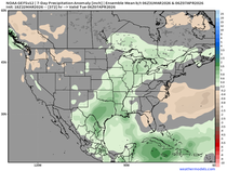
Let me end with this, it appears that we may make the transition to a traditional summer pattern in the next 2 weeks. Here's the 500mb flow today, showing a persistent trough in the central and east.

Look at the cool air that delivers over the next week or so.

June 4th, the ensembles of the EURO are finally breaking down the eastern trough, with signs of the Bermuda high emerging off the SE coast of the U.S.

Coast to cast, temperatures are warming and likely will end up significantly warmer than what's shown beyond June 4th below. We shall see.

That's all I've got for now. Have a fine day despite the UGLY conditions. Roll weather...TS


Comments