WHOA NELLY, THAT CAN'T BE
- Feb 11
- 3 min read
A SPECIAL MESSAGE, I need your help to fund the site
I would like to thank the 271 people who have stepped up to the plate and made a donation to fund the site through this December. In the past year, TSwails had over 600,000 sessions, meaning less than 1 donation per session. If you do not find value in the site or don't have the funds, I understand and still welcome you with open arms. For those of you here daily, who gain knowledge, or make financial decisions based on the information, I ask that you make a reasonable contribution. Every little bit helps. After much deliberation, I've decided that due to the daily commitment of time, money, and hard work, this will be the last year for the site if I don't reach my financial goal. I'm 72 percent there. The future depends on you. Thank you for your consideration and support the past 13 years. T. Swails
WHOA NELLY, THAT'S A DROP
As a forecaster (one who's talking about temperatures that could reach the 60s in early February), the last thing you want to see is a disappointing bust on the cold side. The GFS, which has been promoting the idea of a 70-degree high in the Quad Cities for days, just threw the baby out with the bathwater. I've been saying I wouldn't be surprised to see cooler trends, but nothing like the GFS sprung on me today. Yesterday it had 70 on the 19th, today it's down to 48. Just your average 22-degree drop! I have the comparison below.
Today

Yesterday

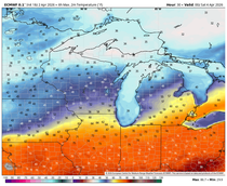
A drop like that raises a huge red flag because, fortunately, you don't see it that often. There is always the chance it's correct, but it is the GFS. What immediately comes to my mind is the EURO showing a similar trend. I couldn't pull it up fast enough to see. And here's what to my wondering eyes appeared.

The EURO does show a 50 the 19th, that's close to the 48 the GFS indicates. The EURO is also similar to what it had the previous day. That indicates the GFS has caught up to the idea of a faster frontal passage that ends the warmth the 18th instead of the 20th. (Again, like the EURO showed 24 hours earlier.) However, it doesn't explain why the GFS is so much cooler than the EURO the previous 3 days. The EURO has 63 and 65 for the 17th and 18th, while the GFS is stuck at 55 and 54.
My takeaway regarding model choice is that the EURO is reasonably consistent with its previous look and does not reflect the much colder, inconsistent solution of the GFS. On top of that, the EURO is a better model with higher skill scores than the GFS. It usually beats it.
Until I see the EURO back down, I'm sticking with its warmer idea early next week. That said, I will have a leery eye out for any cooling in coming days. I have seen many situations where existing cold, dense air and some snow cover around the Great Lakes blocks the leading edge of warm air from advancing much beyond the southern Iowa border. North of there the more buoyant warm air is forced over top of the cold, dense air, creating a temperature inversion. In other words, it's warmer a few thousand feet up than it is at the ground. That puts an end to the idea of 60-degree highs. Maybe that is what the GFS is sensing. If so, this would be a big win for the U.S. model.
Caution is the word going forward. I was not anticipating the GFS to make such a dramatic change. In fact, if one model was going to flip colder, I expected it to be the EURO. There's not much to do now but wait to get new data and hopefully a more consistent signal. Isn't weather fun! Roll weather...TS ON A SERIOUS NOTE, IF I CAN'T MEET MY FINANCIAL GOALS, THIS WILL BE THE LAST YEAR OF THE SITE. IF YOU LIKE THE CONTENT, THE FUTURE IS UP TO YOU. T.S. 72% to my goal.


Comments