WINTER STORM WATCH...
- Feb 14, 2023
- 2 min read

Hi friends, let me start by thanking the 221 of you who made a voluntary donation to my site. Your yearly investment is critical in helping me meet my operating expenses. It's a good start, but for me to continue on, invest the effort and time that I put into my product, I'm going to need a little more help to reach my goal..
As much as I enjoy my work, it's a major investment of time that ties me down every day of the year. My hope is that you all agree it is a first rate product that involves a great deal of thought and passion. Day in and day out, you can trust the source knowing it's as accurate as any weather forecast can be. I make no bones about it, I want to be the best.
To do that, just like any other non for profit organization, I have to go to you the people to ask for support. Whatever you can do to keep this train rolling, it is immensely appreciated. You have my word you will get a 100% return on your investment. CLICK HERE TO DONATE
WINTER STORM WATCH FOR THE POOTENTIAL OF HEAVY SNOW
The National Weather Service has issued a winter storm watch for the NW half of my area late Wednesday Thursday, precisely the area I projected in my post Monday night.
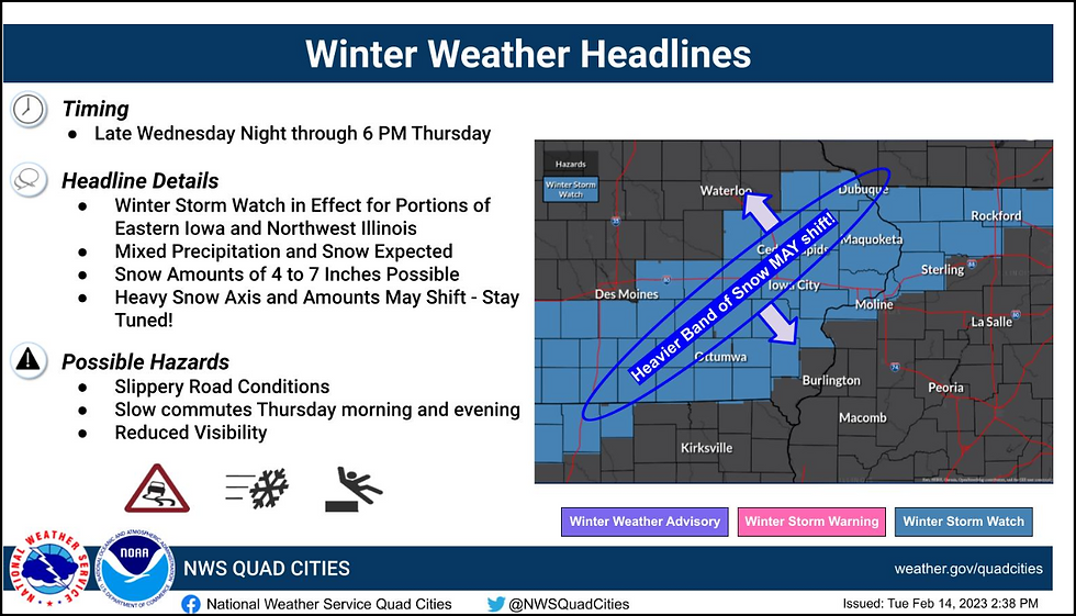
Snow is not expected to develop until late Wednesday night (after 3:00am) and will continue much of the day Thursday before diminishing and ending early Thursday evening. Gusty northeast winds will also create some blowing snow, especially in open areas as temparatures fall and snow ratios increase over time. Some areas, especially southeast of the Quad Cities may see a brief period of freezing rain or sleet before a transiton to snow.
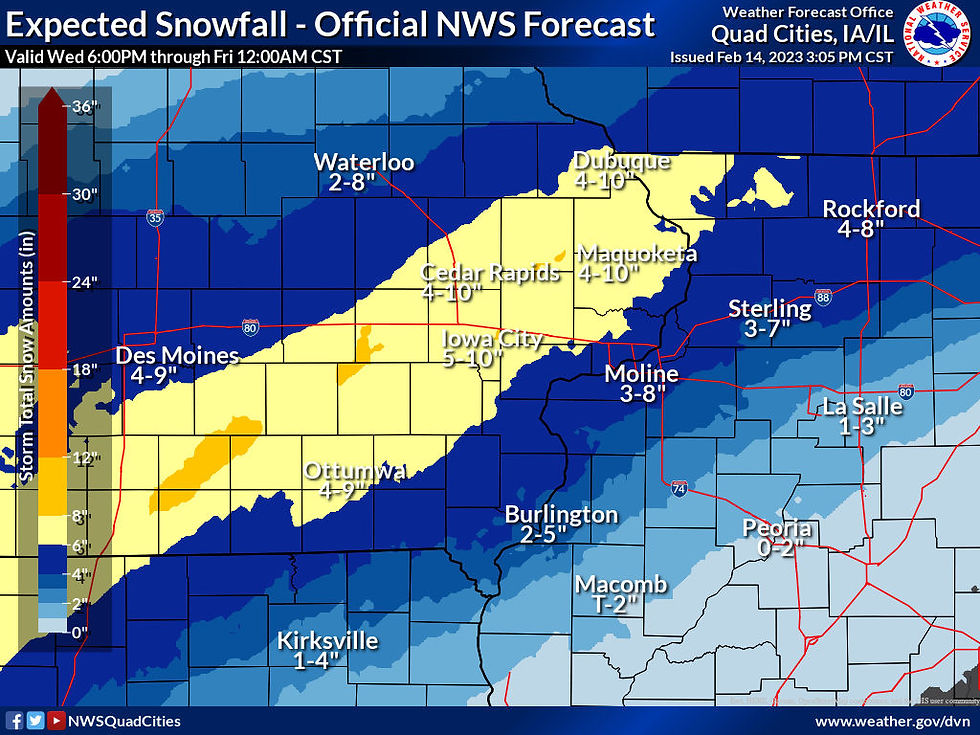
Here's the official NWS snowfall forecast. It does indicate large spreads in the high and low ranges for specific locations. I assume that is due to some uncertainty in the final track.
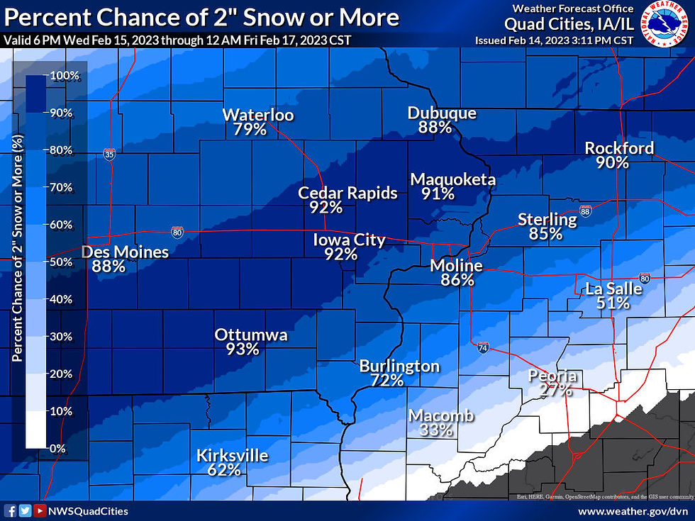
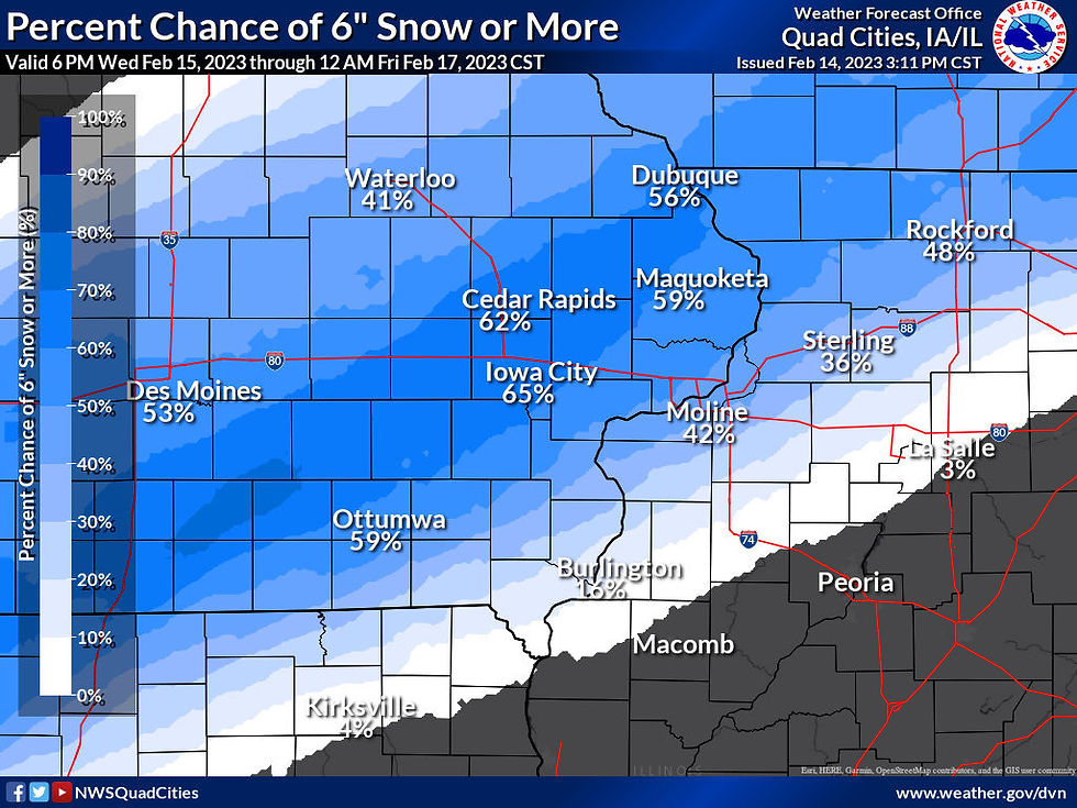
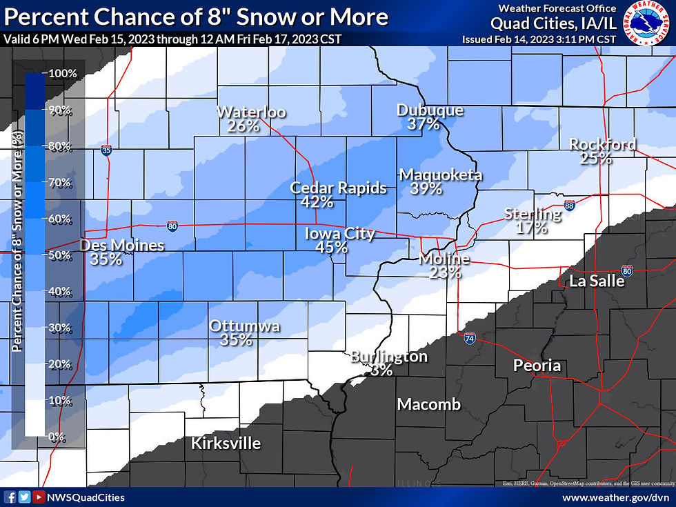
Here are the odds of a 2, 6, or 8 inch snowfall.
2 or more inches
6 or more inches
8 or more inches.
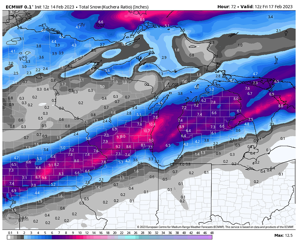
Here are what the latest models are suggesting for snowfall amounts. To be clear, these are not forecasts, just raw model output that is used to detect trends and create forecasts.
The GFS

The EURO
The Canadian RGEM
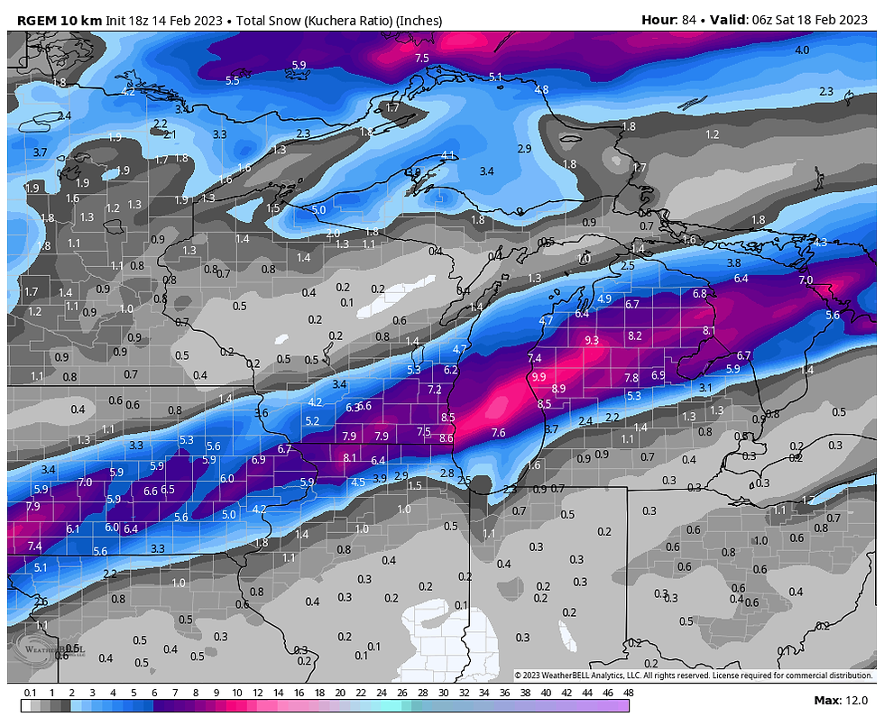
There is very good agreement on the 2" line depiction on the southest fringe of the snowband. The NW fringe is considerably further northwest on the GFS and EURO than what is depicted in the winter storm watches. If that trend holds, they would need to be extended further northwest. Also, the GFS is significantly heavier than the other models, especially NW of a line from Cedar Rapids to Dubuque and on to Madison. I suspect it's overdone but if some banding kicks in a few 8-9" totals could show up in that area.
We still have room for some minor changes but it does appear models are settling in on a solution that brings widespread 4-7" accumulations to the NW half of my area. Further southeast of the Quad Cities 1-3" totals look good.
More on the latest trends in my next post later tonight. Roll weather....TS


Comments