


WHAT'S AHEAD? MAYBE YOU DON'T WANT TO KNOW...
Outside of a couple quick hits, we’ve not seen much in the way of cold this winter. By my account, maybe 10-12 days where it really got your attention. So here we are, knocking on the door of February. What does the future hold?
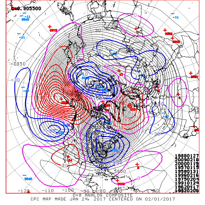
Well, the next 10 days should certainly be colder than the last 15. The 500mb jet stream anomalies look like this. The positive heights in Alaska and the negatives over New England will ensure a northwest flow.
That dictates a temperature analog that depicts a 70-80% chance of below normal readings over my area and much of the Midwest.

Here’s the actual temperature departures for the period.

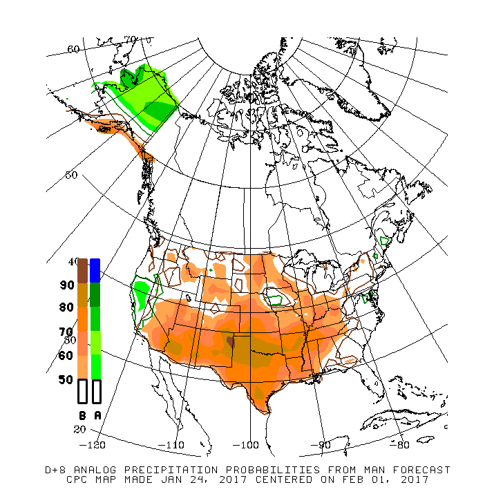
While chilly, the pattern is not great for moisture and there’s a 40-60% chance precipitation will average below normal over the next 6-10 days.
That takes us to February and the U.S. climate model the CFSv2 is bullish on the colder than normal pattern lasting through the month. The February temperature forecast looks like this.

If the CFSv2 is on the right track, the below average trend will go into the first half of March. This is the 45 day temperature departure that takes us out to March 11.

If the cold materializes, there should be snow. The latest ensemble runs show these four solutions for 45 day snowfall. Clearly a snowy trend but remember we’re talking 45 days. The trend not the precision is what’s important and interesting to me.

Here’s the 45 day total precipitation forecast. Pretty wet in most areas.

Bottom line, if the CFSv2 pans out, there is still plenty of winter ahead of us. I’ll believe it when I see it. Roll weather…TS


