FEBRUARY SHOWERS BRING MARCH...?
Friday was a record breaking day across the Central U.S. with dozens of locations reporting record high temperatures.
The pink and orange dots indicate tied or broken records and yellow is within 3 degrees of a record. This map shows the records from Friday afternoon:

More records will likely fall over the next six days as the jet stream stays in Canada and cold air gets locked up to the north.
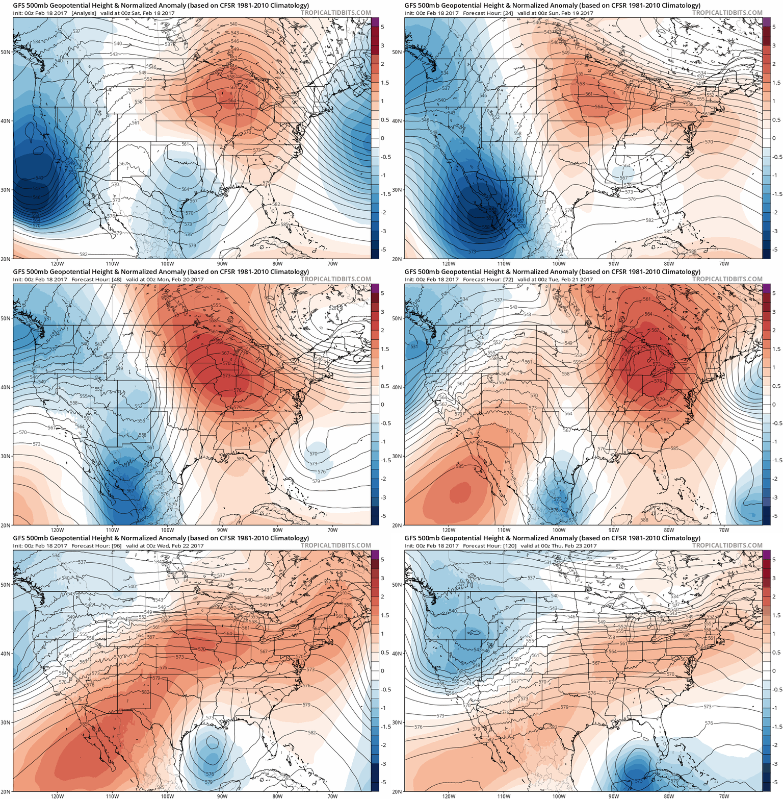
Here are the 500 mb (upper air) height anomalies through next Wednesday. Persistent strong ridging in the upper levels will lead to the warm air moving in off the Pacific and an extended period of spring.

Temperatures will be in the upper 50s and low to mid 60s through Wednesday and maybe even Thursday of this upcoming week. It won't all be dry though, as two storm systems are expected to move through the area in the next 7 days.

The first storm moves in Monday and takes a track through the Dakotas and northern Minnesota. Warm air and moisture will surge in ahead of it. Dew points will even climb close to 60 degrees in spots - impressive for February!

There will actually be a little instability as the front moves through. Here's the CAPE (convective available potential energy) on the GFS:

More scattered and not as robust on the Euro:

A few isolated thunderstorms are not out of the question, and there could be some heavy downpours as well Monday afternoon and Monday night. Here are the rainfall totals on the GFS and Euro:


The second storm arrives late Thursday into Friday and will take a more southern track, likely right through eastern Iowa. Here's the surface pattern Friday morning on the Europeans:

This system will start off with rain and may make a transition by the end to a little bit of light snow in parts of the area. Regardless of snow or no snow, cold air moves back in behind this system.
Here are the 500 mb height anomalies again from next Friday (Feb 24) to March 4th.

The ridging has been replaced by troughiness, which equals colder temperatures and a more active pattern.
I'll leave you with one last note... there has been snow recorded every March for the last 26 years! The last time there was no snow recorded in March was in 1990 in Cedar Rapids. You actually have to go back to 1901 in the Quad Cities record books to find zero snowfall in March (although there were a few years with a trace - but still considered measurable!).
Enjoy a beautiful weekend, but don't put the coats away just yet...
RK


