


EL NINO DEVELOPING, A WET SUMMER AHEAD...

Most of the dynamical models are signaling a developing El Nino in the coming months. At this point it appears weak and centered more in the central Pacific (region 3.4) which would classify it as a Modoki El Nino.

Compared to the recent El Nino of 2 winters ago, this one should be much weaker. The statistical averages currently show the El Nino reaching a base level around 1.0. That would classify it as weak.
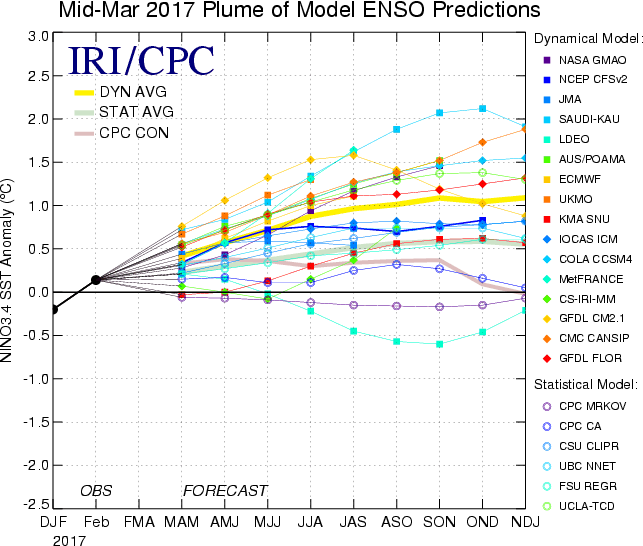
The greatest odds of El Nino conditions (68%) are forecast in late summer. (July, August, & September)

In summers where El Nino conditions develop, there is a statistical trend for many in the eastern 2/3rds of the U.S. to be wetter than normal.

Several long range models are indicating that potential as you can see below.


The EURO EPS 45 day rainfall forecast leading into the period is wet as well. Here's the rainfall forecast leading up to the start of meteorological summer June 1st.

All things considered, it should be a banner year for agricultural interests here in the Midwest. It also looks like I'll be mowing the yard on a very regular basis. Roll weather...TS


