


SUMMER RETURNS, PLUS AN ALL-TIME RAINFALL RECORD!...
- Aug 29, 2017
- 2 min read
I won't dwell on Harvey long but when you break the Continental U.S. rainfall record you have to mention it. That was the case late Monday when Cedar Bayou, Texas (a NE suburb of Houston) reported 51.88" of rain from midnight August 25th to 3:40pm August 29th.

Here's some rain totals from Harris County, Texas and the Houston metro area. I had to set down when I saw how widespread these 30-45" rainfall totals were. My goodness gracious!

This is also pretty cool. It's a 15 hour timelapse showing how quickly flooding along Greens Bayou in Houston developed. The video was put together by Jacob, DeFlitch.
Now the good news, the storm has departed and the worst has passed. Here's the sunset Tuesday evening in Houston! Probably the best the city has ever seen!

The remnants of Harvey are projected to move northeast towards the Ohio Valley the next 48 hours.

Here's the storm Thursday night over NE Mississippi.
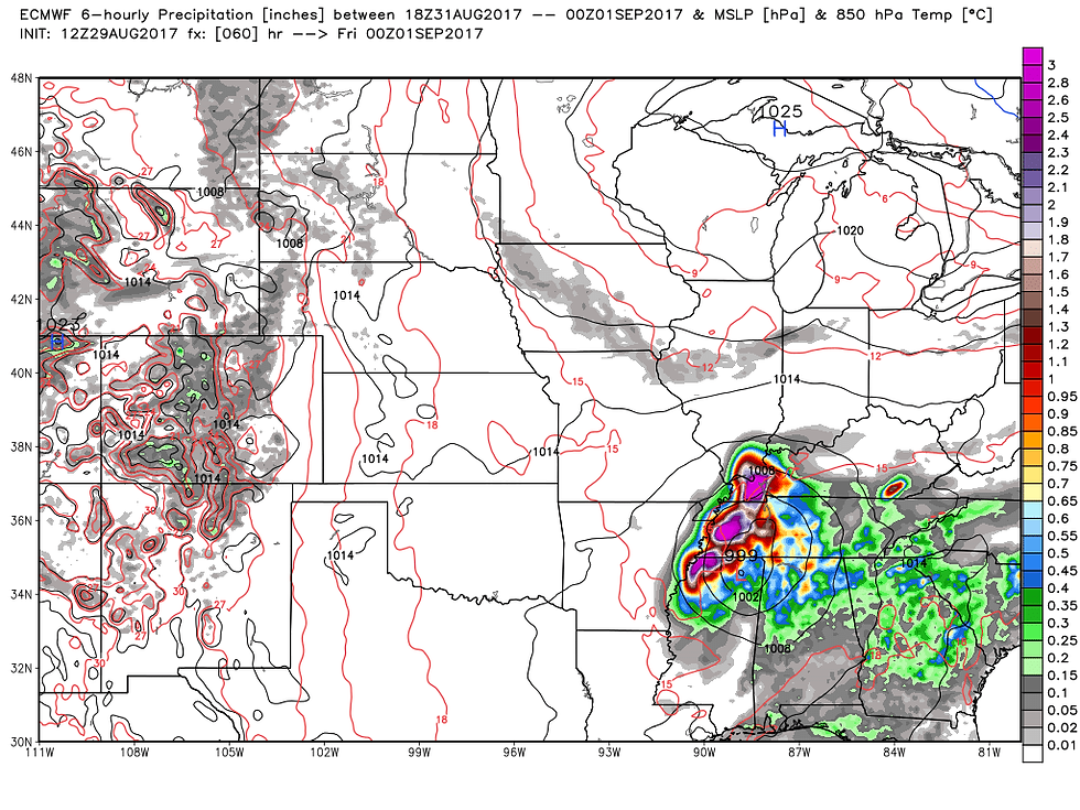
Heavy rains will continue to fall along the track of the storm but they will avoid the Midwest. You can see the heavy rain plume below near and right of the center.

As the storm passes southeast temperatures will continue relatively cool over the Midwest as east to northeast winds blow through the remainder of the week. However, by the holiday weekend southerly winds will return and up go the temperatures. Highs Sunday and Monday should be 5-10 degrees above normal, perhaps even more than that. This is where we get into a huge model fight over just how warm it gets. Look at what the GFS does on Labor Day. It has a high of 103 in Cedar Rapids. Are you kidding me!

The EURO is much closer to reality showing an 83 in Cedar Rapids.

When you get a 20 degree difference in models, what do you do? Well, if you're me you lean hard on the EURO. It's superior physics dominates in the mid to long range period so I like its cooler look. However, I do think it might be a bit low and I could see some highs in my area pushing 90 degrees Labor Day.
Labor Day evening or night a strong front zips across the region that could bring some active storms. The EURO shows them moving across Iowa Monday evening.

By Tuesday a deep trough will cross the Midwest heralding a sharp change to cooler weather. Highs next Wednesday may not get out of the 60s and some parts of the Midwest could see their first lows in the 30's Thursday morning. Check out the lows the GFS shows in Wisconsin.

Plenty of variety to come in the next 7 days. Bring it on and Roll weather...TS


Comments