


THE CALM AFTER THE STORM-TURKEY WEEK....
- Nov 19, 2017
- 1 min read
The storm that powered its way across the Midwest Saturday was certainly a wind maker. 30-40mph gusts were common, not surprising considering the pressure was down to 990mb by the time the system rolled into Illinois. You can see the impressive pressure gradient below at 7:00am with the low center near St. Louis.

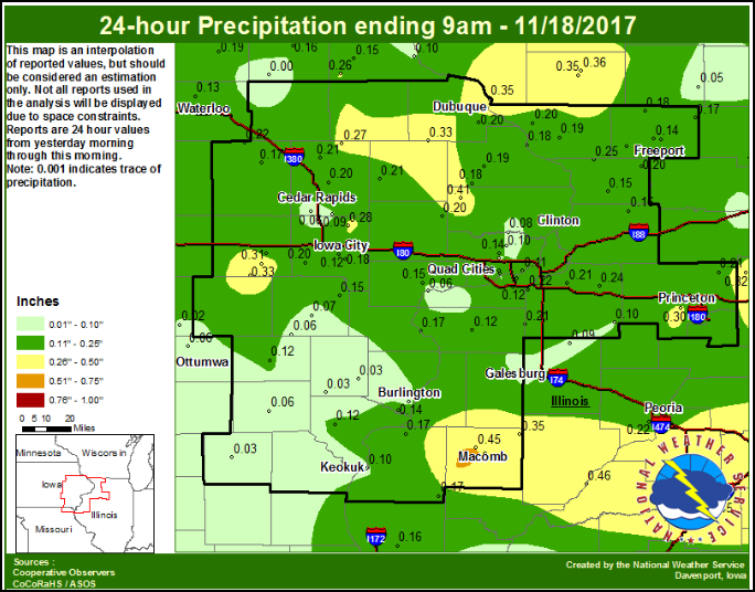
Despite the intensity of the storm it never was a big rain maker for my area. Moisture was late to enter the storm and the deformation band never really kicked in until the center was well to the east.

Rainfall was generally 1/3" or less in my region.
We knew a short transition to snow was a threat late in the event but despite dynamic cooling only a few areas saw flakes. The one part of my area that did witness it was Henry and Bureau Counties. A quick burst of snow there is shown on the radar just before noon. It didn't last long moving rapidly east.

With the storm long gone cold air on its backside will keep temperatures on the cold side Sunday. Highs should hold in the 30s, 5-10 degrees below normal.
That brings us to Thanksgiving week and while temperatures will average below normal through Thanksgiving, little in the way of weather is anticipated with a dry northwest flow. Here's the 500mb jet stream Thanksgiving Day.

Here's the 5 day temperature departure for Thanksgiving week.

Little if any precipitation is expected meaning smooth traveling conditions throughout the Midwest.
Highs Thanksgiving should be close to normal under mostly sunny skies.

Not a bad week or holiday if I do say so myself. Happy trails and roll weather...TS


Comments