


BACK IN THE SADDLE....
- Aug 13, 2018
- 1 min read
Rainfall around the central Midwest the past couple of weeks has ranged from feast to famine. In Iowa alone amounts have varied from 7" near Independence to 0.10" just south of Des Moines. That's a 7" difference in less than 100 miles. Check the 14 day numbers below.

The lack of rain in southern Iowa allowed drought conditions there to expand northward to about I-80.
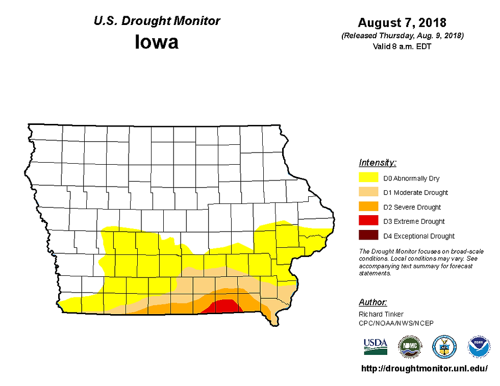
Even with some rain in Missouri much of the state remains in severe to extreme drought conditions.

Needless to say some rain would be welcome in the southern half of the Midwest and there is a system with the potential to do just that. Here's the disturbance Thursday morning crossing Kansas.

You can see the system getting organized on the hi-resolution GOES 16 satellite imagery.

By Tuesday evening PWAT's (precipitable water vapor) are up to 2" into Iowa. That's a healthy injection of moisture.

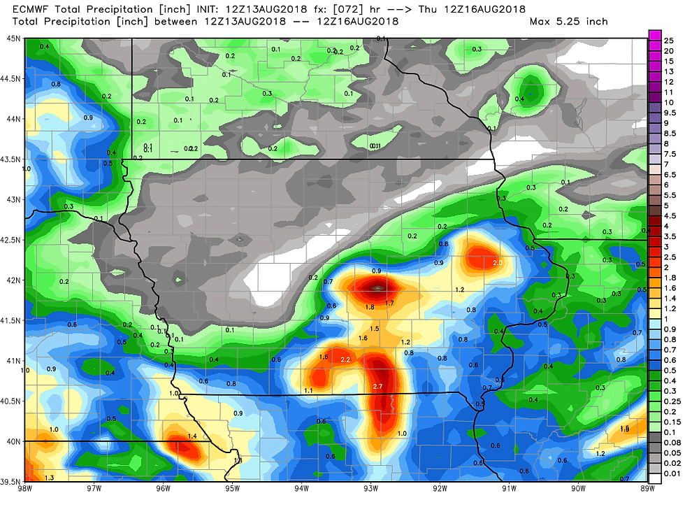
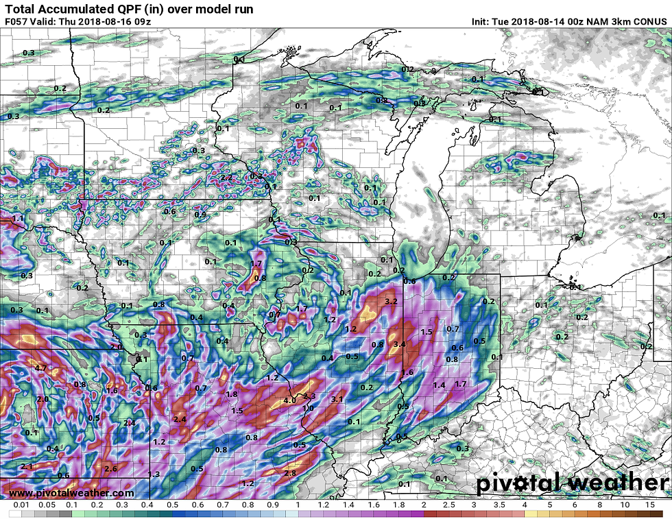
With the available moisture it's possible that some nice rains will fall where they are needed most. Unfortunately models are not in good agreement on amounts or placement even though the event is 24-36 hours away. We should have a better grasp on those issues early Tuesday. At any rate, here's a sampling of some of the rainfall forecasts available on the models as of Monday night.
The EURO:
The NAM:

The 3k hi-res NAM NEST
The GFS:

That's a wrap for now. Working my way back into the groove after surgery. I'm feeling good and grateful for all the support and prayers so many of you sent my way. It's very humbling to say the least. Glad to be back in the saddle. Roll weather...TS


Comments