WINTER KEEPS ON ROLLING...
- Jan 19, 2019
- 1 min read
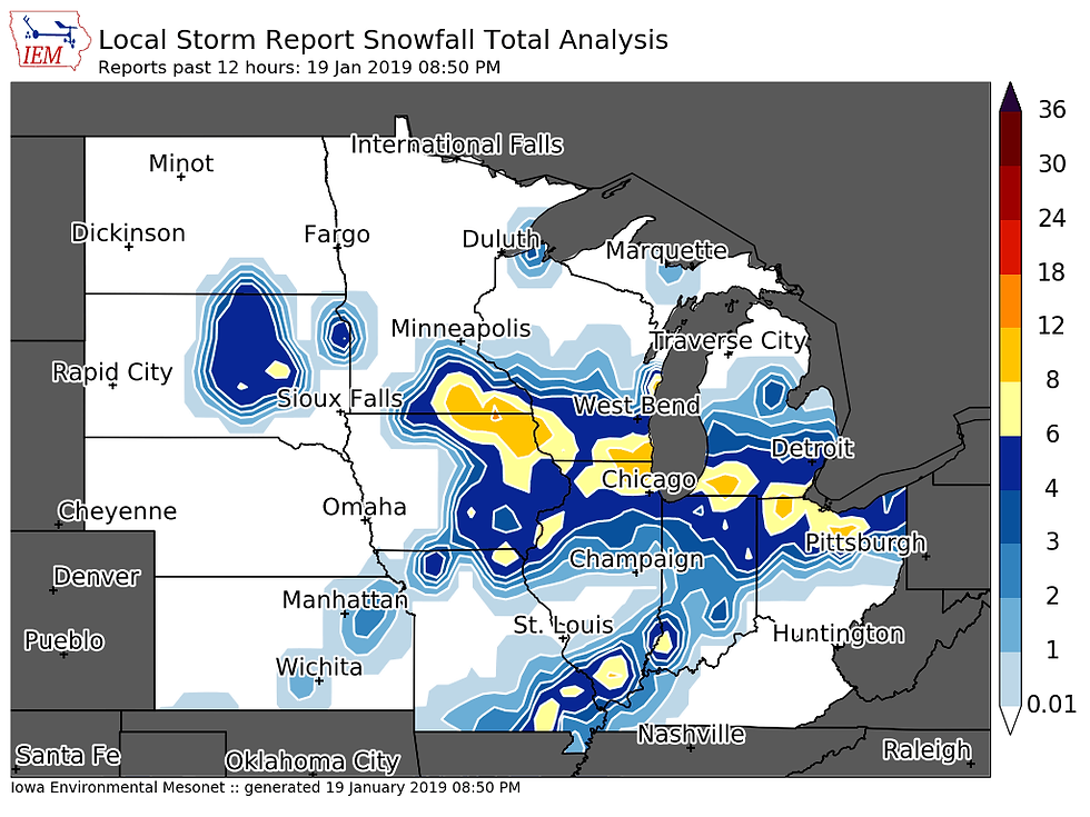
Cold air is now settling in behind the snowstorm. We're starting to build up a snow pack now across the Midwest. Here's the snow that fell with the latest storm -

The snow depth as of Saturday morning:

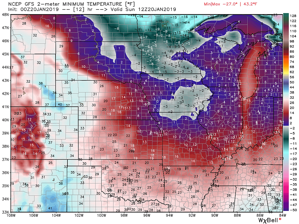
With all of this fresh powder on the ground, it is going to get mighty cold. An arctic high pressure system is moving in and will lead to the coldest night of the season so far.
Sunday morning low temperatures:

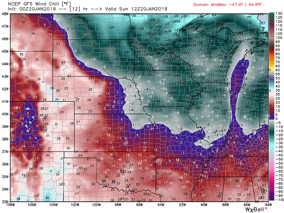
Then factor in the wind chill -

And it will be even colder Monday. Low temperatures -

And the wind chills once again -

And with the snowpack and cold air in place we are going to just see the wintry pattern continue. A weak disturbance will move through Sunday and may lead to a quick shot of snow in parts of Iowa.

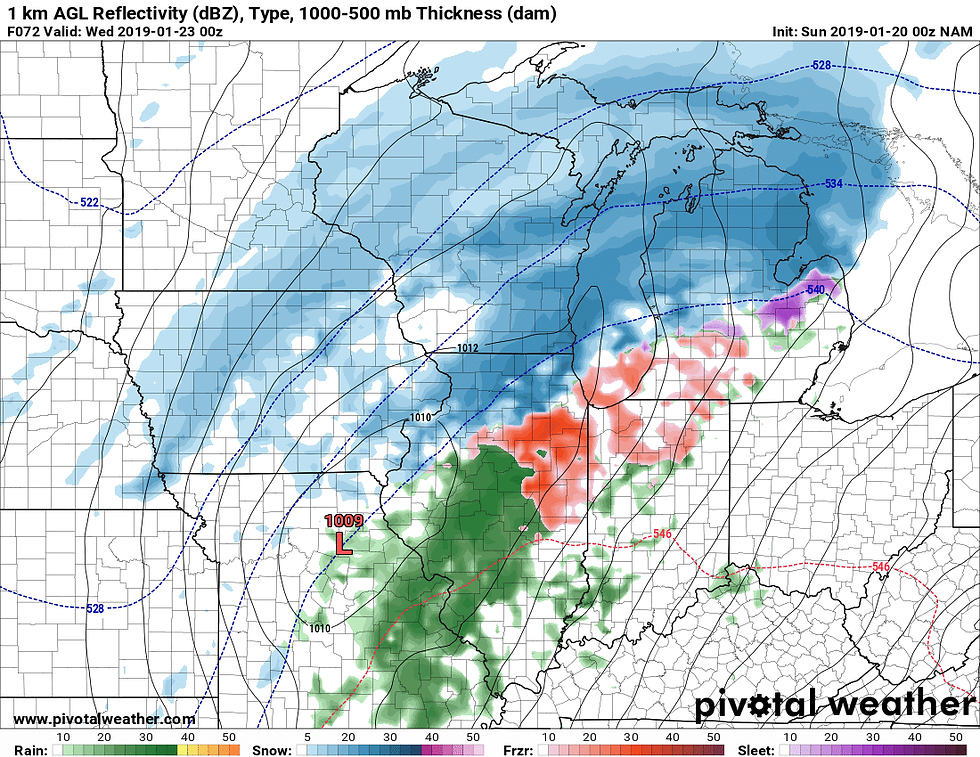
Another storm is on tap for Tuesday. This storm is still out in the Pacific so it will be another 36 hours before the models have better sampling of it. The models are still getting a handle of the new snow on the ground. Here's a look at the storm on the latest GFS:

I think the GFS solution is too far north, especially considering how much snow is on the ground across Iowa. Here's a look at a more southern solution on the NAM:

We'll get into specifics with snowfall totals over the next few days, but this storm will produce several inches of snow.. it's just a matter of where the heaviest snow falls.
Stay warm and stay buckled up for winter!
RK


Comments