


SIBERIAN EXPRESS ON THE WAY....
- terryswails1
- Jan 26, 2019
- 2 min read

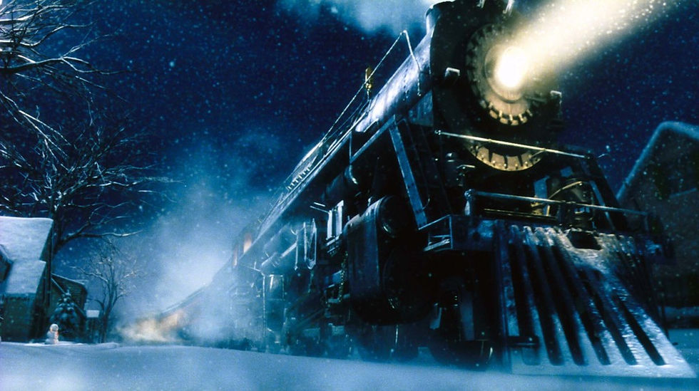
The Siberian Express has left the station on its long cross polar journey. It's next scheduled stop, the Midwest. On board is the coldest air on the planet relative to average. Get ready for an icy embrace when the big rattler rumbles into town next Tuesday!
On the animation below you can actually see the polar vortex drop south out of the North Pole and descend on the upper Midwest Tuesday evening. The loop is 4 days long.

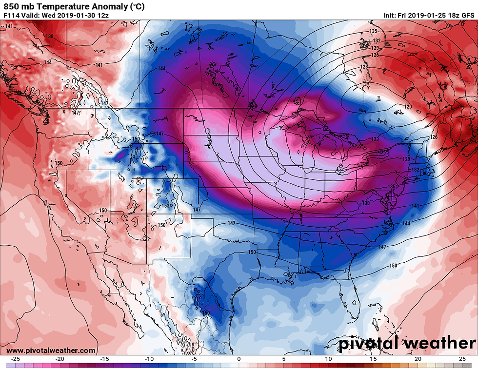
By next Wednesday temperatures on the GFS in my area are 50 degrees below normal. A very rare sight....thank goodness.

Here's a larger view of all the real estate involved in the intense cold.
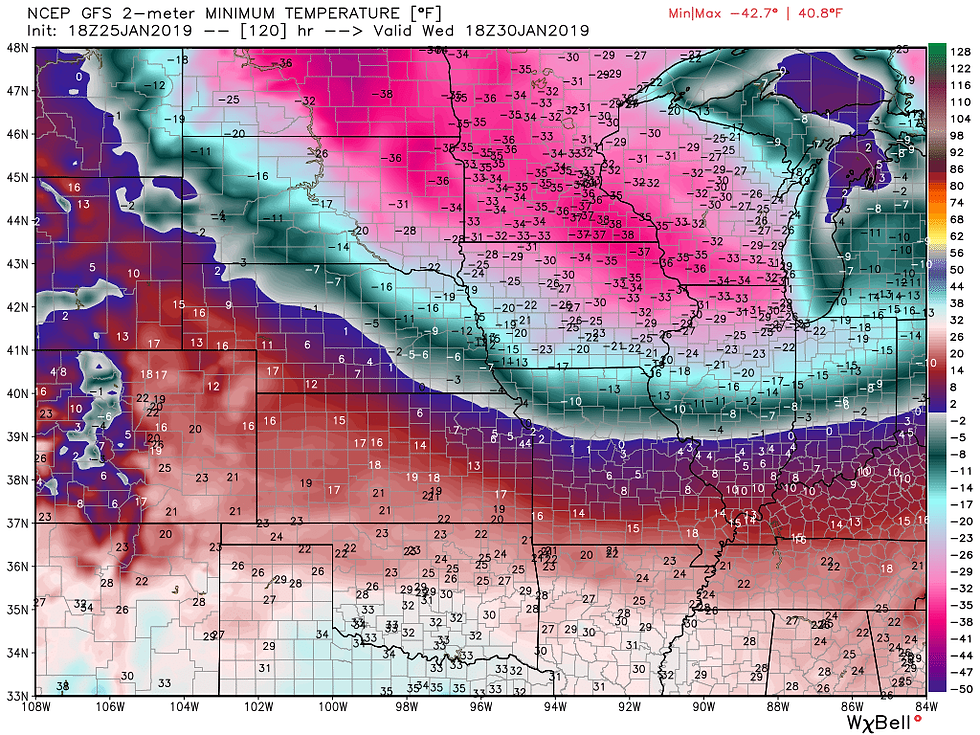
As far as actual temperatures go, the GFS has lows of 30-37 below Wednesday the 30th. That's the absolute worse case scenario. Most likely 22-29 below will end up covering it.
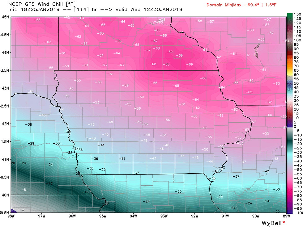
Now this is really something. Wind chills on the GFS are shown reaching 69 below on the Iowa Minnesota border. That is flat out deadly. Again, I will believe it when I see it. Before this breaks, some of us may go more than 100 consecutive hours without temperatures above zero. That's straight temperatures, not wind chill.
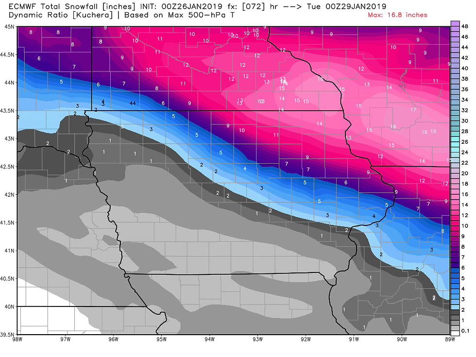
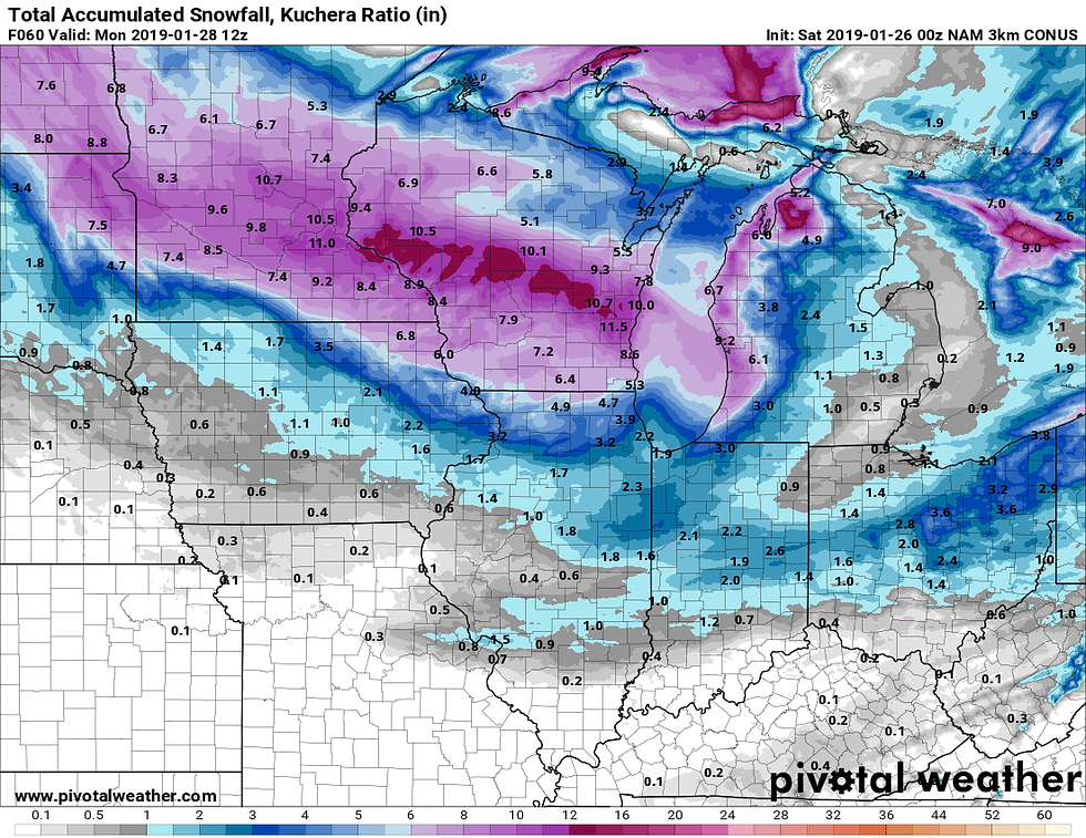
That brings me to the snow system that develops Sunday night and early Monday. The latest trends on all the models has been to push the track much further north. That has big implications for my southern counties keeping snow near and south of HWY 30 minimal on the order of 1-2", even less in the far south. In some areas sleet or even rain may mix in for a time. The further north you go, the better the chances for more significant accumulations. especially near and north of HWY 20. This is a big break for my area as this storm will bring up to a foot of snow and near blizzard conditions to parts of Minnesota and Wisconsin. Here's the latest snowfall forecasts.
The EURO.
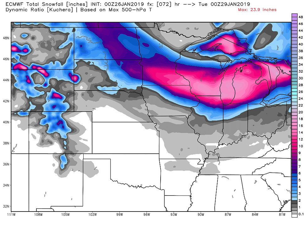
A regional perspective of the EURO.
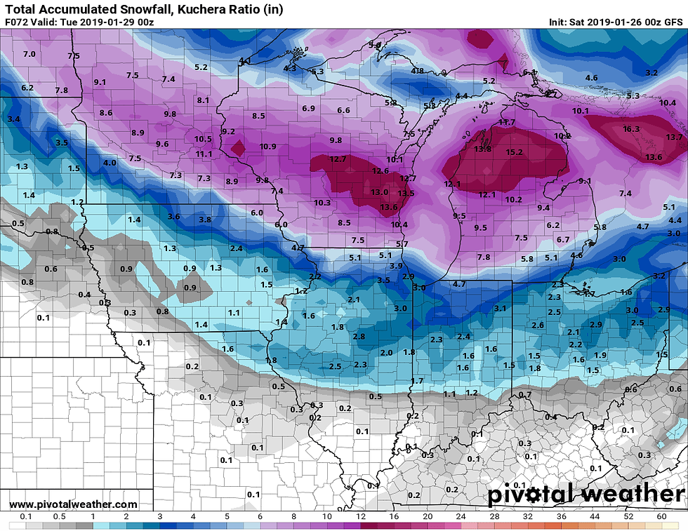
The GFS.
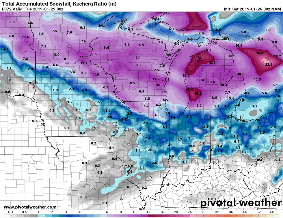
The NAM.
The 3k NAM
Some other good news is that after the severe cold departs in a about a week a much gentler pattern is expected from February 3rd to the 13th with near to above normal readings and little snow. It's only temporary but it looks like a welcome break to the wild and severe winter weather of the previous 4 weeks. Roll weather...TS


Comments