TUNE UP THE AIR CONDITIONER...
- Brandon Marshall
- Jun 24, 2019
- 3 min read
Hello again everyone. My name is Brandon Marshall. I work with Terry at KGAN/KFXA in Cedar Rapids. Mr. Swails is away at a weather conference in beautiful Maine this week. I'm sure he'd rather be there during the winter when the landscape is covered in the "white gold" as he says. I'll be taking over the blog this week keeping you up-to-date as best as possible on what to expect and plan for from Mother Nature. I'm sure he may chime in with an update on what he's up to in the northeast.
One thing is for sure and you read it in the headline.. tune up the air conditioner. An extended period of warm and humid weather is on the way. Quite the change from where we've been lately. June got off to a warm start where seven of the first ten days had a high temperature over 80°. Since then, bouts of clouds and occasional rain brought the cooler temperatures with the month currently 1.1° below normal. In fact, the last 80° high temperature was nine days ago. Highs have generally been in the 70s, and even 60s over the last week with it feeling more like late May.

We can now leave the cooler than normal weather in the past as a pattern change will unfold bringing typical summer weather to the area which includes plenty of warmth and humidity.
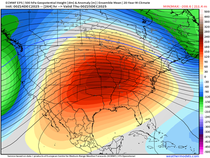
An upper-level ridge of high pressure will build into the central part of the country. That will shift the jet stream and storm track to the north across the Dakota's and upper Midwest by this weekend, capping off thunderstorm development in my area and leaving us basking in the heat and humidity.

High temperatures will likely be in the upper 80s with some areas possibly touching 90° or above. Factor in the high humidity with dew points near or in the low 70s and heat index values will be in the range of 90-95°. So it may be a good idea to tune up the air conditioner now to make sure it runs properly if you haven't already.

Before the pattern takes hold there will be a few stormy periods to watch. The first arrives on Tuesday. A surface cold front will approach from the northwest during the late afternoon and evening. Due to abundant sunshine and a warm, moist airmass in place, instability shouldn't be hard to come by. The GFS model below has 1500-3000+ J/kg of CAPE across eastern Iowa by late afternoon which is a fairly high amount.

Wind shear should be sufficient enough to support storm development, however various models aren't enthusiastic about generating storms given the weak nature of the front. The NAM 3km fires storms in far southern Iowa and northern Missouri by mid evening. Other models are in the same boat.

However, the EURO pulls the better moisture further northeast into Iowa.

The GFS is similar, but not as wet.

Given the variety of model solutions, and a fairly high amount of instability in the models along with ample shear, the Storm Prediction Center has highlighted much of the area in a broad "SLIGHT" risk (which is the standard risk) for the possibility of some strong storms. This may get fine tuned through the day Tuesday. The main threats would be hail, gusty winds and locally heavy downpours.

In either case, most of the day should be dry with highs temperatures in the low 80s and dew points in the 60s making for a summery afternoon and a change from where we've been.
Another period to watch is Thursday and Friday as a warm front will approach and stall out across the region. Several uncertainties remain with regard to where it'll end up, the coverage area of any storms, cloud debris which may inhibit instability and remnant storm boundaries which may act to further initiate storm development. We'll try and iron these details once we get closer.
Thanks for reading. Until next time.
Brandon (BMARSH)


Comments