


THE USUAL SPRING SMORGASBORD...
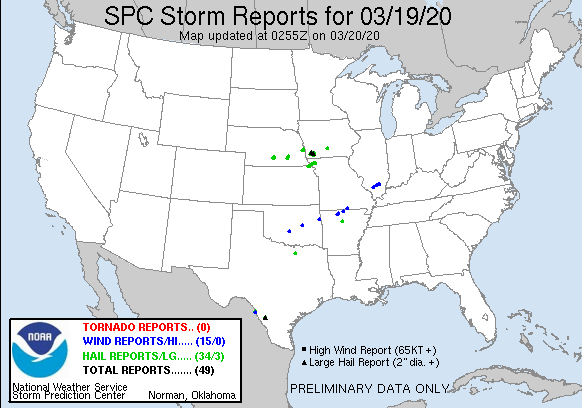
Well, for some parts of my area the first tornado watch of the year has come and gone. While there were some reports of severe weather in SW Iowa nothing major came to pass. SPC showed this for severe weather reports as of late Thursday night.
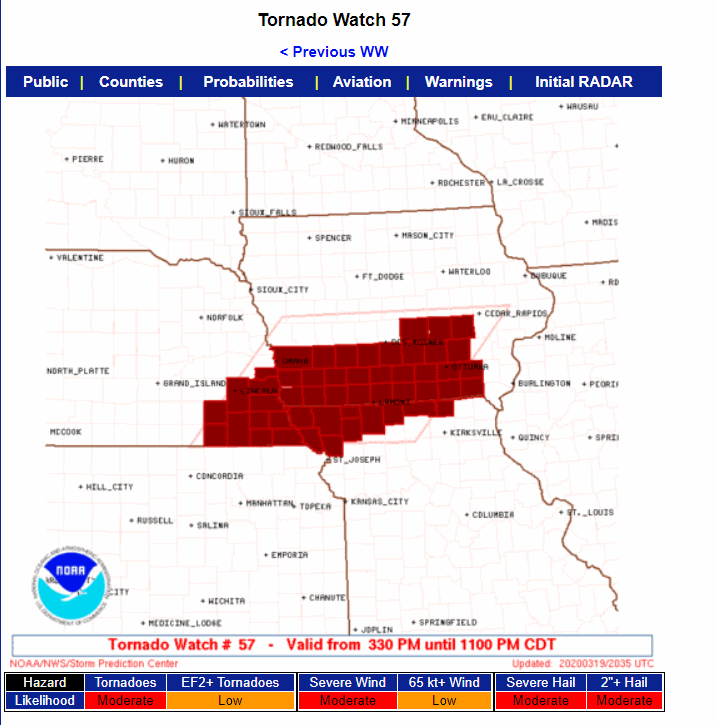
This is the area the watch encompassed Thursday afternoon and evening. That is 2-3 weeks earlier than normal for that specific area.
You can see the wide variety in temperatures that resulted from the warm front that made it as far north as I-80 during the day.

Early Friday a strong cold front is blasting a trail southeast. Some lingering rain (and snow showers) are in the process of winding down. Some areas of northern Iowa, mainly near and north of HWY 20 into Minnesota and SW Wisconsin have picked up an inch or two of wet snow, especially on grassy and elevated surfaces.

The most noticeable aspect of today's weather will be the wind and cold temperatures that are sweeping the region. Gusts today will likely be in the 30-35 mph range and temperatures are not going up much. Readings this afternoon will be as much as 35 degrees colder than 24 hours earlier in my southern counties. These are the projected 24 hour changes in temperature.

That results in readings holding in the range of 35-40 all day. In the north readings will start in the mid to upper 20s. Toss in the wind and wind chills Friday morning will be in the teens and low 20s. You will want the big coat!

The remainder of the weekend will be dominated by chilly temperatures that will run 5-10 degrees below normal. That keeps highs in the upper 30 to mid 40s Saturday and low to mid 40s Sunday. There is a disturbance that needs to be watched for the end of the weekend that could bring some wet snow or rain and snow mixed to the south Sunday afternoon and evening. Best chances look to be along and south of I-80. Models are currently indicating some slushy accumulations. This is very tentative and I currently would say low confidence in regards to amounts and placement. Here's what models are currently showing.
The EURO

The 12k NAM...always high end.

The GFS

I think the big take away is that spring is on hold the next few days as cool unsettled weather taunts the Midwest. If nothing else, spring officially started Thursday with the vernal equinox...equal hours of day and night. Have a great weekend despite the conditions and as always, roll weather...TS


