GOING THE WRONG DIRECTION...
- terryswails1
- Apr 3, 2020
- 2 min read
I talked a couple days ago about what looked to be a potential temperature crash the middle of next week. Today's data continues to push that agenda and if anything, it's even colder. Here's a meteogram for Cedar Rapids showing highs dropping from 75 next Tuesday April 7th to 43 the 12th. Even worse, it shows 4 consecutive days with highs in the 40s and a maximum of 41 the 15th (normal is 62). This might be a bit overdone but it's certainly not the direction we want to going.

The EPO (eastern Pacific Oscillation) nails the trend in both the EURO and GFS ensembles showing the negative phase developing the 7th which is right in line with when the chilly air would be expected to arrive.
The EURO

The GFS

These are the day 10-15 temperature departures on the GEFS. We haven't seen them this cold in some time.

Compare the single day departures of April 7th to the 15th. Were going the wrong direction from 20 above to at least 15 below normal.
April 7th

April 15th

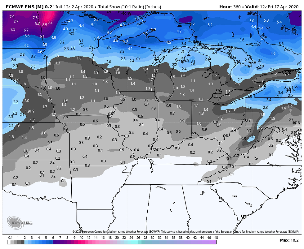
One of the questions that comes with the emergence of cold air is will there be snow? If flakes fly it won't be for at least a week but the ensembles of both the EURO and GFS do show the potential. Check out what both lay down.
The EURO

The GFS

Going into mid-April this is impressive and depressing at the same time. Both models have trace amounts of snow into NW Arkansas. I'm far from endorsing snow forecasts that are more than a week away in April. It's very difficult to pull it off this late in the spring, especially this far south. On the other hand, there's enough evidence and cold air to keep an eye on the threat going forward.
Circling back to your Friday and the weekend ahead, a cold front will ease its way across my area during the day. Around noon it should be cutting through eastern Iowa. Ahead of it readings will be in the 60s, behind it a sharp fall into the 30s. Below are the 1PM temperatures.

Showers will also attend the front and could linger through midnight. They might hold off in Illinois until early afternoon. Amounts in eastern Iowa should be in the 1/4 to 1/2 inch range. East of the Mississippi totals look lighter near 1/4" or less.

My area should not have to worry about snow but some wet flakes may fly in parts of NC Iowa into Minnesota and Wisconsin.

By daybreak Saturday the precipitation is gone and the rest of the weekend looks dry. A bit cool Saturday with highs in the low to mid 50s but warmer Sunday as readings approach 60...close to normal! Roll weather and stay virus free...TS


Comments