


A CHANGE IN THE WEATHER...
It was hard not to notice the change in the weather around the central Midwest Friday. A cold front which passed by daybreak was followed by much cooler and drier air. The rain which had been an occasional feature all weak long was finally no longer a player aside from a few spotty showers and sprinkles in Wisconsin. On the satellite you can see the leading edge of the cooler air marked by clouds and the cold front from Michigan into Indiana.

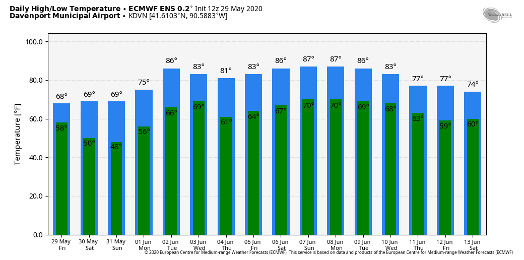
Late day temperatures were stuck in the 60s over much of my area. A big drop from those mid to upper 80s earlier in the week. NC Wisconsin was fighting to get out of the low to mid 50s!

The biggest change was the expected drop in moisture levels. Thursday dew points were in the mid 60s locally.

By Friday evening they had lowered to the 40s over most of the Midwest.

Below you can see the 24 hour drop of 15-20 degrees on the dew points behind the front.

That has set the stage for the chill you're feeling Saturday morning with much of the northern half of my region back in the 40s to start the day. We're going to get a repeat performance Sunday morning with some colder valley locations poised to hit the upper 30s to low 40s in NE Iowa and NW Illinois. No records are anticipated but a few locations could be within 2-3 degrees. Why not? These are the projected lows on the NAM, one of the colder solutions. Considering the potential for optimal radiational cooling this may not be far off.

As far as highs go, cool will be the rule the rest of the weekend with maximums pegged in the mid to upper 60s. That's a good 10-14 degrees below normal.
That brings us to warmer days ahead next week as we turn the calendar to June and the start of meteorological summer. The magnitude of the warmth is still in doubt as the EURO slips a back door front in and holds the core of the heat further west. The GFS on the other hand is all in for heat showing 13 consecutive days with a high of at least 80...and 3 days in the 90s in the Quad Cities.

The EURO has a scaled down version of the warmth which is my personal preference as I see the potential for a couple of back door fronts in this pattern, especially since it's early June.
The position of the front will also dictate daily convection and potential MCS development. The proximity of the front will lead to significant convective clusters at times in a ring of fire type scenario. The big question is where? It could be several more days before the precipitation potential and placement is resolved. That will keep me occupied.
Meantime it's been 14 consecutive days since it rained here in Portland. It would be a big deal back home but out here the agricultural impacts are less impacted by the amount of moisture. Personally, I miss the active climate of the Midwest in spring but I'm hoping to make up for it with more in the way of snow this winter. A little give and take if you know what I mean.
Alright then, have a great weekend and to all my friends and family back in the Midwest, I miss you! Roll weather...TS


