


TROPICAL STORM TAKES AIM ON THE MIDWEST...
Over the years I have witnessed a few occasions where the remnants of a tropical storm or hurricane will sweep north from the Gulf and cause a little mischief here in the Midwest. It's not common as two things usually happen. First and foremost, the storm gets caught up in the westerlies and is steered to the east into the Ohio or Tennessee Valley. Number two. It weakens so much there's really not much energy left to cause problems outside of a good soaking rain.
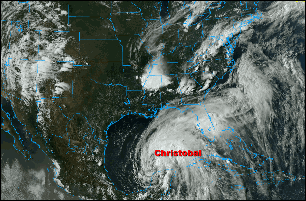
Then there is the rare situation we are looking at next Tuesday where the tropical energy is absorbed by a strong trough and the hybrid scenario comes to fruition where the storm actually strengthens when the merger takes place. That seems to be the set-up that models are pointing to with the remains of Christobal.
Below you can see the 500mb trough over the Plains drawing the moisture and energy of Christobal northward into Missouri. Eventually it hammers our a negatively tilted trough and spins up a potent little storm. A unique event to be sure.

Most of the operational and hurricane models are in agreement with this scenario. Here are the mean tracks that are currently being projected by the EURO, GFS, and CMC. These are pretty tight clusters for an event 96 hours away. That leads to good confidence at this range.
The EURO EPS

The GEFS

The CMC

The EURO indicates a 90 percent chance the energy of Christobal remains a tropical depression all the way to Missouri and Illinois.

At the surface, both the EURO and GFS have the storm hitting my area Tuesday afternoon and night. Here's the surface map of each model.
The EURO

The GFS

The final track will be important because the excessive rains will fall west of the center of circulation. Additionally, as we all know, winds tend to be lighter where the center (eye) of the storm tracks.We'll need to keep tabs on that in the coming days to see where the heaviest rains and strongest winds (perhaps gusts 45-50) occur.
As it stands now, the excessive rains are favored over eastern Iowa where 2 to locally 6" rains are possible in roughly 24 hours time. If this falls on ground recently saturated by heavy rains, that could pose a serious flash flood threat that could morph into river flooding as the rain enters the basins. If the worst case scenario develops, this could become a serious concern and needs to be watched very closely. I can assure you flood and flash flood watches are likely for some part of my area if current trends hold.
For now, very early in the game the EURO shows this for precipitation in a 5 day period. Most of it coming in 36 hours centered on next Tuesday.

Just like with a winter storm, the amount of phasing and the final track of the storm will determine its strength and impact in any given area. It's still possible that less phasing occurs and the overall system is weaker with less severity. These are the issues that will need to be answered in the coming 24-48 hours. Overall, I think confidence is high that the storm is headed for my area but low to moderate with respect to rain totals and the location of the heavy rain band.
During the interim between now and then, the weather looks pretty good this weekend. Overall lower temperatures and humidity levels should make for some very pleasant June conditions. While you are out enjoying the elements, forecasters will be dialed in on the development of this unique tropically enhanced storm. Happy Saturday to you all and roll weather...TS


