


UPDATE ON TODAY'S THUNDERSTORM THREAT...
- Jun 26, 2020
- 2 min read
Thunderstorms that developed around the region last night and this morning have largely dissipated or become widely scattered. In the wake of the storms outflow boundaries and residual moisture remain over the area. Breaks for sunshine are also developing which will further increase instability this afternoon.

By late afternoon CAPE which measures instability is forecast to be significant, especially south of HWY 20.

By late afternoon a surface cold front will drift into the unstable air mass and become the focus for thunderstorm development. It appears that the greatest coverage will be over the southern half of my area later today and into the evening as a line forms and sinks southeast.
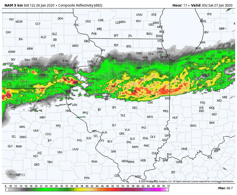
The 3k NAM a high resolution model designed to capture convective development shows storms lining up at 6:00pm just south of Dubuque to the north of Cedar Rapids and back to near Des Moines.

By 9:00pm a a large squall line extends from southern Iowa to Chicago and points NE.

By midnight all but my far southern counties in SE Iowa and WC Illinois will be free of the storms.
The Storm Prediction Center does have a slight to enhanced risk of a few severe storms. Deep layer shear is marginal so downburst winds and perhaps some hail are the primary risks in the strongest updrafts.

Another concern will be the potential of torrential rains and perhaps some areas of flash flooding. Water vapor values up to 2.2 inches depict the potential nicely. 1-2" rains in an hours time is possible in the strongest cores.

The 3K NAM shows the southern half of my area (near and south of HWY 30) with the heaviest rains and the greatest chance of any severe weather. These are the projected rain totals...just a guide.

Most of the development should hold of until 4 or 5pm along a line that roughly extends from Dubuque to Anamosa back to Vinton. There is a good chance that some part of my area south of HWY 20 will see a severe thunderstorm watch issued at some point later today. That's the latest and greatest. Roll weather...TS


Comments