IN DESPERATE NEED OF RAIN...
- Aug 29, 2020
- 2 min read
August has been bleak for rain across much of the Upper Midwest. On one hand the lack of rain has been beneficial for areas cleaning up after the August 10th derecho. On the other hand there are many areas that are in need of the rain (and those areas cleaning up from the derecho and dry areas do overlap, too). Iowa is experiencing the worst of both... the worst of the drought and worst of the derecho damage.

Here's a list of rainfall totals for August to show why the dry and drought conditions have been worsening across the Midwest:
Moline: 0.14"
Cedar Rapids: 0.42"
Burlington: 0.3"
Davenport: 0.73"
Carroll: 1.29"
Peoria: 0.59"
Galesburg: 0.62"
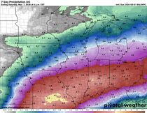
And unfortunately the prospects for decent rain/drought busting rains is low right now. And as we head toward fall the chance for heavy rain tends to go down (unless a tropical system moves toward the Midwest and brings higher moisture levels). Here's a look at the Climate Prediction Center Outlook through the second week of September:

This is due to northwest flow setting up in the upper levels of the atmosphere. While that leads to dry air it also leads to cooler weather, as we already started to experience on Saturday.
Sunday will be another one of those comfortable, fall-like and unfortunately dry days:

There will be a chance for rain as we head into next week. Two systems may lead to rain Monday...


And Tuesday...

Unfortunately neither looks to deliver heavy rain at this time.
Temperatures will be a bit of a roller coaster ride this upcoming week but you can see the trend toward cooler and fall-like weather in general.
10-day forecast for Cedar Rapids:

Quad Cities:

Fingers crossed for some rain...
RK


Comments