


A PRONOUNCED WARMUP THROUGH MAY
- May 10
- 2 min read

As Terry continues to recover, the weather decided to take a long break from the recent excitement. I know he's happy to not be missing much, just as I am sure everyone could enjoy a bit of a spring warmup. Thank you all for keeping him in your thoughts as he recovers in the ICU through the weekend!
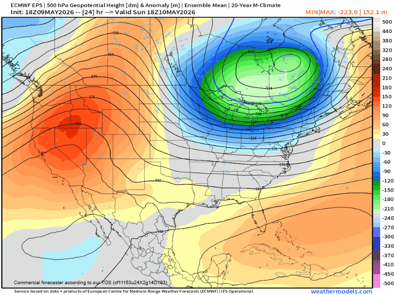
Locally, we will be watching an overall warming trend over the next week as a strong ridge in the jet stream takes over. Above you can see the five-day temperature anomalies this upcoming weekend into early the following week (May 15-20). That is a strong signal for warm temperatures taking over. We have just one somewhat cool morning to get through which might even feature a low chance for frost Sunday night into Monday morning.
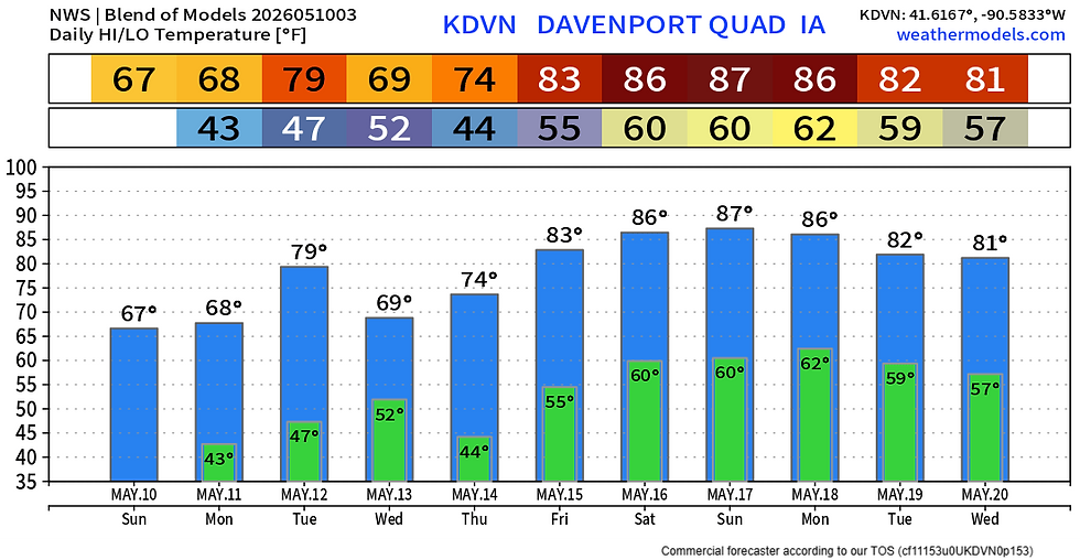
The model blend shows low 40s Monday morning, but this might be a little too warm. Either way there are a few things to break out in the 10-day temperature outlook above. A cold front Tuesday will send temperatures down Wednesday. This weekend is when the big warmup is on the horizon. Confidence in mid/upper 80s is increasing. Here comes the warmth!
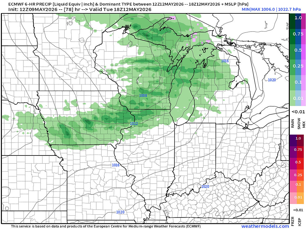
Tuesday's cold front may feature a chance for showers or a rogue thunderstorm, although the moisture supply is limited. The Euro (above) is one of the most aggressive with the rain chances. Dry air in the low levels I think will cause significant evaporation of the rain being indicated on the forecast models.

The total precipitation forecast off the high resolution RRFS through Wednesday morning has little if any rain locally with most of the rain evaporating before reaching the surface.

Ahead and behind the cold front Tuesday it will be rather breezy. Wind gusts will be in the 20-30mph range which will bring the warmth before the front and a brief cool down behind said front. Those southwest wind gusts ahead of the front will not be enough to bring in adequate moisture for rainfall thus the lack of accumulation potential.
The ridging pattern looks to keep the weather warm for some time into mid-May. Later in the period there may be a bit of an uptick in rain and storm chances with southwesterly flow leading to more shortwaves to enter the picture triggering storm systems. Nothing really clear as of now.

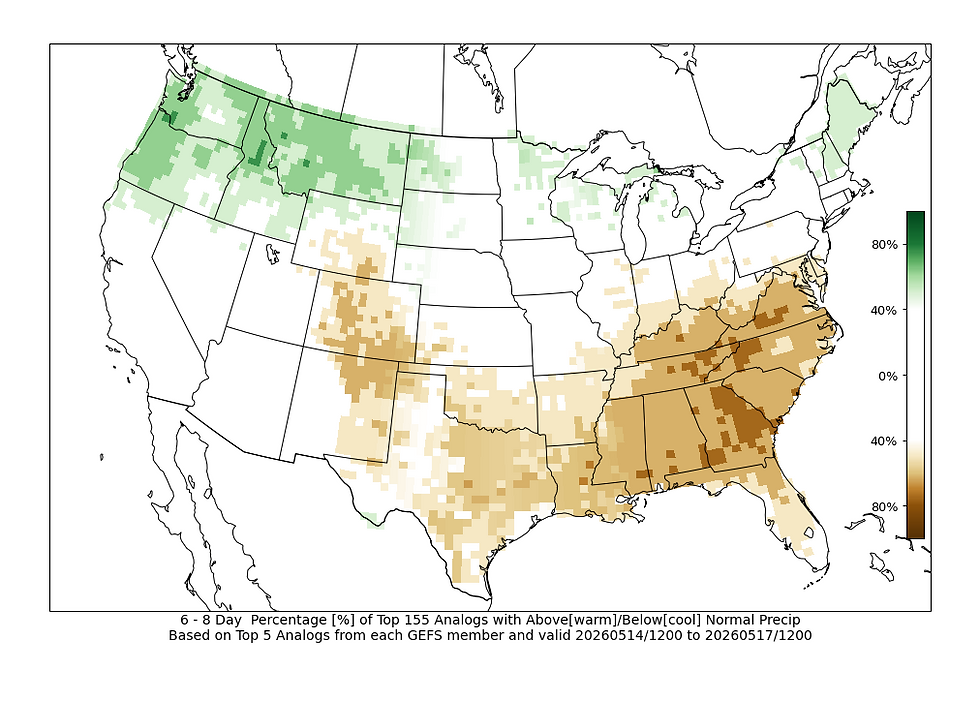
The latest Climate Prediction Center outlook has a signal for above-normal precipitation, while analogs are near normal. I personally am leaning towards a drier pattern through May 17-18 which is a bit against the official medium-range outlook. The pattern does not look wildly active to me over the next week.
I hope to be filling in for Terry a little more frequently over the next week. I spent some time in the Caribbean taking advantage of the rocket launches slowing down a bit from the Florida Space Coast to get away for a few days last week.
Have a great rest of the weekend everyone!
-Meteorologist Nick Stewart


Comments