


ACTIVE IS THE WORD...
It wasn't more that a few weeks ago when we were in the midst of one of the coldest, snowiest February's on record. The monthly temperature departure for the nation looked like this.

Then March came in like a lamb and for the most part kept that friendly mentality going. Look at temperature departures this month compared to last. Now that's what I call a well deserved change!

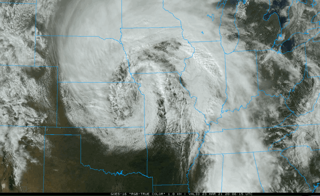
Readings were cooler Tuesday as a healthy storm spun up clouds, moisture, and rain. It certainly had the classic look one would expect from a well organized mid-latitude cyclone. Deep moisture is surging north from the Gulf of Mexico into the conveyor belt circulating around the center of the storm in SW Iowa.
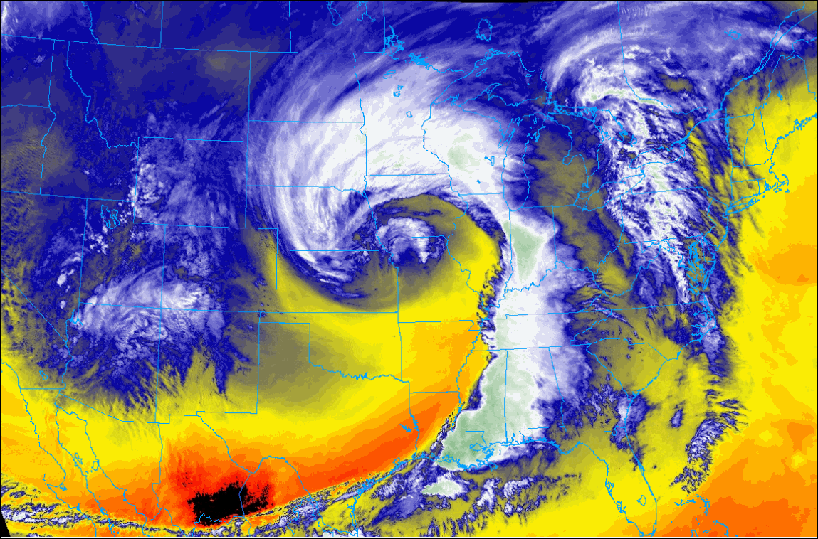
Here's a closer view of the storm and its tight circulation generating spiral bands of clouds which is a tell-tale sign of shear. At the lowest levels 0-3KM shear of 35 knots was noted which is plenty to get any thunderstorm updrafts rotating. The biggest drawback for tornado producing storms was limited heating. We knew this would be an issue inhibiting any strong or sustained tornadoes. This is what's known as a high shear, low CAPE environment. Once in a while you can get a brief spin up in such a situation despite limited instability.
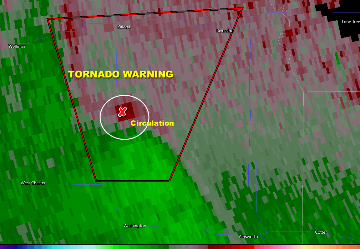
I had mentioned there was at least a small chance of a couple spin ups 24 hours earlier and sure enough we did have the first tornado warnings of the year issued in my area. The first was down near Ft. Madison and the second for Washington, County in Iowa around 7:45 PM Tuesday. Here's the Doppler showing the Washington County warning and another south of Hannibal, Missouri.

Here's a closer view of the circulation north of Washington, Iowa that prompted the warning for that area. It was quickly cancelled.
By early today the heavier rains that will fall in bands, especially in Iowa, will have ended as the storm wobbles northeast. That leaves us with a mostly cloudy, breezy Wednesday. A few brief showers are possible but they look spotty, light, and mainly confined to my NW counties in Iowa. Temperatures will be chilly with highs in the upper 40s and low 50s.
The pattern quickly reloads and the next system blazes a trail northeast into Missouri and SE Illinois. The EURO is the strongest solution with a 984mb surface low tracking southeast of Champaign. It has a really tight compact system with a significant rain band. The GFS is far weaker but both models are consistent keeping the precipitation shield over far southeast Iowa and WC Illinois. This is the EURO surface depiction near midnight Thursday.

With its stronger solution the EURO is the furthest NW with precipitation and heaviest with amounts. It does bring 1/4 to 1/2 inch amounts into my counties SE of the Quad Cities.

The GFS is pretty much a miss and I suspect the rain shield to be further NW like the EURO indicates.

The odd model out right now is the high resolution NAM. The 3K version brings rain to the entire eastern half of Iowa.

It's also colder and brings accumulating snow from Ames and Waterloo to Decorah.

I just can't see any rational for that to happen so I'm inserting this idea in the garbage. Bye bye.
After a short break following this system, the next one arrives Friday night and early Saturday bringing a chance of rain to most areas. We'll focus more on that in the coming days. Active is the word. Roll weather...TS


