


BLIZZARD CRIPPLES IOWA, BUT SIGNS OF SPRING AHEAD
- Mar 16
- 2 min read

A well-advertised blizzard continues to wallop the region with the major interstates closed due to extremely dangerous travel conditions. I-80 from the Omaha metro to Iowa City as well as I-35 from Ames to the Minnesota border were shut down Sunday due to major blowing and drifting.
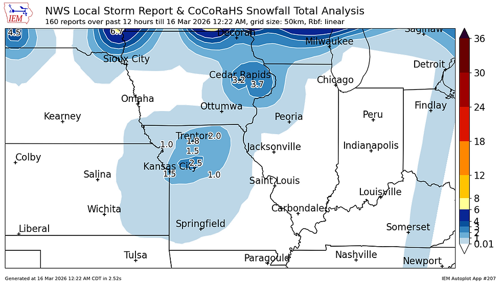
As of midnight during the writing of this post the snowfall reports have been pretty limited. Generally 3" have been reported in east-central Iowa from Cedar Rapids towards the Quad Cities region. We expect these totals to continue to climb, and with the wind through the night blizzard conditions will continue.

Wind gusts overnight were clocked over 50mph across central and western Iowa causing significant blowing and drifting snow.
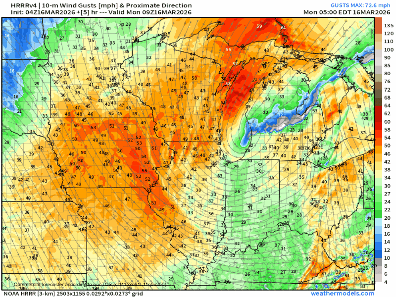
Wind gusts over blizzard criteria persist through Monday morning and afternoon which will prolong the impacts across the region taking that freshly fallen snow and continuing the blowing and drifting hazards. There will likely be many rural roadways in the region that could take days to be cleared and open for travel. By Thursday the snow and wind will be winding down and a gradual warmup starts to build in.
However there's a bit of snow still in the forecast.

Late Tuesday we are watching another clipper system that could bring some more snow to the region. This will have significantly less moisture to work with compared to the Sunday blizzard, but a little snow is certainly on the table to add insult to injury.

The blended model forecasts have some snowfall totals approaching 1-3" for the general area. The heaviest at this point looks to be north of I-80. Jut a little more snow before spring appears to want to build back in.

We will see some rather impressive snowmelt in the days ahead with highs reaching the 60s likely by Friday. The snowpack could potentially keep temperatures cooler than forecast so that will need to be monitored going forward. We will get a much better handle on the temperatures once the snowpack is analyzed in the models.

Impressive ridging will build in the western CONUS which will shut down the active pattern for some time after a wild stretch of weather. This will bring the drier weather as well as the warmer temperatures forecast by the weekend.

Seven-day precipitation anomalies are projected to be well below normal over the next 10 days across the eastern CONUS as the pattern truly shuts down. Again this will be accompanied by generally warming temperatures going forward. It will be feeling much more like spring going forward.
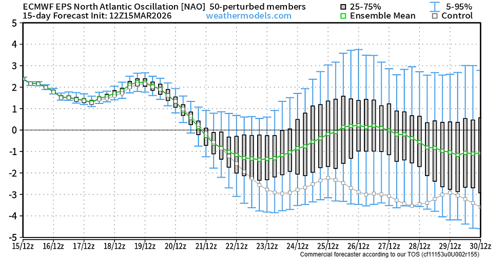
I briefly want to take a look long term into the end of March and early April. The NAO appears to want to take a pretty sizable dip into the negative standard deviation range late this month. This would indicate some return to active SPRING weather.

The EPS weeklies are actually indicating this active threat developing with above-normal precipitation anomalies being indicated in the March 29-April 5 time frame. Of note, if this ends up being a heavy rain event, this could potentially coincide with the melted snowpack making its way downstream. Far from any solid details to note at this point, but those with interests along area rivers should very closely monitor flooding forecasts going forward.
Have a great week everyone!
-Meteorologist Nick Stewart


Comments