


BRIEF RELIEF...
- Jun 23, 2024
- 1 min read
A round of storms moved through the Upper Midwest on Saturday with heavy rain once again near the Iowa/Minnesota border:

Some of these storms were strong with gusty winds along with some reports of funnel clouds and tornadoes (mainly in Wisconsin).

This additional rain will lead to rises on area rivers in eastern Iowa, including the Mississippi over the next week or two:

Record flooding has been occurring in northern Iowa and the town of Rock Valle had to be evacuated due to flood waters. Any additional rain over the next week or so may change river forecasts n eastern Iowa. Sunday will be quiet as drier air has moved in behind Saturday's front.

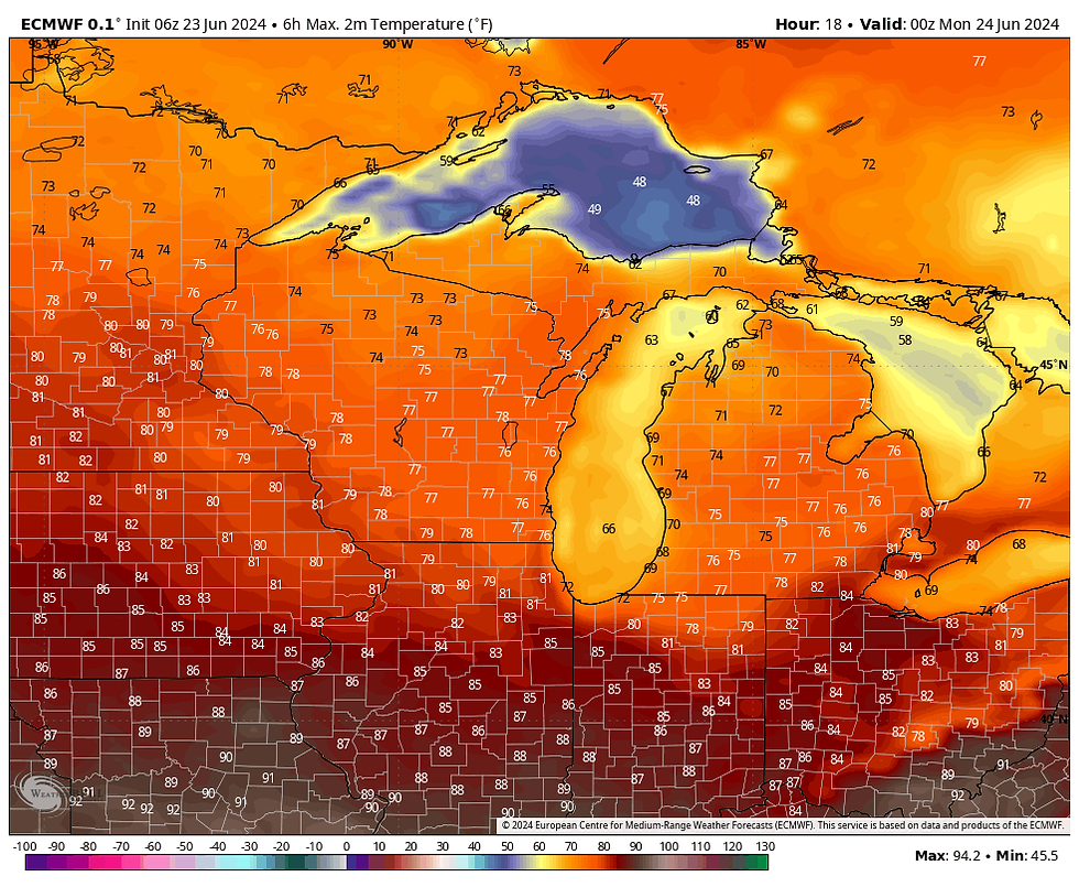
The gross 70 degree dew points are off to the southeast for Sunday. Temperatures will be around 80:
Monday will be another toasty day with temperatures back around 90:

There's a chance for storms Monday night into Tuesday morning as a warm front lifts north:

Some storms may be strong with gusty winds and hail. Temperatures will then rise back into the 90s on Tuesday afternoon with high humidity:

Additional strong storms are possible as the cold front sweeps through on Tuesday evening:

There will be more relief behind the front with humidity levels dropping for Wednesday and Thursday.


Comments