DARK DAYS...
- Nov 20, 2025
- 3 min read
With Thanksgiving just a week away, we've entered the time of year when the shadows are long and the days are short. Throw some clouds and drizzle into the mix, and it can be exceedingly dreary. It's what I call the dark days, the period where fall is about to transition into winter. It's not really cold, but far from warm and the clouds hang low as if to say, there's a lot worse where this came from, and you know it.
Thursday will be the 4th day stuck in the muck, thanks to a stagnant pattern featuring a temperature inversion and light winds. This has trapped low level moisture, making it hard to scour out with the limited solar radiation of late November. With little overall change in the atmosphere Thursday, more of the same is anticipated locally, resulting in another cool, dreary November day with highs in the 40s. Some areas of fog could also be found in the morning. If we do see any sun, it would most likely be late in the day and confined to the north. The satellite below shows the swath of low stratus that prevailed Wednesday, with a layer of mid to high clouds on top of them.

Thursday, here's the simulated late afternoon water vapor image. Not promising for much in the way of sunshine.

GIVE THE GIFT OF MY 5 STAR AIRBNB IN GALENA

Holiday and winter specials are now in effect through March. Let us help you set up a personalized gift certificate that's sure to create a lifetime of memories! Santa Claus approved. Call or text Carolyn at 563-676-3320 for details and our very best pricing. https://www.littlewhitechurchgalena.com/
SPLIT IN THE MIDDLE?
Longer range, split flow is evident at 500mb. You can see energy in the northern and southern streams avoiding my area, keeping us dry until late Monday or Monday night, when the northern branch begins to phase with its counterpart to the south.

That allows a gradual warm-up, especially Sunday, Until then highs Friday and Saturday will remain in the low to mid 50s before reaching the upper 50s to low 60s Sunday.
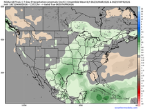
Monday afternoon or evening, a surface low takes shape that sweeps northeast through central Illinois by Tuesday morning. That spreads a band of rain across the region of light to moderate intensity. Despite being in the cold sector of the system, a lack of cold air preceding it should keep readings in the 50s Monday and Tuesday as it passes. Here's what guidance is suggestion for rainfall Monday into Tuesday morning.
The EURO

The GFS

Behind the system, we begin the first phase of a long talked about pattern change. Winds switch to the northwest, allowing colder air to gain access to the Midwest. Readings will go from the 40 Wednesday to the 30s Thanksgiving Day and could remain there through the remainder of the holiday weekend. On the good news front, there does not appear to be any precipitation producing systems of consequence that could impede holiday travel.

One thing about the pattern change is that it's likely to come in stages (3-4 cold fronts). That is likely going to make for some challenging changeable temperature forecasts until the full transition to colder weather is complete. By that I mean temperatures will drop with one front, rise again ahead of the next, then fall to even colder levels with the next one. This may go on into the first week of December. No matter what, each successive front will bring colder and colder weather.
The GFS is already showing big run to run differences. Compare the temperatures below from the 12Z run of the GFS (6 hours earlier), to that of the latest 18z run above. There's quite a difference late in the period. That's the kind of issues I'm concerned about in coming mid to long range temperature forecasts due to phasing concerns at 500mb.

Beyond that, in the long range, no big changes are noted in the MJO. Both the EURO and GFS remain committed to a cycle through the colder phases of 7, 8, (and likely 1) through December.
The EURO

THE GFS

Through Christmas the EURO 32 day extended shows this for snow.

The GFS means look like this.

These are 7 day temperature departures for the period December 1st-7th. Much colder than where we will be this weekend.

That's a wrap for now as we search for light on another dark November day. Roll weather...TS

TSWAILS.COM is now proud to offer expert weather consulting services, including:
Private consulting
Legal forensic services as an expert witness
Public speaking engagements for groups or individuals
Post storm analysis
A private day-long weather school class session
Specialized meteorological needs
Severe weather seminars
Call 563-676-3377 or email terryswails1@gmail.com


Comments