


FALL MAKES A COMEBACK....
Temperatures will be on the up and up this week after Sunday's little set back. A chilly, strong north wind held temperatures down for the first day of November:

Warmer air will build in starting Monday as a ridge builds in the upper levels of the atmosphere.

The ridge will also force the jet stream (the storm track) to our north and lead to very quiet weather through the week. High pressure will be dominate at the surface, too, and contribute to the calm weather with mostly sunny skies each day:

Temperatures will be running around normal on Monday afternoon:

And then we step it up a notch on Tuesday, temperatures will be about ten degrees above normal:

Not much else will happen... temperatures will warm each day and run in the 60s and 70s. There will be little to no precipitation all the way through Saturday:

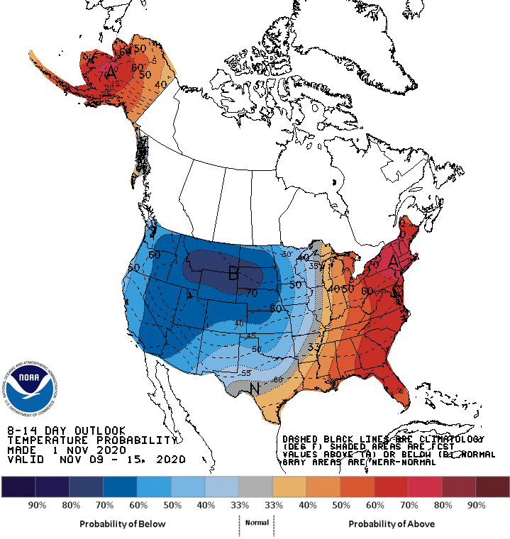
The pattern will start to turn more active early next week and that will start to knock temperatures back. Here's a look at the temperature outlook from the Climate Prediction Center for November 9 to 15:
Enjoy the warmth while it lasts!
And if you're looking for a comprehensive story of the historic derecho of 2020 there is a special going on! Limited time offer you can get Derecho 911: Iowa's Inland Hurricane written by Terry Swails and Carolyn Wettstone for a reduced price. Just click the photo below:

RK


