HUFFING AND PUFFING...
- Dec 30, 2025
- 3 min read
A powerful winter storm steam rolled the Midwest Sunday and Monday with a wide variety of weather ranging from blizzard conditions to tornadoes and severe thunderstorms. The National Weather Service reported over 1,000 storm reports including snow, straight line winds, and even a few tornadoes in EC Illinois Sunday through Monday morning.

While my counties in SE Iowa and WC Illinois did experience thunderstorms, wind, and some snow showers, the worst of the stronger storms and heaviest snow avoided my area. That said, up to 2 inches of snow fell in my northern counties late Sunday NW of a line from Cedar Rapids to Dubuque into NW Illinois.

The snow was whipped around Sunday night by winds of 50-60 mph. Cedar Rapids reported a gust of 64 mph, and Davenport clocked in with a 59 mph gust. It was huffing and puffing!

Visibility was severely restricted at times locally in the north, but not nearly to the degree it was in NC Iowa where I-35 was closed due to whiteout conditions from Ames to the Minnesota border Sunday night through Monday morning. This video was provided by the Iowa State Patrol, showing a 14 car pile up in blizzard conditions Sunday near the intersection of I-35 and HWY 20.
With the storm pulling away into Canada, the worst of the winds and cold will ease Tuesday. However, it will remain chilly, with highs in the range of 26 to 31 north to south. W/SW winds of 10-20 will keep wind chills low, especially in the morning, when they will be in the zero to 10 above category. A fast moving disturbance will spread some clouds SE, and a few snow showers are possible in the afternoon across my counties northeast of the Quad Cities. Not much more than a dusting is expected.
BORED, IN NEED OF A CHANGE?
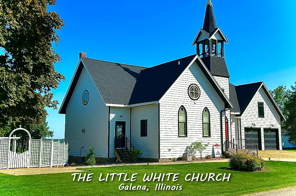
My AIRBNB outside of Galena is ready and waiting. Enjoy our unique, fully renovated church. It's an AIRBNB guest favorite with 5-star reviews. Warm and cozy, even in the winter. Call or text Carolyn at 563-676-3320 for details and our very best seasonal pricing. https://www.littlewhitechurchgalena.com/
NEW YEARS WEATHER...
That is followed by a new round of channeled vorticity Wednesday that produces another fast moving swath of light snow or flurries Wednesday afternoon or evening. Again, it's the NE half of my area that could see some minor accumulations. As you can see by way of the EURO, there is little surface reflection.

There might be a narrow stripe of 1/2 inch to an inch of snow, mainly northeast of the Quad Cities. Nothing more than a nuisance. Here's some raw model output.
The EURO

The GFS

The 3k NAM

The Canadian 10K RDPS

The start of the new year, and much of the first 10 days, appears relatively mild and quiet. W/NW flow appears to dominate the upper air pattern with the GFS showing this at 500mb next Monday the 5th. If indeed that structure evolves as shown, minimal moisture and storminess would be found around the country.

In fact, more than 90 percent of the continental U.S. is shown with near to below normal precipitation in the period today through January 14th with the Midwest and Ohio Valley the driest.

Along with that, temperatures the first 10 days of January appear to be close to normal, perhaps a bit above.

Going out further to January 15th, the GFS is even warmer with departures that look like this January 5th to the 15th. The warmth extends well into Canada and most of North America.

That's a pretty darn good way to start what's typically the coldest month of the year.
Now, not to spoil all the good news, the EURO control does not see that pattern holding beyond mid-January. Over the month-long period ending February 1st, the EURO shows well below normal temperatures, with most of the cold coming after the 10th.

For the same period, the control indicates a very active storm track locally with plenty of snow. Again, most of it coming after the 10th.

The way this winter has gone and with the challenges models have had, I would absolutely not bet the farm on this scenario, as I think the warmer solutions have a better chance of ruling the day. On the other hand, nothing would surprise me after all the weather we've seen since Thanksgiving. For now, I'm just gently throwing this out as food for thought with minimal confidence. Have a solid day and roll weather...TS
TSWAILS.COM expert weather consulting services (CLICK FOR MORE)
Private consulting
Legal forensic services as an expert witness
Public speaking engagements for groups or individuals
Post storm analysis
A private day-long weather school class
Specialized events forecasts
Severe weather seminars
Lectures and training
Climatological services
Meteorological workshops.


Comments